1900s (20th Century) Maps of Barton Riverfront Industrial Park, Colbert County
Explore 18 historic maps of Barton Riverfront Industrial Park from the 1900s (20th Century). These maps offer a rare glimpse into what life looked like during the 1900s — showing old roads, neighborhoods, homes, and landmarks that have changed or disappeared over time.
Whether you're researching your family's past, planning a metal detecting trip, or studying how Barton Riverfront Industrial Park's landscape evolved across the 1900s, these high-resolution maps are a powerful tool for exploring the history of this region.
- Focus on a specific era: All maps on this page are from the 1900s, giving you a focused view of this time period.
- See what’s changed: Compare century-old streets, trails, and buildings to today's modern landscape using overlays and satellite layers.
- Research with precision: Use these maps for genealogy, historical research, land use analysis, or educational projects.
- View, download, or print: Maps are fully viewable online in high resolution, and can be downloaded or printed for your own records.
Start exploring Barton Riverfront Industrial Park's history through authentic maps from the 1900s. This is your window into the past.
Barton Riverfront Industrial Park, Colbert County maps
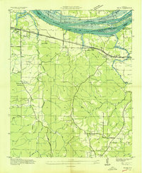
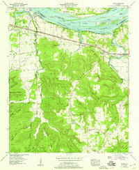
(18)- 1924 Map of Gravelly Springs
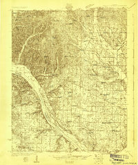 1924 Gravelly Springs1924 Print · USGSCovers Barton Riverfront Industrial Park, including Cherokee, Threet, and other nearby areas2 unique versions available
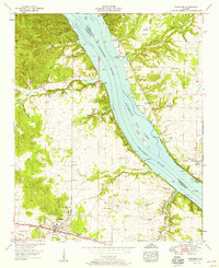
 - 1925 Map of Barton, 1954 Print
 1925 Barton1954 Print · USGSCovers Barton Riverfront Industrial Park, including Russellville, Tuscumbia, and other nearby areas
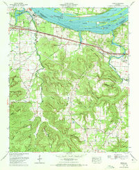
 - 1926 Map of Barton
 1926 Barton1926 Print · USGSCovers Barton Riverfront Industrial Park, including Russellville, Tuscumbia, and other nearby areas
 - 1926 Map of Gravelly Springs
 1926 Gravelly Springs1926 Print · USGSCovers Barton Riverfront Industrial Park, including Cherokee, Threet, and other nearby areas2 unique versions available
 - 1929 Map of Barton
 1929 Barton1929 Print · USGSCovers Barton Riverfront Industrial Park, including Russellville, Tuscumbia, and other nearby areas3 unique versions available
 - 1935 Map of Cherokee
 1935 Cherokee1935 Print · USGSCovers Barton Riverfront Industrial Park, including Cherokee, Lane Springs, and other nearby areas
 - 1936 Map of Pride
 1936 Pride1936 Print · USGSCovers Barton Riverfront Industrial Park, including Tuscumbia, Hawk Pride, and other nearby areas
 - 1936 Map of Barton
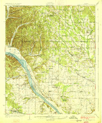
 1936 Barton1936 Print · USGSCovers Barton Riverfront Industrial Park, including Cherokee, Barton, and other nearby areas
 - 1953 Map of Barton, 1974 Print
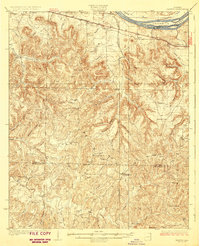
 1953 Barton1974 Print · USGSCovers Barton Riverfront Industrial Park, including Cherokee, Barton, and other nearby areas4 unique versions available
 - 1954 Map of Sinking Creek
 1954 Sinking Creek1954 Print · USGSCovers Barton Riverfront Industrial Park, including Kimbrough Crossroads, New Hope, and other nearby areas4 unique versions available
 - 1954 Map of Pride, 1958 Print
 1954 Pride1958 Print · USGSCovers Barton Riverfront Industrial Park, including Tuscumbia, Hawk Pride, and other nearby areas
 - 1954 Map of Cherokee, 1958 Print
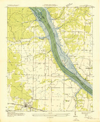
 1954 Cherokee1958 Print · USGSCovers Barton Riverfront Industrial Park, including Cherokee, Lane Springs, and other nearby areas4 unique versions available
 - 1956 Map of Gadsden, 1966 Print
 1956 Gadsden1966 Print · USGSCovers Barton Riverfront Industrial Park, including Huntsville, Decatur, and other nearby areas3 unique versions available
 - 1958 Map of Gadsden
 1958 Gadsden1958 Print · USGSCovers Barton Riverfront Industrial Park, including Huntsville, Decatur, and other nearby areas
 - 1960 Map of Gadsden
 1960 Gadsden1960 Print · USGSCovers Barton Riverfront Industrial Park, including Huntsville, Decatur, and other nearby areas2 unique versions available
 - 1963 Map of Gadsden
 1963 Gadsden1963 Print · USGSCovers Barton Riverfront Industrial Park, including Huntsville, Decatur, and other nearby areas
 - 1971 Map of Pride, 1972 Print
 1971 Pride1972 Print · USGSCovers Barton Riverfront Industrial Park, including Tuscumbia, Hawk Pride, and other nearby areas2 unique versions available
 - 1986 Map of Tuscumbia
 1986 Tuscumbia1986 Print · USGSCovers Barton Riverfront Industrial Park, including Decatur, Florence, and other nearby areas3 unique versions available
End of results
Showing maps 1-18 of 18
Frequently asked questions
- What are the different types of historical maps available for Barton Riverfront Industrial Park?
- What is the oldest map of Barton Riverfront Industrial Park?
- Where can I purchase historical maps of Barton Riverfront Industrial Park for my home or office?
- Where can I download high-res historical maps of Barton Riverfront Industrial Park?
- Are there historical topographic maps available for Barton Riverfront Industrial Park?
- Is there historical aerial imagery available for Barton Riverfront Industrial Park?
- Where are historical maps of Barton Riverfront Industrial Park sourced from?