Old Maps of Barton Riverfront Industrial Park, Colbert County for Metal Detecting
Plan your next treasure hunt with 18 historic maps of Barton Riverfront Industrial Park. Find old homesites, ghost towns, trails, and gathering spots that may be lost to time — perfect for identifying promising metal detecting locations.
- Locate forgotten sites: Uncover places like long-lost settlements, abandoned rail lines, or gathering spots.
- Plan better hunts: Use map overlays combined with LiDAR or satellite views to narrow in on historically rich areas.
- Made for detectorists: Thousands of hobbyists use these maps to discover relics, coins, and hidden history.
Use these historic maps to boost your research and find new opportunities beneath the surface of Barton Riverfront Industrial Park.
Barton Riverfront Industrial Park, Colbert County maps
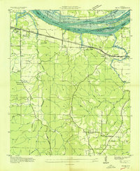
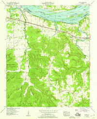
(18)- 1924 Map of Gravelly Springs
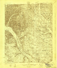 1924 Gravelly Springs1924 Print · USGSCovers Barton Riverfront Industrial Park, including Cherokee, Threet, and other nearby areas2 unique versions available
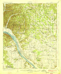
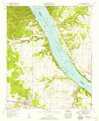
 - 1925 Map of Barton, 1954 Print
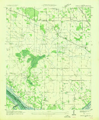
 1925 Barton1954 Print · USGSCovers Barton Riverfront Industrial Park, including Russellville, Tuscumbia, and other nearby areas
 - 1926 Map of Barton
 1926 Barton1926 Print · USGSCovers Barton Riverfront Industrial Park, including Russellville, Tuscumbia, and other nearby areas
 - 1926 Map of Gravelly Springs
 1926 Gravelly Springs1926 Print · USGSCovers Barton Riverfront Industrial Park, including Cherokee, Threet, and other nearby areas2 unique versions available
 - 1929 Map of Barton
 1929 Barton1929 Print · USGSCovers Barton Riverfront Industrial Park, including Russellville, Tuscumbia, and other nearby areas3 unique versions available
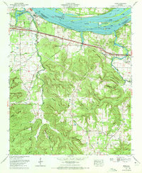
 - 1935 Map of Cherokee
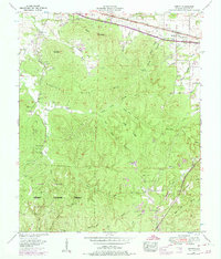
 1935 Cherokee1935 Print · USGSCovers Barton Riverfront Industrial Park, including Cherokee, Lane Springs, and other nearby areas
 - 1936 Map of Pride
 1936 Pride1936 Print · USGSCovers Barton Riverfront Industrial Park, including Tuscumbia, Hawk Pride, and other nearby areas
 - 1936 Map of Barton
 1936 Barton1936 Print · USGSCovers Barton Riverfront Industrial Park, including Cherokee, Barton, and other nearby areas
 - 1953 Map of Barton, 1974 Print
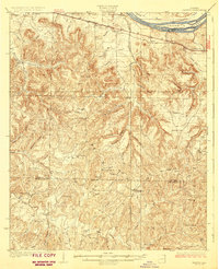
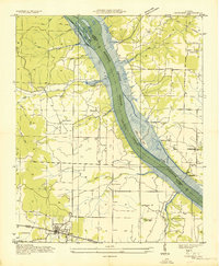
 1953 Barton1974 Print · USGSCovers Barton Riverfront Industrial Park, including Cherokee, Barton, and other nearby areas4 unique versions available
 - 1954 Map of Sinking Creek
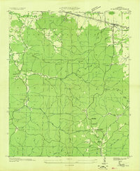
 1954 Sinking Creek1954 Print · USGSCovers Barton Riverfront Industrial Park, including Kimbrough Crossroads, New Hope, and other nearby areas4 unique versions available
 - 1954 Map of Pride, 1958 Print
 1954 Pride1958 Print · USGSCovers Barton Riverfront Industrial Park, including Tuscumbia, Hawk Pride, and other nearby areas
 - 1954 Map of Cherokee, 1958 Print
 1954 Cherokee1958 Print · USGSCovers Barton Riverfront Industrial Park, including Cherokee, Lane Springs, and other nearby areas4 unique versions available
 - 1956 Map of Gadsden, 1966 Print
 1956 Gadsden1966 Print · USGSCovers Barton Riverfront Industrial Park, including Huntsville, Decatur, and other nearby areas3 unique versions available
 - 1958 Map of Gadsden
 1958 Gadsden1958 Print · USGSCovers Barton Riverfront Industrial Park, including Huntsville, Decatur, and other nearby areas
 - 1960 Map of Gadsden
 1960 Gadsden1960 Print · USGSCovers Barton Riverfront Industrial Park, including Huntsville, Decatur, and other nearby areas2 unique versions available
 - 1963 Map of Gadsden
 1963 Gadsden1963 Print · USGSCovers Barton Riverfront Industrial Park, including Huntsville, Decatur, and other nearby areas
 - 1971 Map of Pride, 1972 Print
 1971 Pride1972 Print · USGSCovers Barton Riverfront Industrial Park, including Tuscumbia, Hawk Pride, and other nearby areas2 unique versions available
 - 1986 Map of Tuscumbia
 1986 Tuscumbia1986 Print · USGSCovers Barton Riverfront Industrial Park, including Decatur, Florence, and other nearby areas3 unique versions available
End of results
Showing maps 1-18 of 18
Frequently asked questions
- What are the different types of historical maps available for Barton Riverfront Industrial Park?
- What is the oldest map of Barton Riverfront Industrial Park?
- Where can I purchase historical maps of Barton Riverfront Industrial Park for my home or office?
- Where can I download high-res historical maps of Barton Riverfront Industrial Park?
- Are there historical topographic maps available for Barton Riverfront Industrial Park?
- Is there historical aerial imagery available for Barton Riverfront Industrial Park?
- Where are historical maps of Barton Riverfront Industrial Park sourced from?