1940s Maps of Covington County, Alabama
Explore 3 historic maps of Covington County from the 1940s. These maps offer a rare glimpse into what life looked like during the 1940s — showing old roads, neighborhoods, homes, and landmarks that have changed or disappeared over time.
Whether you're researching your family's past, planning a metal detecting trip, or studying how Covington County's landscape evolved across the 1940s, these high-resolution maps are a powerful tool for exploring the history of this region.
- Focus on a specific era: All maps on this page are from the 1940s, giving you a focused view of this time period.
- See what’s changed: Compare century-old streets, trails, and buildings to today's modern landscape using overlays and satellite layers.
- Research with precision: Use these maps for genealogy, historical research, land use analysis, or educational projects.
- View, download, or print: Maps are fully viewable online in high resolution, and can be downloaded or printed for your own records.
Start exploring Covington County's history through authentic maps from the 1940s. This is your window into the past.
Covington County, AL maps
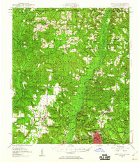
(3)- 1949 Map of Glendale
 1949 Glendale1949 Print · USGSNorthern Walton County in the late 1940s reveals a landscape of isolated turpentine stills and rural congregations. Trace family roots at Halls Still, Darlington, and Limestone Cem while exploring the wetlands of Big Swamp.
 - 1949 Map of Crestview, 1960 Print
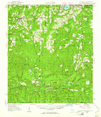
 1949 Crestview1960 Print · USGSOkaloosa County at the close of the 1940s shows a landscape of river-bottom forests and rural crossroads. Researchers can trace family sites at Pilgrims Rest Ch, locate old timber operations like Campbells Mill, and follow the Louisville & Nashville rail line through Crestview.2 unique versions available
 - 1949 Map of Laurel Hill, 1961 Print
 1949 Laurel Hill1961 Print · USGSOkaloosa and Walton counties at mid-century reveal a landscape of creek-fed bays and isolated timber settlements along the Alabama line. Genealogists can trace family names and lost locations through Travelers Rest Ch, Old Dorcas Cem, and the Childrens Home.2 unique versions available
End of results
Showing maps 1-3 of 3
Top cities of Covington County
- Andalusia historical maps
- Opp historical maps
- Florala historical maps
- Babbie historical maps
- River Falls historical maps
- Lockhart historical maps
See more
Frequently asked questions
- What are the different types of historical maps available for Covington County?
- What is the oldest map of Covington County?
- Where can I purchase historical maps of Covington County for my home or office?
- Where can I download high-res historical maps of Covington County?
- Are there historical topographic maps available for Covington County?
- Is there historical aerial imagery available for Covington County?
- Where are historical maps of Covington County sourced from?