Old Maps of Covington County, Alabama for Academic Research
Study the evolution of Covington County with 188 high-resolution historic maps. Whether you're teaching, researching, or modeling changes in land use, these maps provide essential visual documentation of urban, environmental, and geographic change.
- Analyze long-term change: Track patterns in development, transportation, and natural features.
- Ideal for environmental or urban studies: Support academic projects with primary historical map data.
- Use in the classroom or lab: Educators and researchers rely on these maps to bring historical context to life.
These maps are a powerful tool for teaching, research, and visualizing how Covington County has changed over the decades.
Covington County, AL maps
(188)- 1949 Map of Glendale
 1949 Glendale1949 Print · USGSNorthern Walton County in the late 1940s reveals a landscape of isolated turpentine stills and rural congregations. Trace family roots at Halls Still, Darlington, and Limestone Cem while exploring the wetlands of Big Swamp.
 - 1949 Map of Crestview, 1960 Print
 1949 Crestview1960 Print · USGSOkaloosa County at the close of the 1940s shows a landscape of river-bottom forests and rural crossroads. Researchers can trace family sites at Pilgrims Rest Ch, locate old timber operations like Campbells Mill, and follow the Louisville & Nashville rail line through Crestview.2 unique versions available
 - 1949 Map of Laurel Hill, 1961 Print
 1949 Laurel Hill1961 Print · USGSOkaloosa and Walton counties at mid-century reveal a landscape of creek-fed bays and isolated timber settlements along the Alabama line. Genealogists can trace family names and lost locations through Travelers Rest Ch, Old Dorcas Cem, and the Childrens Home.2 unique versions available
 - 1950 Map of Laurel Hill
 1950 Laurel Hill1950 Print · USGSThe Florida-Alabama border region is captured here at mid-century, showcasing the timberlands and rail-centered settlements between Laurel Hill and Florala. Researchers can trace old transportation routes like the Old Spanish Trail and find family sites like Mt Zion Cem or Dorcas Ch.2 unique versions available
 - 1951 Map of Glendale
 1951 Glendale1951 Print · USGSThe Alabama-Florida borderlands come to life in this mid-century survey of the pine-studded interior. Genealogists and local historians can trace family-named landmarks like Braxton Cem and old community hubs including Gaskin, Glendale, and Limestone Ch.2 unique versions available
 - 1951 Map of Crestview
 1951 Crestview1951 Print · USGSMid-century Okaloosa County is centered on the growth of Crestview along the Louisville and Nashville Railroad. Genealogists and historians can trace numerous rural landmarks, from Campbells Mill to the Old Spanish Trail and family-named sites like Peaden Cem.2 unique versions available
 - 1953 Map of Andalusia, 1965 Print
 1953 Andalusia1965 Print · USGSSouth Alabama in the mid-twentieth century remains a land of pine forests and river-fed settlements. You can trace the vital rail corridors of the Louisville & Nashville and locate regional centers such as Andalusia, Brewton, and Monroeville.3 unique versions available
 - 1957 Map of Andalusia
 1957 Andalusia1957 Print · USGSSouthern Alabama in the mid-1950s was a landscape defined by timbered stretches and the rhythmic flow of the Alabama River. Researchers can trace the legacy of the rail era through the Central of Georgia tracks and the storied river bluffs at Choctaw Bluff.
 - 1957 Map of Pensacola, 1967 Print
 1957 Pensacola1967 Print · USGSThe Florida Panhandle and Alabama coast are seen here at the height of the Cold War, showcasing a unique mix of military aviation and emerging beach tourism. Genealogists and local historians can trace legacy sites like Old Corry Field, the lumber town of Bagdad, and the coastal reaches of Santa Rosa Island.3 unique versions available
 - 1959 Map of Pensacola
 1959 Pensacola1959 Print · USGSThe Florida Panhandle and Alabama coast come alive in this late fifties survey of military aviation and maritime life. Genealogists can trace family roots in Bagdad, Loxley, and Milton while mapping the rails of the Louisville and Nashville.
 - 1960 Map of Pensacola
 1960 Pensacola1960 Print · USGSThe Florida Panhandle and Alabama's eastern shore are shown during a period of rapid military and coastal growth. Genealogists and historians can trace the mid-century footprints of Warrington, the Pensacola NAS (Chevalier), and the Blackwater River timber lands.
 - 1968 Map of Danleys Crossroads, 1970 Print
 1968 Danleys Crossroads1970 Print · USGSSoutheast Alabama in the late sixties reveals a landscape of tight-knit farming communities at the junction of Coffee, Crenshaw, and Covington Counties. Researchers can trace family history through local landmarks like Mt Olive Ch, Danleys Crossroads, and Friendship.2 unique versions available
 - 1968 Map of Opp East, 1971 Print
 1968 Opp East1971 Print · USGSEastern Covington County is documented in the late 1960s as the rail-and-river landscape of the wiregrass region evolved. Trace the Louisville and Nashville line past Skelly Field or locate legacy landmarks like Old Town Cem.2 unique versions available
 - 1969 Map of Hacoda, 1971 Print
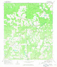 1969 Hacoda1971 Print · USGSThe borderlands of Covington and Geneva counties come into focus in the late 1960s, showing a landscape of state forests and quiet settlements. Researchers can trace the Old Railroad Grade or locate family sites like Smyrna Church and Finks Millpond.
 - 1969 Map of Kinston, 1971 Print
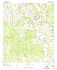 1969 Kinston1971 Print · USGSSoutheast Alabama is captured here in the late sixties, showcasing the interplay between the Louisville and Nashville rail line and the deep timberlands of the Geneva State Forest. Researchers can locate old crossroads and family sites like Earlytown, St Pauls Cem, and Fine Level Ch.2 unique versions available
 - 1971 Map of Dixie, 1972 Print
 1971 Dixie1972 Print · USGSIn the early seventies, the borderlands of Escambia and Covington counties remained a world of deep timber and quiet settlements. Genealogists can locate family landmarks like Mason Cem and Welfare Ch, or trace the path of the Old RR Grade through the Conecuh National Forest.3 unique versions available
 - 1971 Map of Bradley, 1972 Print
 1971 Bradley1972 Print · USGSCoastal plain timberlands and river bottoms define the Bradley area in the early seventies, at the crossroads of the Escambia Co and Covington Co line. Genealogists and local historians can trace the Old Railroad Grade or locate family sites at Old Bradley Cem and Union Hill Ch.2 unique versions available
 - 1971 Map of Brooks, 1972 Print
 1971 Brooks1972 Print · USGSConecuh and Covington counties come together in the early 1970s along the winding Sepulga River and the rural communities of South Alabama. Researchers can locate family landmarks like New Home Ch, the community of Cohassett, and the Louisville and Nashville rail line.2 unique versions available
 - 1971 Map of Carolina, 1972 Print
 1971 Carolina1972 Print · USGSIn the early seventies, the rural landscape of Covington County was defined by its timberlands and small crossroads communities. Genealogists and historians can trace family locations near Carolina and Pleasant Home, or locate the Shady Hill Cem and Shady Hill Ch.2 unique versions available
 - 1971 Map of Libertyville, 1973 Print
 1971 Libertyville1973 Print · USGSCovington County is seen here in the early 1970s as a quiet expanse of timberland and small crossroads communities bordering the national forest. Researchers can locate family-named landmarks and rural congregations like Stanley, Judson Ch, and the Yellow River Lookout Tower.
 - 1971 Map of Dozier, 1973 Print
 1971 Dozier1973 Print · USGSDozier and the surrounding Covington-Crenshaw county line are captured here in the early seventies, centered on the Conecuh River valley. Researchers can trace the Central of Georgia rail corridor and locate family sites like Rose Hill Cem and Pleasant Call Ch.
 - 1971 Map of Industry, 1973 Print
 1971 Industry1973 Print · USGSSoutheastern Butler County was a network of rural hamlets and country churches in the early 1970s. Researchers can locate family landmarks like Oaky Streak, Industry, and Consolation Ch along the winding banks of Pigeon Creek.
 - 1971 Map of Onycha, 1973 Print
 1971 Onycha1973 Print · USGSSouthern Covington County comes alive in this early 1970s survey of rural Alabama settlements and family landmarks. Researchers can trace the Louisville and Nashville line past Onycha or locate country churches like New Hope Ch.
 - 1971 Map of Wing, 1973 Print
 1971 Wing1973 Print · USGSCovington County was a landscape of timber and quiet forest settlements in the early 1970s. Trace the rural crossroads of Falco and Wing, or locate family landmarks like Mt Hermon Ch and Union Ch Cem near the winding Yellow River.2 unique versions available
 - 1971 Map of Brantley, 1973 Print
 1971 Brantley1973 Print · USGSCrenshaw and Covington counties come together at the Conecuh River in the early 1970s, as the Central of Georgia rail line links the timber and farm lands. Trace family roots at Mt Olive Ch Cem, Sasser Ch Cem, and the rural community of Theba.
Showing maps 1-25 of 188
Top cities of Covington County
- Andalusia historical maps
- Opp historical maps
- Florala historical maps
- Babbie historical maps
- River Falls historical maps
- Lockhart historical maps
See more
Frequently asked questions
- What are the different types of historical maps available for Covington County?
- What is the oldest map of Covington County?
- Where can I purchase historical maps of Covington County for my home or office?
- Where can I download high-res historical maps of Covington County?
- Are there historical topographic maps available for Covington County?
- Is there historical aerial imagery available for Covington County?
- Where are historical maps of Covington County sourced from?