Old Maps of Crenshaw County, Alabama for Hiking & Exploration
Hike through history with 111 historic maps of Crenshaw County. Explore old trails, ghost towns, and forgotten backroads — perfect for outdoor adventurers and local explorers.
- Rediscover forgotten places: Map out old mining camps, roads, and footpaths that no longer exist on modern maps.
- Layer with modern tools: Combine with LiDAR or satellite views to plan hikes through historical terrain.
- Made for exploration: Popular among hikers, overlanders, and local history lovers.
Use these maps to find adventure and explore the hidden past of Crenshaw County.
Crenshaw County, AL maps
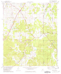
(111)- 1953 Map of Montgomery, 1964 Print
 1953 Montgomery1964 Print · USGSCentral Alabama's river-and-rail corridor is mapped here in the mid-fifties, showing the vital connections between the capital and the Black Belt. Genealogists and historians can trace rail depots and crossroads from Marion Junction to Wetumpka, alongside landmarks like Craig AFB.4 unique versions available
 - 1953 Map of Andalusia, 1965 Print
 1953 Andalusia1965 Print · USGSSouth Alabama in the mid-twentieth century remains a land of pine forests and river-fed settlements. You can trace the vital rail corridors of the Louisville & Nashville and locate regional centers such as Andalusia, Brewton, and Monroeville.3 unique versions available
 - 1956 Map of Montgomery
 1956 Montgomery1956 Print · USGSCentral Alabama in the mid-1950s shows a landscape defined by its great river systems and a booming military aviation presence. Genealogists and historians can trace the rail corridors of the Southern Railway and locate tactical bases like Maxwell AFB and Craig AFB.
 - 1957 Map of Montgomery
 1957 Montgomery1957 Print · USGSCentral Alabama in the mid-fifties is defined by the winding Alabama River and a strategic network of military bases and rail lines. Trace family roots in Montgomery and Selma, or locate landmarks like Craig AFB and the State Capitol before the interstate era.
 - 1957 Map of Andalusia
 1957 Andalusia1957 Print · USGSSouthern Alabama in the mid-1950s was a landscape defined by timbered stretches and the rhythmic flow of the Alabama River. Researchers can trace the legacy of the rail era through the Central of Georgia tracks and the storied river bluffs at Choctaw Bluff.
 - 1957 Map of Letohatchee, 1958 Print
 1957 Letohatchee1958 Print · USGSSouthern Montgomery and Lowndes counties are shown here in the mid-fifties, dominated by timbered creek bottoms and small agricultural centers. Genealogists can trace family names at Shackelford Cem, Letohatchee, and the Louisville and Nashville RR corridor.
 - 1968 Map of Danleys Crossroads, 1970 Print
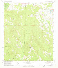
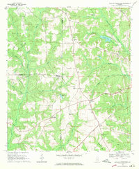 1968 Danleys Crossroads1970 Print · USGSSoutheast Alabama in the late sixties reveals a landscape of tight-knit farming communities at the junction of Coffee, Crenshaw, and Covington Counties. Researchers can trace family history through local landmarks like Mt Olive Ch, Danleys Crossroads, and Friendship.2 unique versions available
 - 1968 Map of Glenwood, 1970 Print
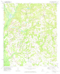
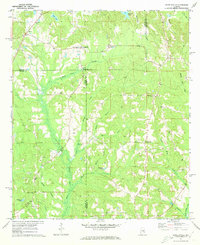
 1968 Glenwood1970 Print · USGSCrenshaw and Pike counties appear here in the late sixties as a landscape of river-bottom farms and emerging strip mines. Genealogists can trace family names at Emmaus Cem and Shirleys Crossroads or follow the Georgia Central Railroad through Glenwood.2 unique versions available
 - 1968 Map of Bullock, 1971 Print
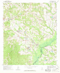
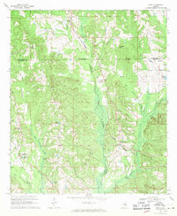
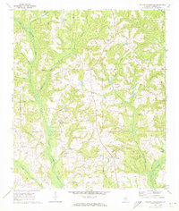
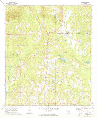
 1968 Bullock1971 Print · USGSCrenshaw County is documented here in the late sixties as the timber and rail economy shaped the rural landscape. Genealogists and local historians can locate many rural landmarks including Mt Zion Ch, Oak Grove Cem, and the Central of Georgia line.
 - 1968 Map of Petrey, 1971 Print
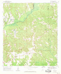
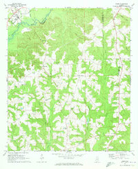
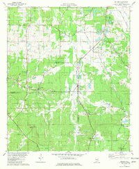
 1968 Petrey1971 Print · USGSSoutheast Alabama is captured here in the late sixties, showing the rural communities along the Crenshaw and Pike County line. Genealogists and historians can trace the Old Railroad Grade and locate ancestral sites like Petrey Cemetery and Camp Ground Church.
 - 1968 Map of Grady, 1971 Print
 1968 Grady1971 Print · USGSAgricultural life in the late sixties centers on the intersection of three counties and the SEABOARD COAST LINE railroad. Genealogists can trace family landmarks like Carter Cem, Shady Grove, and Rockelyn Ch along the Patsaliga Creek drainage.2 unique versions available
 - 1971 Map of Dozier, 1973 Print
 1971 Dozier1973 Print · USGSDozier and the surrounding Covington-Crenshaw county line are captured here in the early seventies, centered on the Conecuh River valley. Researchers can trace the Central of Georgia rail corridor and locate family sites like Rose Hill Cem and Pleasant Call Ch.
 - 1971 Map of Luverne, 1973 Print
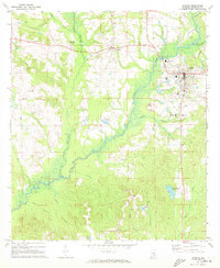 1971 Luverne1973 Print · USGSLuverne and the surrounding Crenshaw County countryside are captured here in the early seventies, centered on the Patsaliga Creek basin. Researchers can trace local lineage at Faith Hill Ch, Antioch Cem, and the rural Ivy Creek Sch.
 - 1971 Map of Brantley, 1973 Print
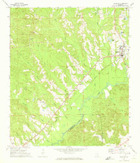 1971 Brantley1973 Print · USGSCrenshaw and Covington counties come together at the Conecuh River in the early 1970s, as the Central of Georgia rail line links the timber and farm lands. Trace family roots at Mt Olive Ch Cem, Sasser Ch Cem, and the rural community of Theba.
 - 1971 Map of Fullers Crossroads, 1973 Print
 1971 Fullers Crossroads1973 Print · USGSCrenshaw County is documented here in the early seventies, showing a landscape of rural crossroads and creekside settlements. Genealogists can locate family landmarks like Mitchell Cem, Rock Hill Ch, and the community at Fullers Crossroads.
 - 1971 Map of Honoraville, 1973 Print
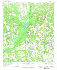
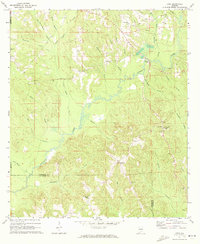
 1971 Honoraville1973 Print · USGSCrenshaw County is documented here during the early seventies, a time when rural life centered on a dense network of local churches. Researchers can trace family roots through landmarks like Mt Zion Ch, Bethlehem Ch, and Honoraville, while identifying the location of old Strip Mines and local water bodies such as Lake Jane.
 - 1971 Map of Gantt, 1973 Print
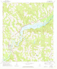 1971 Gantt1973 Print · USGSCovington County communities surround the impounded waters of the Conecuh River in the early seventies. Genealogists and historians can trace family locations near Gantt Lake and find rural landmarks like Zion Chapel Ch, Dunns Bridge, and the community of Searight.2 unique versions available
 - 1971 Map of Leon, 1973 Print
 1971 Leon1973 Print · USGSCrenshaw County in the early seventies reveals a landscape of dispersed rural settlements and active creek-side industry. Genealogists and local historians can trace old homesteads and landmarks like Merrill Mill, Zion Ch Cem, and the community of Leon.
 - 1971 Map of Moodys Crossroads, 1973 Print
 1971 Moodys Crossroads1973 Print · USGSCrenshaw and Butler counties are captured here in the early seventies, showing a landscape of small crossroads and rural churches. Genealogists and local historians can trace family locations near Cooks Stand, St James Ch, and the Old Railroad Grade.
 - 1971 Map of Danielsville, 1973 Print
 1971 Danielsville1973 Print · USGSCrenshaw County at the dawn of the 1970s reveals a quiet landscape of rural crossroads and creek-side settlements. Genealogists and local historians can trace family locations near Danielsville and Ellis Crossroads, or locate burial sites at King Cem and Hopewell Cem.
 - 1971 Map of Lapine, 1979 Print
 1971 Lapine1979 Print · USGSThe Montgomery and Crenshaw county line comes alive in the early seventies, showcasing a landscape of creek-fed valleys and rural crossroads. Trace old family roots and transport history at Lapine, Rocky Mount Cem, and along the Old Railroad Grade.2 unique versions available
 - 1981 Map of Sellers
 1981 Sellers1981 Print · USGSCentral Alabama's agricultural heartland is documented here in the early eighties, showing the transition between Montgomery and Crenshaw Counties. Researchers can locate family landmarks like Bell Cem, rural churches such as Fair Prospect Ch, and trace the path of the Seaboard Coast Line railroad.2 unique versions available
 - 1981 Map of Sandy Ridge, 1982 Print
 1981 Sandy Ridge1982 Print · USGSLowndes County and its neighbors are captured here in the early eighties as a rural landscape of family cemeteries and crossroad hamlets. Researchers can find generational landmarks like Lily Ch Cem, Sawyer Cem, and the settlement of Guys Village.2 unique versions available
 - 1986 Map of Montgomery
 1986 Montgomery1986 Print · USGSCentral Alabama's river-and-rail corridor is captured in the mid-1980s, centered on the state capital and its surrounding rural counties. Researchers can trace ancestral landmarks like Oakwood Cemetery, military sites like Maxwell Air Force Base, and small towns such as Lowndesboro.2 unique versions available
 - 1986 Map of Andalusia
 1986 Andalusia1986 Print · USGSCovington County and the Wiregrass region are shown here in the mid-1980s, centered on the growing hubs of Andalusia and Opp. Genealogists and local historians can trace legacy sites like the Old Pioneer Cem, Straughn Sch, and the rail lines of the Louisville and Nashville RR.2 unique versions available
Showing maps 1-25 of 111
Top cities of Crenshaw County
- Luverne historical maps
- Brantley historical maps
- Rutledge historical maps
- Dozier historical maps
- Glenwood historical maps
- Petrey historical maps
Frequently asked questions
- What are the different types of historical maps available for Crenshaw County?
- What is the oldest map of Crenshaw County?
- Where can I purchase historical maps of Crenshaw County for my home or office?
- Where can I download high-res historical maps of Crenshaw County?
- Are there historical topographic maps available for Crenshaw County?
- Is there historical aerial imagery available for Crenshaw County?
- Where are historical maps of Crenshaw County sourced from?