1900s (20th Century) Maps of Ozark, Alabama
Explore 13 historic maps of Ozark from the 1900s (20th Century). These maps offer a rare glimpse into what life looked like during the 1900s — showing old roads, neighborhoods, homes, and landmarks that have changed or disappeared over time.
Whether you're researching your family's past, planning a metal detecting trip, or studying how Ozark's landscape evolved across the 1900s, these high-resolution maps are a powerful tool for exploring the history of this region.
- Focus on a specific era: All maps on this page are from the 1900s, giving you a focused view of this time period.
- See what’s changed: Compare century-old streets, trails, and buildings to today's modern landscape using overlays and satellite layers.
- Research with precision: Use these maps for genealogy, historical research, land use analysis, or educational projects.
- View, download, or print: Maps are fully viewable online in high resolution, and can be downloaded or printed for your own records.
Start exploring Ozark's history through authentic maps from the 1900s. This is your window into the past.
Ozark, AL maps
(13)- 1942 Map of Enterprise
 1942 Enterprise1942 Print · USGSSoutheast Alabama is shown at a wartime turning point, just as Camp Rucker was established. Family historians can trace hundreds of rural landmarks, from Oak Grove Ch & Sch to the New Prospect Ch.
 - 1948 Map of Ozark, 1965 Print
 1948 Ozark1965 Print · USGSPostwar Dale County reveals a landscape in transition as rural milling communities adjust to the expansion of Camp Rucker. Genealogists can trace family landmarks like Claybank Church, Salem Cemetery, and the old crossroads at Browns Crossroads.
 - 1950 Map of Ozark
 1950 Ozark1950 Print · USGSSoutheast Alabama in the postwar era is defined here by the rise of Camp Rucker and the steady rhythms of Dale County farming. Researchers can find many family landmarks, from Marley Mill to the Klondike School and Johnstown Cemetery.2 unique versions available
 - 1953 Map of Dothan, 1966 Print
 1953 Dothan1966 Print · USGSSoutheast Alabama and Southwest Georgia are captured during a period of massive hydraulic and military expansion in the mid-fifties. Genealogists and historians can trace rural landmarks like Antioch Church and School, the Andrew Jackson Monument, and the early footprint of Fort Rucker Military Reservation.3 unique versions available
 - 1954 Map of Dothan
 1954 Dothan1954 Print · USGSSoutheast Alabama and Southwest Georgia are seen here in the mid-fifties, during a decade of military expansion and rural transition. Genealogists can trace the location of country schools like Little Zion School or the grounds of Kolomoki Mounds State Park.
 - 1955 Map of Dothan
 1955 Dothan1955 Print · USGSSoutheast Alabama and Southwest Georgia are captured here in the mid-fifties, showing a landscape of river-port history and growing military bases. Researchers can trace rural life via the Andrew Jackson Monument, Bauxite mines, and the Central of Georgia RR.
 - 1960 Map of Ewell, 1963 Print
 1960 Ewell1963 Print · USGSThe Dale County countryside outside Ozark was undergoing significant postwar development in the early sixties. Researchers can trace the path of the Atlantic Coast Line through rural Ewell or find family landmarks like Chalk Head Ch and Johnsons Pond.2 unique versions available
 - 1960 Map of Ozark, 1964 Print
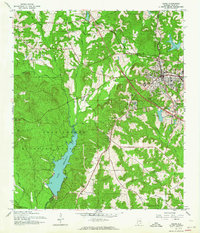 1960 Ozark1964 Print · USGSIn the early 1960s, the area around Ozark shows a landscape defined by the growth of the Fort Rucker Military Reservation. Researchers can trace family history at Old Salem Cem or locate the historic Marley Millpond and Hopeful Primitive Ch.2 unique versions available
 - 1962 Map of Ewell
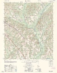 1962 Ewell1962 Print · USGSThe rural landscape of Dale County comes into focus in the early sixties as the railroad and highway systems expanded around Ewell. Researchers can trace old family roots at Friendship Church Cem, locate Matson, and find landmarks like the Ozark Municipal Airport.
 - 1969 Map of Ariton, 1971 Print
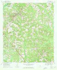 1969 Ariton1971 Print · USGSSoutheast Alabama's Wiregrass region comes alive in the late sixties as a busy rail junction where two major lines meet. Genealogists can trace family names at the Universalist Cem, Sammon Cem, or the Pleasant Grove Ch (Cem).2 unique versions available
 - 1969 Map of Skipperville, 1971 Print
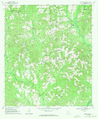 1969 Skipperville1971 Print · USGSThe rural crossroads and river valleys of Dale County are documented in this late-sixties survey. Researchers can trace family sites at Phillips Crossroads, locate the Skipperville Sch, or find old stream crossings like Bottoms Mill Bridge.
 - 1981 Map of Dothan, 1982 Print
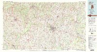 1981 Dothan1982 Print · USGSSoutheast Alabama and the tri-state border region are shown here in the early 1980s as the area thrived on military and rail connectivity. Researchers can trace historic transit lines like the Hartford and Slocomb railroad or locate family roots in Ozark, Headland, and Geneva.
 - 1981 Map of Troy, 1982 Print
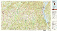 1981 Troy1982 Print · USGSThe Chattahoochee River valley and the wiregrass region of Alabama come alive in the early eighties as the Walter F George Reservoir reshapes the eastern border. Genealogists can trace family roots through historic railroad towns like Brundidge and Louisville or explore the rural surroundings of Blue Springs State Park.
End of results
Showing maps 1-13 of 13
Top cities near Ozark
- Dothan historical maps
- Enterprise historical maps
- Headland historical maps
- Daleville historical maps
- Midland City historical maps
- Level Plains historical maps
See more
Top neighborhoods of Ozark
Frequently asked questions
- What are the different types of historical maps available for Ozark?
- What is the oldest map of Ozark?
- Where can I purchase historical maps of Ozark for my home or office?
- Where can I download high-res historical maps of Ozark?
- Are there historical topographic maps available for Ozark?
- Is there historical aerial imagery available for Ozark?
- Where are historical maps of Ozark sourced from?