Old Maps of DeKalb County, Alabama for Metal Detecting
Plan your next treasure hunt with 192 historic maps of DeKalb County. Find old homesites, ghost towns, trails, and gathering spots that may be lost to time — perfect for identifying promising metal detecting locations.
- Locate forgotten sites: Uncover places like long-lost settlements, abandoned rail lines, or gathering spots.
- Plan better hunts: Use map overlays combined with LiDAR or satellite views to narrow in on historically rich areas.
- Made for detectorists: Thousands of hobbyists use these maps to discover relics, coins, and hidden history.
Use these historic maps to boost your research and find new opportunities beneath the surface of DeKalb County.
DeKalb County, AL maps
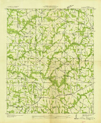
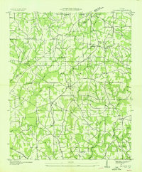
(192)- 1885 Map of Gadsden
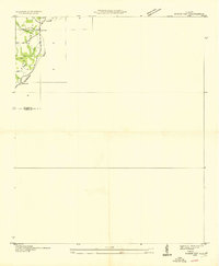
 1885 Gadsden1885 Print · USGSNortheast Alabama in the mid-1880s was a landscape of river-side landings and emerging rail towns. Genealogists and historians can trace the early foundations of Guntersville and Gadsden while locating rural landmarks like Hillian Store, Cottonville, and Law Landing.
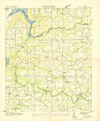
 - 1886 Map of Stevenson
 1886 Stevenson1886 Print · USGSNortheast Alabama at the peak of the railroad era shows a landscape tied to the river and the rails. Genealogists can trace family landmarks like Coffey's Store or locate river crossings such as Caperton Ferry and Snodgrass Ferry.
 - 1888 Map of Gadsden
 1888 Gadsden1888 Print · USGSNorth Alabama's river valleys and plateau lands are captured here in the late nineteenth century as the region transitioned from river landings to rail transport. Researchers can locate early post offices and commerce centers like Hillian's Store, Guntersville, and the ferry at Ft Deposit.
 - 1892 Map of Stevenson
 1892 Stevenson1892 Print · USGSNortheast Alabama and the Tennessee border in the 1890s reveal a landscape of mountain coves and vital river crossings. Genealogists and historians can trace rail junctions at Stevenson, river landings like Coffey's Ferry, and landmarks like Nickajack Cave.
 - 1892 Map of Gadsden
 1892 Gadsden1892 Print · USGSNorth Alabama's river-and-rail economy is captured here in the late nineteenth century as Guntersville and Gadsden emerge as regional hubs. Genealogists and historians can trace the routes of the Birmingham Mineral R. R. or locate old community centers like Cottonville and Mt Zion.
 - 1893 Map of Fort Payne
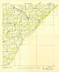
 1893 Fort Payne1893 Print · USGSNortheast Alabama is shown here in the late nineteenth century as the rail network transformed the valley floor. Genealogists and historians can trace family-named crossroads like Hoge's X Roads and vital river crossings including Coker Ferry and Sewell Ferry.
 - 1895 Map of Stevenson
 1895 Stevenson1895 Print · USGSThe Tennessee River valley and surrounding plateaus were a hub of rail and river commerce at the close of the century. Genealogists can trace family crossings at Island Creek Ferry or locate old communities like Bellefonte, Stevenson, and Valley Head.6 unique versions available
 - 1895 Map of Gadsden
 1895 Gadsden1895 Print · USGSNortheast Alabama at the close of the century was a landscape of river landings and mountain gaps where the Tennessee River met growing rail hubs. Genealogists can trace family holdings near Hillian Store, Cottonville, and the remote heights of Lookout Mountain.
 - 1898 Map of Fort Payne, 1964 Print
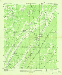
 1898 Fort Payne1964 Print · USGSDeKalb and Cherokee counties in the late 1890s are defined by the steep ridges of Lookout Mountain and a bustling network of river ferries. Genealogists can trace family roots through numerous river crossings like Hardwick Ferry and early industrial sites such as Sloan Mill or Abernathy Mill.
 - 1900 Map of Fort Payne
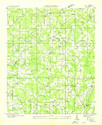
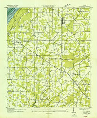
 1900 Fort Payne1900 Print · USGSNortheast Alabama is defined by its deep ridges and river valleys in the late nineteenth century. Researchers can trace the era's ferry network across the Coosa River and find old family-run landmarks like Wagners Store and Santy Mills.6 unique versions available
 - 1903 Map of Gadsden
 1903 Gadsden1903 Print · USGSNorthern Alabama in the late nineteenth century centers on the busy Tennessee River corridor and its surrounding ridges. Trace old family sites and transport hubs like Hillian Store, Lovelace Landing, and the Mt Zion church.4 unique versions available
 - 1936 Map of Trenton
 1936 Trenton1936 Print · USGSThe Georgia and Alabama borderlands are captured here in the mid-1930s as mountain life met the era's emerging highway and rail networks. Genealogists can locate family landmarks like Sand Mtn Academy, Hanna Cem, and the community of Rising Fawn.
 - 1936 Map of Painter
 1936 Painter1936 Print · USGSDeKalb and Marshall counties are shown here during the mid-1930s, documenting a landscape of plateau farms and essential creek crossings. Genealogists can trace family roots through landmarks like Blessing Sch, Dalrymple Cem, and rural centers like Whiton and Lathamville.
 - 1936 Map of Ider
 1936 Ider1936 Print · USGSThe plateau of De Kalb and Jackson counties is captured here in the mid-1930s as a network of crossroads and family farms. Local historians can trace family roots through sites like Yorks Mill, Pilgrims Home Ch, and the Fuller Cem.
 - 1936 Map of Crossville
 1936 Crossville1936 Print · USGSDeKalb County and the Sand Mountain area are shown here in the mid-1930s as a thriving rural community of small crossroads and family-named landmarks. Researchers can trace the locations of Orphir Sch, Friendship Ch, and early businesses like Gilbert Store.
 - 1936 Map of Flat Rock
 1936 Flat Rock1936 Print · USGSSand Mountain in the mid-thirties remains a landscape of high plateaus and remote community centers. Genealogists can trace family names at Smith Cem and Cooley Cem or locate the rural crossroads at Christian Home and Flat Rock.
 - 1936 Map of Dugout Valley
 1936 Dugout Valley1936 Print · USGSDeKalb County mountain life in the mid-1930s is captured here, showing the scattered farmsteads and schools along SAND MOUNTAIN. Genealogists can locate family landmarks such as Hawkins Chapel Sch, Blackburns Store, and Mt Parron Ch tucked between the ridges.
 - 1936 Map of Rodentown
 1936 Rodentown1936 Print · USGSNortheast Alabama hill country is captured here during the mid-thirties, showing the rural communities of Sand Mountain. Researchers can trace family roots through numerous local landmarks like Whitesboro, Smith Chapel, and Duck Springs Sch.
 - 1936 Map of Roden Gap
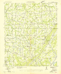
 1936 Roden Gap1936 Print · USGSThe upland terrain along the DeKalb and Etowah county line is captured in the mid-1930s as the Tennessee Valley Authority began its systematic mapping. Researchers can trace rural landmarks like Wallace, Marcus Sch, and the natural pass at Roden Gap.
 - 1936 Map of Chavies
 1936 Chavies1936 Print · USGSDeKalb County is captured here in the mid-1930s, showing a landscape of upland farms and mountain gaps along the Tennessee Basin Divide. Researchers can trace rural life through sites like Peeks Corner Sch, Bohannon Ford, and the many churches of Rainsville.
 - 1936 Map of Dutton
 1936 Dutton1936 Print · USGSSand Mountain and the Tennessee River valley appear here in the mid-thirties just as the landscape began to change. Trace the old community footprints of Dutton and Macedonia or locate family landmarks like Happy Hill Ch and Patterson Sch.
 - 1936 Map of Sulphur Springs
 1936 Sulphur Springs1936 Print · USGSLookout Mountain and the Alabama-Georgia borderlands are captured here in the mid-1930s. Researchers can trace families near Sulphur Springs or find landmarks like Amos Mill, Battelle, and the Lookout Chapel Sch.
 - 1936 Map of Sylvania
 1936 Sylvania1936 Print · USGSSand Mountain's rural plateau comes to life in the mid-1930s, showing a landscape of family farms and community centers. Genealogists can trace family footprints at Bowman Crossroads, Mahan Sch, or the Dean Chapel Cem.
 - 1936 Map of Grove Oak
 1936 Grove Oak1936 Print · USGSDeKalb and Marshall counties are captured in the mid-1930s as the Tennessee Valley Authority began transforming the river landscape. Genealogists can locate numerous rural landmarks like Prospect Ch, Old Beulah Ch, and High Falls Bridge.
 - 1936 Map of Little Falls
 1936 Little Falls1936 Print · USGSDeKalb County, Alabama, is captured in the mid-1930s just as the Tennessee Valley Authority began modernizing the region. Researchers can trace rural life through the upland community of Violet Hill, its Violet Hill Ch, and the high ridges of Lookout Mountain.
Showing maps 1-25 of 192
Top cities of DeKalb County
- Fort Payne historical maps
- Rainsville historical maps
- Henagar historical maps
- Collinsville historical maps
- Crossville historical maps
- Sylvania historical maps
See more
Frequently asked questions
- What are the different types of historical maps available for DeKalb County?
- What is the oldest map of DeKalb County?
- Where can I purchase historical maps of DeKalb County for my home or office?
- Where can I download high-res historical maps of DeKalb County?
- Are there historical topographic maps available for DeKalb County?
- Is there historical aerial imagery available for DeKalb County?
- Where are historical maps of DeKalb County sourced from?