Old Maps of Raley Forest Hill, Atmore
Explore 12 old maps of Raley Forest Hill, spanning from 1942 to today. These high-resolution historic maps reveal how streets, neighborhoods, landmarks, and natural features evolved over time — perfect for genealogy, metal detecting, research, and local history exploration.
What you can do with these maps:
- See how Raley Forest Hill changed over time: Compare historical maps to modern-day views to trace roads, homesites, rail lines & more.
- View detailed metadata: Each map includes creators, publishers, year, scale, and archive source.
- Overlay maps with satellite & LiDAR: Visualize the past alongside modern tools to explore terrain & human change.
- Trusted historical sources: Maps sourced from the USGS, Library of Congress, and other archives.
- Access maps your way: View online, download high-res files, or order prints for personal or research use.
Start exploring old maps of Raley Forest Hill to uncover forgotten places, hidden landmarks, and the deep history beneath your feet.
Raley Forest Hill, Atmore maps
(12)- 1942 Map of Perdido, 1965 Print
 1942 Perdido1965 Print · USGSCoastal Alabama and its inland timberlands are captured here in the early 1940s, showing a transition from remote logging camps to growing railroad towns. Genealogists can locate family landmarks like Steadham Cem, the Langham Lottie Sch, and settlements at Lottie and Nokomis.
 - 1944 Map of Perdido
 1944 Perdido1944 Print · USGSCoastal plain settlements and timber country in South Alabama come alive on this mid-forties survey. Trace family history at Lindsey Cem and St Johns Ch, or locate vanished rail stops along the Logging RR and St Louis - San Francisco RR.2 unique versions available
 - 1953 Map of Andalusia, 1965 Print
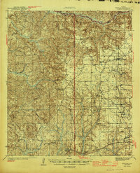
 1953 Andalusia1965 Print · USGSSouth Alabama in the mid-twentieth century remains a land of pine forests and river-fed settlements. You can trace the vital rail corridors of the Louisville & Nashville and locate regional centers such as Andalusia, Brewton, and Monroeville.3 unique versions available
 - 1957 Map of Andalusia
 1957 Andalusia1957 Print · USGSSouthern Alabama in the mid-1950s was a landscape defined by timbered stretches and the rhythmic flow of the Alabama River. Researchers can trace the legacy of the rail era through the Central of Georgia tracks and the storied river bluffs at Choctaw Bluff.
 - 1983 Map of Freemanville
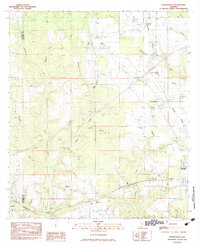 1983 Freemanville1983 Print · USGSEscambia County's borderlands are detailed in this early 1980s survey, showing the rural communities of Poarch and Freemanville at a crossroads of rail and river. Genealogists can locate Mothershed Cem or trace family roots near St Annas Ch and Nokomis.
 - 1986 Map of Atmore
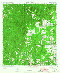
 1986 Atmore1986 Print · USGSSouth Alabama’s river country and timberlands are captured here in the mid-eighties, showing the deep-water bends of the Alabama River and the expanding road networks. Genealogists and historians can trace family locations through small-town post offices and rural churches like Chrysler Ch and the settlement of Barlow Bend.2 unique versions available
 - 2002 Map of Perdido
 2002 Perdido2002 Print · USGSCoastal Alabama at the turn of the millennium reveals a rural landscape of timberlands and small family settlements. Researchers can trace ancestral roots through several documented burial sites like Mothershed Cemetery and Steadham Cemetery or locate old community hubs like Poarch and Lottie.
 - 2011 Map of Freemanville, 2011 Print
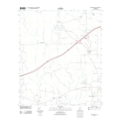 2011 Freemanville2011 Print · USGSCovers Raley Forest Hill, including Atmore, Ewing Farms, and other nearby areas
 - 2014 Map of Freemanville, 2014 Print
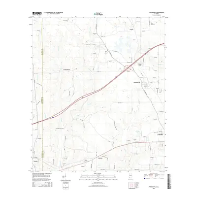 2014 Freemanville2014 Print · USGSCovers Raley Forest Hill, including Atmore, Ewing Farms, and other nearby areas
 - 2018 Map of Freemanville, 2018 Print
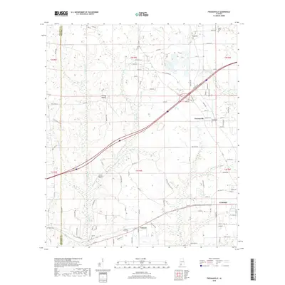 2018 Freemanville2018 Print · USGSCovers Raley Forest Hill, including Atmore, Ewing Farms, and other nearby areas
 - 2020 Map of Freemanville, 2020 Print
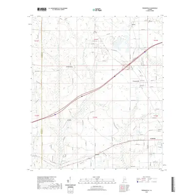 2020 Freemanville2020 Print · USGSCovers Raley Forest Hill, including Atmore, Ewing Farms, and other nearby areas
 - 2024 Map of Freemanville, 2024 Print
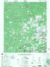
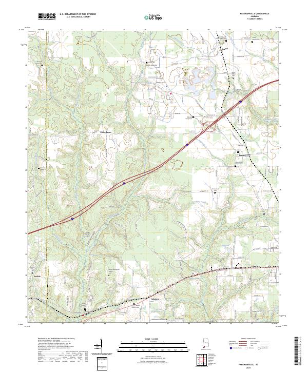 2024 Freemanville2024 Print · USGSSouthern Alabama's rural corridor between Atmore and the Perdido River comes into focus in this contemporary study of Escambia County. Genealogists can trace deep local roots through indigenous and family burial sites like Judson Indian Cem and the Pierce Rabb Cem.
End of results
Showing maps 1-12 of 12
Top cities near Raley Forest Hill
- Atmore historical maps
- Bay Minette historical maps
- McDavid historical maps
- Perdido historical maps
- Huxford historical maps
Frequently asked questions
- What are the different types of historical maps available for Raley Forest Hill?
- What is the oldest map of Raley Forest Hill?
- Where can I purchase historical maps of Raley Forest Hill for my home or office?
- Where can I download high-res historical maps of Raley Forest Hill?
- Are there historical topographic maps available for Raley Forest Hill?
- Is there historical aerial imagery available for Raley Forest Hill?
- Where are historical maps of Raley Forest Hill sourced from?