Old Maps of Glencoe, Alabama for Genealogy
Trace your family roots with 27 historic maps of Glencoe. These high-res maps reveal old neighborhoods, homesites, landmarks, and streets — helping you uncover where your ancestors lived and how the area evolved over time.
- Explore historic neighborhoods: Identify where your relatives may have lived in the 1800s or 1900s.
- Compare maps over time: Trace the changes in streets, buildings, and landmarks for multi-generational research.
- Perfect for genealogy & ancestry research: Used by family historians and researchers to map out lineage and migration.
These maps are an incredible resource for exploring your personal connection to Glencoe's past.
Glencoe, AL maps
(27)- 1893 Map of Fort Payne
 1893 Fort Payne1893 Print · USGSNortheast Alabama is shown here in the late nineteenth century as the rail network transformed the valley floor. Genealogists and historians can trace family-named crossroads like Hoge's X Roads and vital river crossings including Coker Ferry and Sewell Ferry.
 - 1898 Map of Fort Payne, 1964 Print
 1898 Fort Payne1964 Print · USGSDeKalb and Cherokee counties in the late 1890s are defined by the steep ridges of Lookout Mountain and a bustling network of river ferries. Genealogists can trace family roots through numerous river crossings like Hardwick Ferry and early industrial sites such as Sloan Mill or Abernathy Mill.
 - 1900 Map of Fort Payne
 1900 Fort Payne1900 Print · USGSNortheast Alabama is defined by its deep ridges and river valleys in the late nineteenth century. Researchers can trace the era's ferry network across the Coosa River and find old family-run landmarks like Wagners Store and Santy Mills.6 unique versions available
 - 1900 Map of Anniston
 1900 Anniston1900 Print · USGSNortheast Alabama thrived as a railroad and industrial crossroads at the turn of the century. Genealogists and researchers can trace family landmarks and early transport hubs from the Coosa River to Anniston, including Salt Creek Church and Fowler Ferry.6 unique versions available
 - 1947 Map of Glencoe, 1953 Print
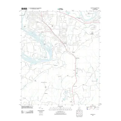
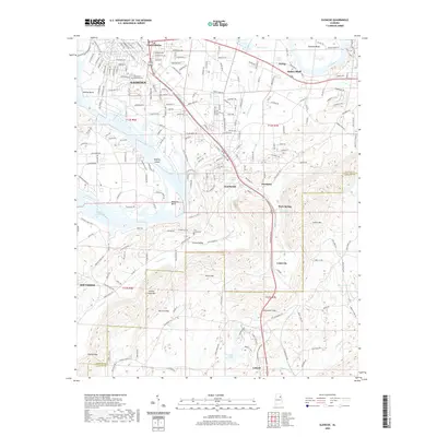
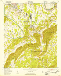 1947 Glencoe1953 Print · USGSGadsden and the Coosa River valley are seen here in the post-war era, showing a mix of industrial mobilization and rural life. Researchers can find military installations like the Specialized Depot 889th AF and historic churches including Antioch Ch and Oak Grove Ch.2 unique versions available
 - 1947 Map of Jacksonville, 1953 Print
 1947 Jacksonville1953 Print · USGSPostwar Etowah and Calhoun counties show a unique mix of expanding industrial centers and deeply rooted rural communities. Local historians can trace early school sites like Webster Sch and long-standing spiritual hubs such as Tredegar Chapel or Friendship Ch.
 - 1953 Map of Atlanta, 1965 Print
 1953 Atlanta1965 Print · USGSThe growing Atlanta metro and the industrial corridors of Eastern Alabama are captured here during the mid-century transition. Researchers can trace the rail-to-road shift through hubs like Anniston and La Grange or locate sites within Fort McClellan.2 unique versions available
 - 1955 Map of Rome
 1955 Rome1955 Print · USGSThe tri-state borderlands of Georgia, Alabama, and Tennessee appear in the mid-fifties as a landscape of ridge-and-valley industry and river navigation. Genealogists can trace family footprints near Chattanooga, the iron works of Gadsden, and textile towns like Trion or Summerville.
 - 1956 Map of Glencoe, 1961 Print
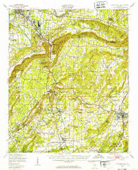
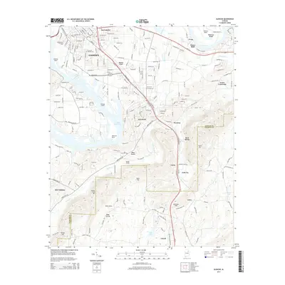
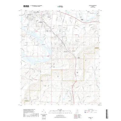
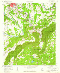 1956 Glencoe1961 Print · USGSThe industrial corridor south of Gadsden comes alive in this mid-century portrait of Etowah County. Researchers can trace the sprawling Gadsden Air Force Depot and local landmarks like Paden Ch and the State Prison Camp.3 unique versions available
 - 1957 Map of Atlanta
 1957 Atlanta1957 Print · USGSAtlanta and the Alabama borderlands appear here in the mid-fifties, capturing the region's post-war suburban and industrial transition. Trace the development of early transport hubs and military sites like Fort McPherson, Anniston, and the Kennesaw Mountain National Battlefield Park.
 - 1958 Map of Atlanta
 1958 Atlanta1958 Print · USGSMid-century Georgia and Alabama are shown in this regional study of the corridor between the Chattahoochee River and the Appalachian foothills. Local historians can trace the development of suburban Atlanta alongside vital landmarks like Stone Mountain, Dobbins AFB, and the Seaboard Air Line rail routes.
 - 1958 Map of Rome, 1966 Print
 1958 Rome1966 Print · USGSNorthwest Georgia and neighboring Tennessee and Alabama are captured here in the late fifties, showcasing a landscape of high ridges and river valleys. Researchers can trace historic rail lines like the Seaboard Air Line RR and explore the bounds of Cloudland Canyon State Park or Fort Oglethorpe.3 unique versions available
 - 1961 Map of Rome
 1961 Rome1961 Print · USGSNorthwest Georgia and neighboring Tennessee and Alabama are shown here at a moment of significant mid-century growth. Researchers can trace the rail networks of the Central of Georgia or locate landmarks within Chickamauga and Chattanooga Nat Military Park.
 - 1963 Map of Rome
 1963 Rome1963 Print · USGSThe tri-state corner of Georgia, Alabama, and Tennessee is captured here during a period of massive reservoir expansion and post-war growth. Genealogists and historians can trace the rail corridors of the Southern Ry or locate landmarks like Fort Oglethorpe and Cloudland Canyon State Park.
 - 1967 Map of Gadsden East, 1970 Print
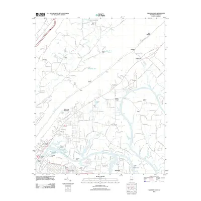
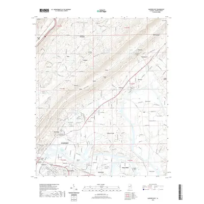
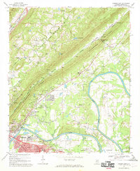 1967 Gadsden East1970 Print · USGSGadsden and the Coosa River are captured here in the late sixties as the region balanced its industrial growth with its rural roots. Trace family history through local landmarks like Tillison Cem, Whites Chapel, and the river crossing at Fitts Ferry.2 unique versions available
 - 1981 Map of Rome, 1982 Print
 1981 Rome1982 Print · USGSNorthwest Georgia and the Alabama borderlands come into focus in the early eighties, defined by the winding Coosa River and the high ridges of Lookout Mountain. Researchers can trace the rail-and-river economy through Rome, Gadsden, and Cedartown, alongside natural landmarks like Yellow Creek Falls.2 unique versions available
 - 1981 Map of Anniston, 1982 Print
 1981 Anniston1982 Print · USGSNortheast Alabama and the Georgia borderlands come alive in the early eighties, showing a landscape of heavy industry, military outposts, and mountain forests. Genealogists and historians can trace the development of towns like Anniston and Carrollton, or locate landmarks such as Whitesides Mill and Webster Chapel.2 unique versions available
 - 2011 Map of Glencoe, 2011 Print
 2011 Glencoe2011 Print · USGSCovers Glencoe, including Gadsden, Southside, and other nearby areas
 - 2011 Map of Gadsden East, 2011 Print
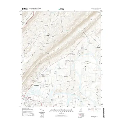
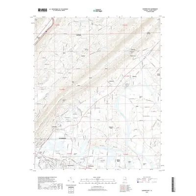
 2011 Gadsden East2011 Print · USGSCovers Glencoe, including Gadsden, Hokes Bluff, and other nearby areas
 - 2014 Map of Gadsden East, 2014 Print
 2014 Gadsden East2014 Print · USGSCovers Glencoe, including Gadsden, Hokes Bluff, and other nearby areas
 - 2014 Map of Glencoe, 2014 Print
 2014 Glencoe2014 Print · USGSCovers Glencoe, including Gadsden, Southside, and other nearby areas
 - 2018 Map of Glencoe, 2018 Print
 2018 Glencoe2018 Print · USGSCovers Glencoe, including Gadsden, Southside, and other nearby areas
 - 2018 Map of Gadsden East, 2018 Print
 2018 Gadsden East2018 Print · USGSCovers Glencoe, including Gadsden, Hokes Bluff, and other nearby areas
 - 2020 Map of Gadsden East, 2020 Print
 2020 Gadsden East2020 Print · USGSCovers Glencoe, including Gadsden, Hokes Bluff, and other nearby areas
 - 2020 Map of Glencoe, 2020 Print
 2020 Glencoe2020 Print · USGSCovers Glencoe, including Gadsden, Southside, and other nearby areas
Showing maps 1-25 of 27
Top cities near Glencoe
- Gadsden historical maps
- Anniston historical maps
- Jacksonville historical maps
- Rainbow City historical maps
- Boaz historical maps
- Southside historical maps
See more
Top neighborhoods of Glencoe
- Pine Grove historical maps
- Rock Spring historical maps
- Cobb City historical maps
- Colvin historical maps
- Keysburg historical maps
Frequently asked questions
- What are the different types of historical maps available for Glencoe?
- What is the oldest map of Glencoe?
- Where can I purchase historical maps of Glencoe for my home or office?
- Where can I download high-res historical maps of Glencoe?
- Are there historical topographic maps available for Glencoe?
- Is there historical aerial imagery available for Glencoe?
- Where are historical maps of Glencoe sourced from?