Old Maps of Fayette County, Alabama for Academic Research
Study the evolution of Fayette County with 109 high-resolution historic maps. Whether you're teaching, researching, or modeling changes in land use, these maps provide essential visual documentation of urban, environmental, and geographic change.
- Analyze long-term change: Track patterns in development, transportation, and natural features.
- Ideal for environmental or urban studies: Support academic projects with primary historical map data.
- Use in the classroom or lab: Educators and researchers rely on these maps to bring historical context to life.
These maps are a powerful tool for teaching, research, and visualizing how Fayette County has changed over the decades.
Fayette County, AL maps
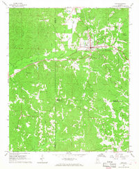
(109)- 1893 Map of Jasper
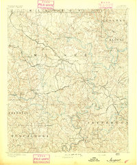 1893 Jasper1893 Print · USGSNorthern Alabama’s coal and timber country comes into focus in the 1890s as railroads began to penetrate the river valleys. Genealogists and historians can trace family-named river crossings like Miller Ferry and Baltimore Ford or early industry at Gamble Mines.5 unique versions available
 - 1949 Map of Oakman, 1972 Print
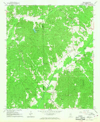
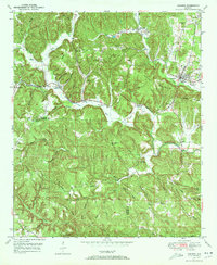 1949 Oakman1972 Print · USGSThe Walker County coal and rail landscape comes alive in this post-war survey of the Oakman area. Researchers can trace the SOUTHERN railroad through the hills to locate Coal Valley, the Patton Hill Fire Tower, and local landmarks like Infant Hill Cemetery.2 unique versions available
 - 1949 Map of Wiley, 1973 Print
 1949 Wiley1973 Print · USGSThe rural borderlands of Fayette, Walker, and Tuscaloosa Counties are captured here in the late 1940s just as the regional landscape was maturing. Genealogists can trace family roots through landmarks like Brandon Sch, Flatwoods Cem, and Rock Springs Ch.3 unique versions available
 - 1951 Map of Oakman
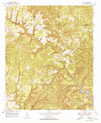
 1951 Oakman1951 Print · USGSWalker and Fayette counties come into focus in the early fifties, showing the rail-dependent settlements of the coal region. Researchers can trace family history through several rural landmarks, including Mt Zion Ch, Infant Hill Cemetery, and the depot at Corona.2 unique versions available
 - 1951 Map of Wiley
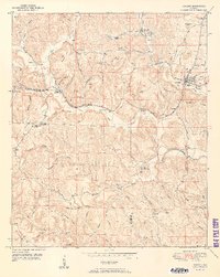
 1951 Wiley1951 Print · USGSTuscaloosa County is shown at mid-century as a land of rural homesteads and winding creek branches. Genealogists can trace family connections through landmarks like Brandon Sch, Rock Springs Ch, and the high ridges of Upton Hill.
 - 1953 Map of Birmingham, 1964 Print
 1953 Birmingham1964 Print · USGSCentral Alabama at mid-century shows a landscape defined by industrial expansion and the iron-rich ridges surrounding Birmingham. Researchers can trace the extensive rail networks of the L & N RR or locate historic federal sites like the Anniston Ordnance Depot.4 unique versions available
 - 1956 Map of Birmingham
 1956 Birmingham1956 Print · USGSCentral Alabama in the mid-fifties exhibits a landscape of growing cities and deep-rooted industrial corridors. Genealogists and historians can trace the development of suburban Mountain Brook or locate regional hubs like Sylacauga and Jasper.
 - 1957 Map of Birmingham
 1957 Birmingham1957 Print · USGSNorth-Central Alabama in the mid-fifties is an industrial powerhouse centered on the steel valleys and sprawling iron ridges. Genealogists and historians can trace the rail-linked growth of Birmingham and Tuscaloosa, or locate rural landmarks like Talladega College and the Anniston Ordnance Depot.
 - 1967 Map of Bankston, 1968 Print
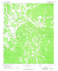
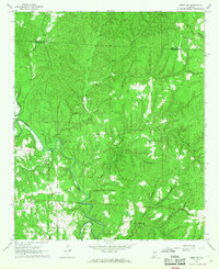
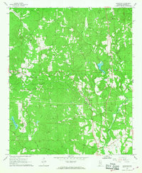 1967 Bankston1968 Print · USGSFayette County's rural heartland during the late sixties is centered on the railroad community of Bankston. Genealogists can trace local roots through numerous landmarks like Philadelphia Cem, Piney Grove Ch, and Woods Cem.2 unique versions available
 - 1967 Map of Winfield SE, 1968 Print
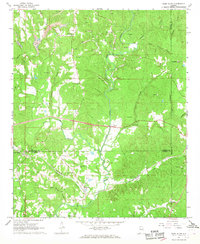
 1967 Winfield SE1968 Print · USGSFayette County in the late sixties remains a landscape of forest and creek-side settlements. Researchers can trace family history through a high density of country landmarks like Housh Chapel Ch, Unity Ch, and the Fowler Cem.
 - 1967 Map of Newtonville, 1968 Print
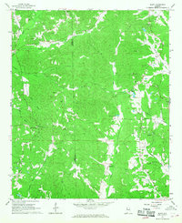
 1967 Newtonville1968 Print · USGSThe rural borderlands of Fayette and Tuscaloosa counties are captured here in the late sixties, centered on the community of Newtonville. Genealogists can trace family landmarks and burial sites like Brotherton Cemetery and Gravlee Cemetery or locate the Newtonville School.3 unique versions available
 - 1967 Map of Kennedy, 1968 Print
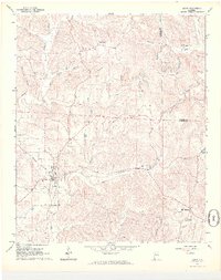
 1967 Kennedy1968 Print · USGSKennedy and the rural borderlands of Lamar, Fayette, and Pickens Counties are captured here in the late sixties as the SOUTHERN railroad still linked these upland communities. Genealogists can locate family landmarks like Moore Cem and Owens Cem or trace rural congregations at Wesley Chapel and Ashcraft Ch.2 unique versions available
 - 1967 Map of Hubbertville, 1968 Print
 1967 Hubbertville1968 Print · USGSNorthwest Alabama's rural hill country comes into focus in the late sixties as the Sipsey River winds through Fayette and Walker Counties. Genealogists and local historians can trace family sites like Killingsworth Ch Cem, Tidwell Chapel, and Hubbertville.2 unique versions available
 - 1967 Map of Glen Allen, 1968 Print
 1967 Glen Allen1968 Print · USGSNorthwest Alabama's coal and rail corridor comes to life in the late 1960s, showing the intersection of heavy industry and rural community life. Genealogists can trace family roots through landmarks like Hallmark Cem, Piney Grove Ch, and the settlement of Rock City.3 unique versions available
 - 1967 Map of Bluff, 1968 Print
 1967 Bluff1968 Print · USGSFayette and Lamar counties are seen here in the late sixties, a period when rural church life and small schoolhouses anchored these Alabama communities. Researchers can trace family history through landmarks like Bethabara Ch, Kirkland Sch, and Powell Cem.3 unique versions available
 - 1967 Map of Berry, 1968 Print
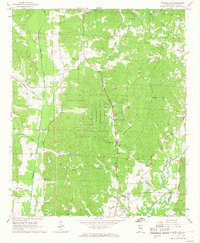
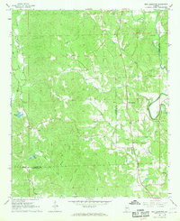
 1967 Berry1968 Print · USGSBerry and the surrounding Fayette County countryside are captured here in the late sixties as the local economy balanced rail transport and industrial mining. Family historians can locate dozens of specific landmarks like Tabernacle Cem, Boley Springs Ch, and the extensive strip mines near Pea Ridge.4 unique versions available
 - 1967 Map of Fayette, 1968 Print
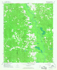
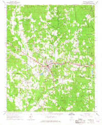
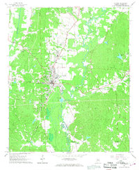 1967 Fayette1968 Print · USGSMid-century Fayette and its riverfront settlements are documented here just as the local infrastructure was modernizing. Researchers can locate family landmarks like Cains Ridge Ch, the Bankhead Cem, and the old Southern rail lines.2 unique versions available
 - 1967 Map of New Lexington, 1968 Print
 1967 New Lexington1968 Print · USGSThe borderlands of Fayette and Tuscaloosa Counties are mapped here in the late sixties, showing a landscape defined by the North River. Genealogists can trace family footprints at New Lexington and numerous landmarks like Ethels Sch and Tucker Cem.2 unique versions available
 - 1967 Map of Winfield, 1968 Print
 1967 Winfield1968 Print · USGSMarion and Fayette counties are shown here in the late sixties as the town of Winfield expands along the railroad. Local researchers can trace family landmarks like Musgrove Chapel, the Drive-in Theater, and the old mining Airshaft.3 unique versions available
 - 1967 Map of Howard, 1968 Print
 1967 Howard1968 Print · USGSThe Fayette and Walker county line comes to life in the late sixties, showing a landscape of ridge-top settlements and creek-side hollows. Genealogists and local historians can trace family locations through numerous sites like Studdards Crossroads, Files Cem, and McDade Ch.3 unique versions available
 - 1967 Map of Guin, 1968 Print
 1967 Guin1968 Print · USGSMarion County hill country centers on the town of Guin during the late sixties as the local economy balances rail transport and gravel mining. Researchers can trace rural lineages through numerous sites like Mount Olive Cem, Love Joy Ch, and Piney Grove Ch.
 - 1967 Map of Belk, 1968 Print
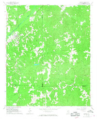
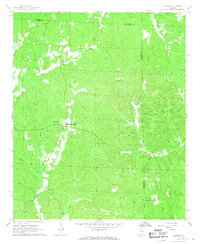
 1967 Belk1968 Print · USGSFayette County's rural landscape is captured here in the late sixties as the rail-and-river economy centered on Belk and Covin remained vital. Family historians can locate specific community landmarks like Sudduth Cem, Wesley Chapel, and Covin Sch New Friendship Ch.
 - 1967 Map of Berry SE, 1968 Print
 1967 Berry SE1968 Print · USGSThe Fayette and Tuscaloosa county line follows the winding course of the North River during the late sixties. Genealogists and local historians can trace family ties through rural landmarks like Gorgas Sch, Sulphur Springs Ch, and the Willingham Cem.4 unique versions available
 - 1984 Map of Jasper, 1985 Print
 1984 Jasper1985 Print · USGSIn the mid-1980s, the Walker County coalfields were a complex web of rail lines and river terminals. Researchers can trace the industrial heritage of the Mulberry Fork and locate local landmarks like the Carbon Hill National Fish Hatchery or Saragossa Ch.2 unique versions available
 - 2011 Map of Belk, 2011 Print
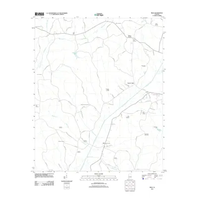 2011 Belk2011 Print · USGSCovers Fayette County, including Belk, Covin, and other nearby areas
Showing maps 1-25 of 109
Top cities of Fayette County
Frequently asked questions
- What are the different types of historical maps available for Fayette County?
- What is the oldest map of Fayette County?
- Where can I purchase historical maps of Fayette County for my home or office?
- Where can I download high-res historical maps of Fayette County?
- Are there historical topographic maps available for Fayette County?
- Is there historical aerial imagery available for Fayette County?
- Where are historical maps of Fayette County sourced from?