1970s Maps of Jefferson County, Alabama
Explore 38 historic maps of Jefferson County from the 1970s. These maps offer a rare glimpse into what life looked like during the 1970s — showing old roads, neighborhoods, homes, and landmarks that have changed or disappeared over time.
Whether you're researching your family's past, planning a metal detecting trip, or studying how Jefferson County's landscape evolved across the 1970s, these high-resolution maps are a powerful tool for exploring the history of this region.
- Focus on a specific era: All maps on this page are from the 1970s, giving you a focused view of this time period.
- See what’s changed: Compare century-old streets, trails, and buildings to today's modern landscape using overlays and satellite layers.
- Research with precision: Use these maps for genealogy, historical research, land use analysis, or educational projects.
- View, download, or print: Maps are fully viewable online in high resolution, and can be downloaded or printed for your own records.
Start exploring Jefferson County's history through authentic maps from the 1970s. This is your window into the past.
Jefferson County, AL maps
(38)- 1971 Map of Dora, 1973 Print
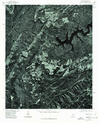
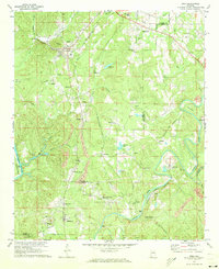 1971 Dora1973 Print · USGSThe river forks of the Alabama coal country come alive in the early seventies, showing a landscape defined by industry and community. Genealogists can trace family roots through Twilley Town, Quintown, and dozens of local landmarks like Morgan Chapel or the Walker Sch.5 unique versions available
 - 1971 Map of Gilmore, 1973 Print
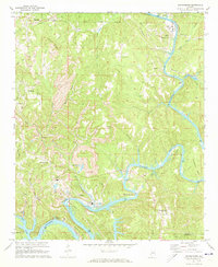
 1971 Gilmore1973 Print · USGSThe Black Warrior River’s winding course defines this Alabama landscape in the 1970s, where coal extraction and river life intersect. Genealogists and historians can trace riverside settlements like Maxine and Gilmore or locate family sites like Prescott Cem and Pleasant Hill Ch.2 unique versions available
 - 1971 Map of Goodsprings, 1973 Print
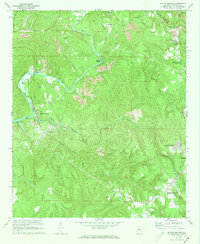
 1971 Goodsprings1973 Print · USGSThe coal and power corridor of Walker County is on full display in the early 1970s, where the winding Mulberry Fork meets industrial growth. Genealogists and historians can locate the Martin High Sch, Busby Cem, and several Strip Mine sites near Gorgas.4 unique versions available
 - 1971 Map of Sylvan Springs, 1973 Print
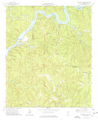
 1971 Sylvan Springs1973 Print · USGSJefferson County in the early seventies shows an active landscape of river commerce and coal extraction along the Locust Fork. Researchers can trace the industrial rail networks of the Birmingham Southern or locate family sites like Atwood Cem and Powhatan.3 unique versions available
 - 1974 Map of Burchfield Store, 1976 Print
 1974 Burchfield Store1976 Print · USGSThe Black Warrior River shapes this mid-1970s landscape along the Tuscaloosa and Jefferson county line as industrial transport meets local recreation. Trace the river's development at John Hollis Bankhead Lock and Dam or locate rural landmarks like Burchfield Store and Providence Ch.3 unique versions available
 - 1975 Map of Cahaba Heights, 1977 Print
 1975 Cahaba Heights1977 Print · USGSThe suburbs of Shelby County are frozen in the mid-seventies, showing the transition from wooded ridges to residential neighborhoods. Researchers can trace the early footprints of Mountain Brook and the growing streets of Cahaba Heights as they looked decades ago.
 - 1975 Map of Yolande NE, 1977 Print
 1975 Yolande NE1977 Print · USGSJefferson County’s industrial and residential fringes come into sharp focus in the mid-1970s. Researchers can trace the development of Hueytown and Virginia, or follow the winding path of Valley Creek through the wooded hills.
 - 1975 Map of Dora, 1977 Print
 1975 Dora1977 Print · USGSWalker County and the surrounding coal districts are seen here in the mid-seventies through detailed aerial orthophotography. Researchers can trace the development of established towns like Dora, Sumiton, and the hillside layout of West Jefferson.
 - 1975 Map of Creel, 1977 Print
 1975 Creel1977 Print · USGSJefferson County's rural river valleys are captured from above in the mid-seventies, showing the landscape just before modern suburban expansion. Researchers can trace the winding paths of the Mulberry Fork and Locust Fork through undisturbed timber and farmland.
 - 1975 Map of Helena, 1977 Print
 1975 Helena1977 Print · USGSShelby County emerges in the mid-seventies in this aerial survey, showing the landscape just as suburban growth began to take hold. Researchers can trace the original footprint of Helena and follow the winding course of the Cahaba River.
 - 1975 Map of Burchfield Store, 1977 Print
 1975 Burchfield Store1977 Print · USGSIn the mid-1970s, the rural hills of Tuscaloosa County were defined by the winding Black Warrior River. Researchers can trace the shoreline of Lake Bankhead and find small inland outposts like Burchfield Store and Bull City.
 - 1975 Map of Yolande SE, 1977 Print
 1975 Yolande SE1977 Print · USGSJefferson County in the mid-1970s is shown in this detailed orthophoto as industrial patterns and rural settlements meet. Genealogists and local historians can trace the clear physical footprints of Mc Calla, Baylor, and Kimbrell.
 - 1975 Map of Trafford, 1977 Print
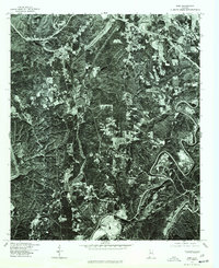
 1975 Trafford1977 Print · USGSNorth-central Alabama comes into clear focus in the mid-seventies through this detailed orthophotograph. Genealogists and land researchers can trace the settlement of Trafford and the winding path of the Locus watercourse.
 - 1975 Map of Remlap, 1977 Print
 1975 Remlap1977 Print · USGSBlount County in the mid-seventies is captured in this detailed orthophoto, revealing the rural character of the Alabama landscape. Researchers can trace the sprawling reach of INLAND LAKE and find the small settlement of REMLAP along the western ridge.
 - 1975 Map of Irondale, 1977 Print
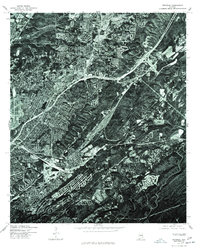 1975 Irondale1977 Print · USGSThe industrial and residential growth of Jefferson County is visible in this mid-seventies aerial survey, showing the landscape just as the modern interstate system matured. Trace the development of Irondale and its surrounding ridge-and-valley terrain.
 - 1975 Map of Birmingham South, 1977 Print
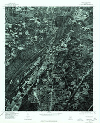
 1975 Birmingham South1977 Print · USGSThe suburban landscape south of Birmingham is captured in detail during the mid-seventies, showing the region's mid-century growth. Researchers can trace the development of residential neighborhoods and road networks through Homewood and Mountain Brook.
 - 1975 Map of Adamsville, 1977 Print
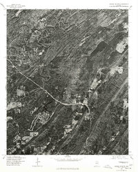
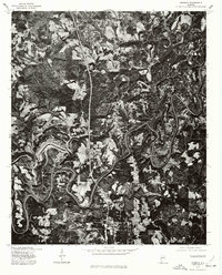
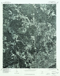 1975 Adamsville1977 Print · USGSBirmingham and its northwestern suburbs are captured in high-detail aerial imagery during the mid-seventies. Local researchers can trace the growth of the city core in Birmingham and examine the early suburban patterns developing around Adamsville.
 - 1975 Map of Argo, 1977 Print
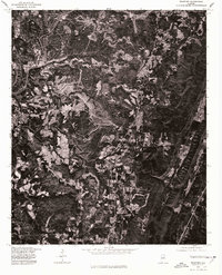
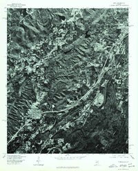 1975 Argo1977 Print · USGSThe foothills of St. Clair County are shown during the mid-seventies in this detailed orthophotoquad. Researchers can trace the early footprint of the settlement at Argo and examine the rural land use patterns across the ridges and valleys of the Alabama landscape.
 - 1975 Map of Goodsprings, 1977 Print
 1975 Goodsprings1977 Print · USGSThe winding Black Warrior River and its surrounding coalfields dominate this mid-seventies aerial survey of Walker County. Genealogists and industrial historians can trace the residential layouts of Gorgas, Dovertown, and Aldridge amidst massive surface mines.
 - 1975 Map of Sylvan Springs, 1977 Print
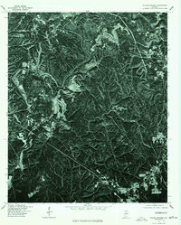 1975 Sylvan Springs1977 Print · USGSJefferson County in the mid-seventies is captured in stark detail through this photographic aerial survey. Trace the winding course of Locust Fork and see how early development in Sylvan Springs sat alongside the massive surface excavations of the time.
 - 1975 Map of Greenwood, 1977 Print
 1975 Greenwood1977 Print · USGSJefferson County residential and industrial clearings are captured during the mid-seventies in this detailed aerial orthophoto. Researchers can trace the development of Greenwood and Parkwood or follow the winding path of the Cahaba River.
 - 1975 Map of Pinson, 1977 Print
 1975 Pinson1977 Print · USGSJefferson County enters a period of rapid suburban growth in the mid-1970s, as shown in this detailed aerial perspective. Researchers can trace development patterns and the early residential footprint of Palmerdale amid the wooded Alabama foothills.
 - 1975 Map of Yolande NW, 1977 Print
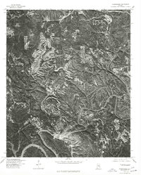
 1975 Yolande NW1977 Print · USGSWestern Jefferson County is captured in the mid-seventies, revealing a landscape defined by heavy industry and rural life. Researchers can trace the layout of Oak Grove and examine the extensive surface mining patterns across the ridges and valleys.
 - 1975 Map of Warrior, 1977 Print
 1975 Warrior1977 Print · USGSJefferson County in the mid-seventies is seen here through high-resolution aerial imagery, revealing the literal landscape of the Alabama coal belt. Local historians can trace the exact 1975 footprints of Warrior and Kimberly alongside the winding Fork.
 - 1975 Map of Brookside, 1977 Print
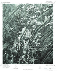
 1975 Brookside1977 Print · USGSJefferson County coal country is captured in the mid-seventies, showing the intersection of industrial mining and small-town life. Trace the development of communities like Brookside, Sayre, and the outskirts of Adamsville across the rugged terrain.
Showing maps 1-25 of 38
Top cities of Jefferson County
- Birmingham historical maps
- Hoover historical maps
- Vestavia Hills historical maps
- Homewood historical maps
- Trussville historical maps
- Bessemer historical maps
See more
Frequently asked questions
- What are the different types of historical maps available for Jefferson County?
- What is the oldest map of Jefferson County?
- Where can I purchase historical maps of Jefferson County for my home or office?
- Where can I download high-res historical maps of Jefferson County?
- Are there historical topographic maps available for Jefferson County?
- Is there historical aerial imagery available for Jefferson County?
- Where are historical maps of Jefferson County sourced from?