1950s Maps of Lowndes County, Alabama
Explore 10 historic maps of Lowndes County from the 1950s. These maps offer a rare glimpse into what life looked like during the 1950s — showing old roads, neighborhoods, homes, and landmarks that have changed or disappeared over time.
Whether you're researching your family's past, planning a metal detecting trip, or studying how Lowndes County's landscape evolved across the 1950s, these high-resolution maps are a powerful tool for exploring the history of this region.
- Focus on a specific era: All maps on this page are from the 1950s, giving you a focused view of this time period.
- See what’s changed: Compare century-old streets, trails, and buildings to today's modern landscape using overlays and satellite layers.
- Research with precision: Use these maps for genealogy, historical research, land use analysis, or educational projects.
- View, download, or print: Maps are fully viewable online in high resolution, and can be downloaded or printed for your own records.
Start exploring Lowndes County's history through authentic maps from the 1950s. This is your window into the past.
Lowndes County, AL maps
(10)- 1953 Map of Montgomery, 1964 Print
 1953 Montgomery1964 Print · USGSCentral Alabama's river-and-rail corridor is mapped here in the mid-fifties, showing the vital connections between the capital and the Black Belt. Genealogists and historians can trace rail depots and crossroads from Marion Junction to Wetumpka, alongside landmarks like Craig AFB.4 unique versions available
 - 1953 Map of Andalusia, 1965 Print
 1953 Andalusia1965 Print · USGSSouth Alabama in the mid-twentieth century remains a land of pine forests and river-fed settlements. You can trace the vital rail corridors of the Louisville & Nashville and locate regional centers such as Andalusia, Brewton, and Monroeville.3 unique versions available
 - 1956 Map of Montgomery
 1956 Montgomery1956 Print · USGSCentral Alabama in the mid-1950s shows a landscape defined by its great river systems and a booming military aviation presence. Genealogists and historians can trace the rail corridors of the Southern Railway and locate tactical bases like Maxwell AFB and Craig AFB.
 - 1957 Map of Montgomery
 1957 Montgomery1957 Print · USGSCentral Alabama in the mid-fifties is defined by the winding Alabama River and a strategic network of military bases and rail lines. Trace family roots in Montgomery and Selma, or locate landmarks like Craig AFB and the State Capitol before the interstate era.
 - 1957 Map of Andalusia
 1957 Andalusia1957 Print · USGSSouthern Alabama in the mid-1950s was a landscape defined by timbered stretches and the rhythmic flow of the Alabama River. Researchers can trace the legacy of the rail era through the Central of Georgia tracks and the storied river bluffs at Choctaw Bluff.
 - 1957 Map of Letohatchee, 1958 Print
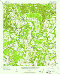
 1957 Letohatchee1958 Print · USGSSouthern Montgomery and Lowndes counties are shown here in the mid-fifties, dominated by timbered creek bottoms and small agricultural centers. Genealogists can trace family names at Shackelford Cem, Letohatchee, and the Louisville and Nashville RR corridor.
 - 1957 Map of Autaugaville, 1958 Print
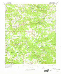
 1957 Autaugaville1958 Print · USGSThe Alabama River and the Western Railway of Alabama define the landscape of Autauga and Lowndes Counties in the late fifties. Genealogists can trace family landmarks like Yankee Town Cem, Morning Star Sch, and the rail stop at St Clair.2 unique versions available
 - 1957 Map of Benton, 1958 Print
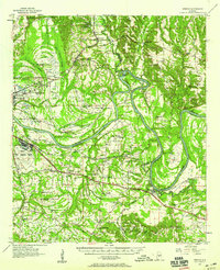 1957 Benton1958 Print · USGSThe river country along the Alabama-Lowndes border in the late fifties is defined by the deep oxbows of the Alabama River. Genealogists and researchers can trace rural life through a network of landmarks like Pine Flat Ch, the Dulaney Sch, and the rail stops at Benton and Tyler.2 unique versions available
 - 1957 Map of Braggs, 1958 Print
 1957 Braggs1958 Print · USGSSouthern Alabama in the late fifties was a region of tight-knit rural communities and family farmsteads. Genealogists and historians can trace the exact locations of local landmarks like the Berlin Normal Sch, Mt Moriah Ch, and the Louisville and Nashville rail stop at Minter (Minters Sta).2 unique versions available
 - 1958 Map of Montgomery, 1959 Print
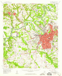 1958 Montgomery1959 Print · USGSThe state capital and its surrounding river bends are captured here during the late fifties, a period of significant military and urban growth. Researchers can trace historic institutions like Alabama State College and the extensive grounds of Maxwell Air Force Base.2 unique versions available
End of results
Showing maps 1-10 of 10
Top cities of Lowndes County
- Fort Deposit historical maps
- Mosses historical maps
- Hayneville historical maps
- White Hall historical maps
- Gordonville historical maps
- Lowndesboro historical maps
See more
Frequently asked questions
- What are the different types of historical maps available for Lowndes County?
- What is the oldest map of Lowndes County?
- Where can I purchase historical maps of Lowndes County for my home or office?
- Where can I download high-res historical maps of Lowndes County?
- Are there historical topographic maps available for Lowndes County?
- Is there historical aerial imagery available for Lowndes County?
- Where are historical maps of Lowndes County sourced from?