Old Maps of Lowndes County, Alabama for Metal Detecting
Plan your next treasure hunt with 147 historic maps of Lowndes County. Find old homesites, ghost towns, trails, and gathering spots that may be lost to time — perfect for identifying promising metal detecting locations.
- Locate forgotten sites: Uncover places like long-lost settlements, abandoned rail lines, or gathering spots.
- Plan better hunts: Use map overlays combined with LiDAR or satellite views to narrow in on historically rich areas.
- Made for detectorists: Thousands of hobbyists use these maps to discover relics, coins, and hidden history.
Use these historic maps to boost your research and find new opportunities beneath the surface of Lowndes County.
Lowndes County, AL maps
(147)- 1927 Map of Montgomery
 1927 Montgomery1927 Print · USGSThe Alabama state capital and its river-bend surroundings are seen here in the late twenties during a period of growth. Researchers can trace the footprints of Maxwell Aviation Field, the Masonic Home, and rural sites like Stones Cem.
 - 1930 Map of Montgomery
 1930 Montgomery1930 Print · USGSThe Alabama state capital is seen here as a bustling rail and river crossroads in the late twenties. Trace the historic growth of the city and its surrounding rural communities through sites like Maxwell Aviation Field, Kilby Prison, and Oakwood Cemetery.4 unique versions available
 - 1953 Map of Montgomery, 1964 Print
 1953 Montgomery1964 Print · USGSCentral Alabama's river-and-rail corridor is mapped here in the mid-fifties, showing the vital connections between the capital and the Black Belt. Genealogists and historians can trace rail depots and crossroads from Marion Junction to Wetumpka, alongside landmarks like Craig AFB.4 unique versions available
 - 1953 Map of Andalusia, 1965 Print
 1953 Andalusia1965 Print · USGSSouth Alabama in the mid-twentieth century remains a land of pine forests and river-fed settlements. You can trace the vital rail corridors of the Louisville & Nashville and locate regional centers such as Andalusia, Brewton, and Monroeville.3 unique versions available
 - 1956 Map of Montgomery
 1956 Montgomery1956 Print · USGSCentral Alabama in the mid-1950s shows a landscape defined by its great river systems and a booming military aviation presence. Genealogists and historians can trace the rail corridors of the Southern Railway and locate tactical bases like Maxwell AFB and Craig AFB.
 - 1957 Map of Montgomery
 1957 Montgomery1957 Print · USGSCentral Alabama in the mid-fifties is defined by the winding Alabama River and a strategic network of military bases and rail lines. Trace family roots in Montgomery and Selma, or locate landmarks like Craig AFB and the State Capitol before the interstate era.
 - 1957 Map of Andalusia
 1957 Andalusia1957 Print · USGSSouthern Alabama in the mid-1950s was a landscape defined by timbered stretches and the rhythmic flow of the Alabama River. Researchers can trace the legacy of the rail era through the Central of Georgia tracks and the storied river bluffs at Choctaw Bluff.
 - 1957 Map of Letohatchee, 1958 Print
 1957 Letohatchee1958 Print · USGSSouthern Montgomery and Lowndes counties are shown here in the mid-fifties, dominated by timbered creek bottoms and small agricultural centers. Genealogists can trace family names at Shackelford Cem, Letohatchee, and the Louisville and Nashville RR corridor.
 - 1957 Map of Autaugaville, 1958 Print
 1957 Autaugaville1958 Print · USGSThe Alabama River and the Western Railway of Alabama define the landscape of Autauga and Lowndes Counties in the late fifties. Genealogists can trace family landmarks like Yankee Town Cem, Morning Star Sch, and the rail stop at St Clair.2 unique versions available
 - 1957 Map of Benton, 1958 Print
 1957 Benton1958 Print · USGSThe river country along the Alabama-Lowndes border in the late fifties is defined by the deep oxbows of the Alabama River. Genealogists and researchers can trace rural life through a network of landmarks like Pine Flat Ch, the Dulaney Sch, and the rail stops at Benton and Tyler.2 unique versions available
 - 1957 Map of Braggs, 1958 Print
 1957 Braggs1958 Print · USGSSouthern Alabama in the late fifties was a region of tight-knit rural communities and family farmsteads. Genealogists and historians can trace the exact locations of local landmarks like the Berlin Normal Sch, Mt Moriah Ch, and the Louisville and Nashville rail stop at Minter (Minters Sta).2 unique versions available
 - 1958 Map of Montgomery, 1959 Print
 1958 Montgomery1959 Print · USGSThe state capital and its surrounding river bends are captured here during the late fifties, a period of significant military and urban growth. Researchers can trace historic institutions like Alabama State College and the extensive grounds of Maxwell Air Force Base.2 unique versions available
 - 1971 Map of Fort Deposit, 1973 Print
 1971 Fort Deposit1973 Print · USGSFort Deposit and the surrounding hill country of Lowndes and Butler counties are captured here in the early seventies. Genealogists and local historians can trace family landmarks like Myrtlewood Cemetery, Indian Hill Church, and the rural community of Searey.2 unique versions available
 - 1971 Map of Fort Dale, 1973 Print
 1971 Fort Dale1973 Print · USGSButler County's rural landscape is detailed here in the early seventies, showing a network of established homesteads and small communities. Genealogists and historians can trace family locations near Clover Hill, Manningham, or the site of Fort Dale.2 unique versions available
 - 1971 Map of Danielsville, 1973 Print
 1971 Danielsville1973 Print · USGSCrenshaw County at the dawn of the 1970s reveals a quiet landscape of rural crossroads and creek-side settlements. Genealogists and local historians can trace family locations near Danielsville and Ellis Crossroads, or locate burial sites at King Cem and Hopewell Cem.
 - 1975 Map of Benton SE
 1975 Benton SE1975 Print · USGSBenton and the surrounding Lowndes County bottomlands are captured in detail during the mid-1970s. This aerial orthophotoquad allows researchers to see the actual fields and structures around the Benton settlement and the wide curves of the Alabama River.
 - 1975 Map of Autaugaville SW, 1977 Print
 1975 Autaugaville SW1977 Print · USGSLowndes County lands south of the Alabama River are shown in high-contrast aerial detail during the mid-seventies. Genealogists and land researchers can trace property lines and field patterns surrounding the settlement of White Hall.
 - 1975 Map of Autaugaville SE, 1977 Print
 1975 Autaugaville SE1977 Print · USGSLowndes County lands south of the Alabama River are shown in mid-seventies detail through this aerial study. Local historians can trace the development of Burkville and the era's evolving transportation and field patterns.
 - 1975 Map of Benton NE, 1977 Print
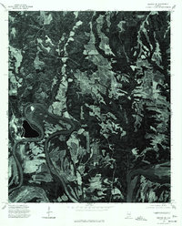 1975 Benton NE1977 Print · USGSAutauga County's agricultural heartland and the winding Alabama River are captured in this mid-seventies aerial survey. Researchers can trace the rural landscape around Mulberry and study the intricate river meanders and historic property boundaries.
 - 1975 Map of Autaugaville NW, 1977 Print
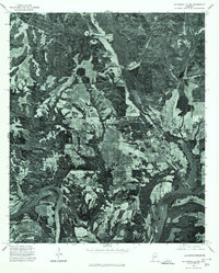 1975 Autaugaville NW1977 Print · USGSAutauga County's riverfront landscape is revealed in this mid-seventies survey of the rural South. Trace the relationship between the bend of the Alabama River and the settlement at Autaugaville through detailed aerial imagery.
 - 1975 Map of Autaugaville NE, 1977 Print
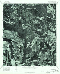 1975 Autaugaville NE1977 Print · USGSAutauga County's riverfront and timberlands are captured in detail during the mid-seventies, showing the rural landscape of central Alabama. Genealogists and local historians can trace the roads and fields surrounding the settlement of Forester and the banks of the Alabama River.
 - 1975 Map of Montgomery SW, 1977 Print
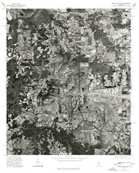 1975 Montgomery SW1977 Print · USGSSouthwest of the state capital in the mid-seventies, this aerial view captures the rural-urban fringe as it transitioned from traditional farmland to modern infrastructure. Researchers can trace the winding course of the Alabama River and examine the intricate field patterns and roadways that defined the region at the time.
 - 1981 Map of Calhoun
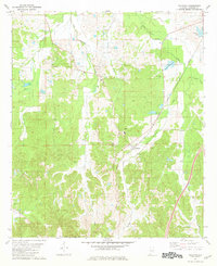 1981 Calhoun1981 Print · USGSLowndes County's rural character and rail connections are visible here in the early 1980s, focused on the settlement of Calhoun. Researchers can trace the Louisville and Nashville rail line and locate community hubs like Big Union Ch and New Hope.
 - 1981 Map of Letohatchee
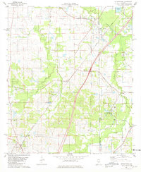 1981 Letohatchee1981 Print · USGSLowndes and Montgomery Counties are captured here in the early eighties, showing a landscape defined by the intersection of historic transit and rural life. Genealogists can locate family-named landmarks and old congregations like Mosleys Cem, Rogers Cem, and Shiloh Ch.2 unique versions available
 - 1981 Map of Hayneville
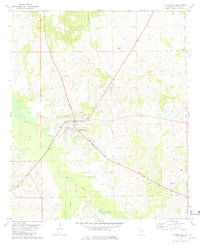 1981 Hayneville1981 Print · USGSCentral Lowndes County in the early eighties is centered on the town of Hayneville and its network of rural churches. Genealogists can trace family landmarks like Mushat-Gilchrist Cem, Friendship Ch, and Grant Cem across this creek-fed landscape.
Showing maps 1-25 of 147
Top cities of Lowndes County
- Fort Deposit historical maps
- Mosses historical maps
- Hayneville historical maps
- White Hall historical maps
- Gordonville historical maps
- Lowndesboro historical maps
See more
Frequently asked questions
- What are the different types of historical maps available for Lowndes County?
- What is the oldest map of Lowndes County?
- Where can I purchase historical maps of Lowndes County for my home or office?
- Where can I download high-res historical maps of Lowndes County?
- Are there historical topographic maps available for Lowndes County?
- Is there historical aerial imagery available for Lowndes County?
- Where are historical maps of Lowndes County sourced from?