Old Maps of Marengo County, Alabama
Explore 187 old maps of Marengo County, spanning from 1946 to today. These high-resolution historic maps reveal how streets, neighborhoods, landmarks, and natural features evolved over time — perfect for genealogy, metal detecting, research, and local history exploration.
What you can do with these maps:
- See how Marengo County changed over time: Compare historical maps to modern-day views to trace roads, homesites, rail lines & more.
- View detailed metadata: Each map includes creators, publishers, year, scale, and archive source.
- Overlay maps with satellite & LiDAR: Visualize the past alongside modern tools to explore terrain & human change.
- Trusted historical sources: Maps sourced from the USGS, Library of Congress, and other archives.
- Access maps your way: View online, download high-res files, or order prints for personal or research use.
Start exploring old maps of Marengo County to uncover forgotten places, hidden landmarks, and the deep history beneath your feet.
Marengo County, AL maps
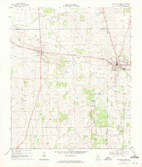
(187)- 1946 Map of Demopolis, 1947 Print
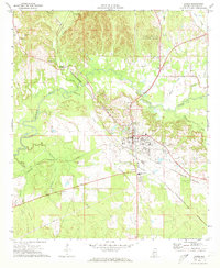
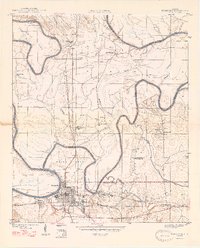 1946 Demopolis1947 Print · USGSDemopolis and its surrounding river bends are captured here in the mid-1940s, showing a landscape defined by the Tombigbee and Black Warrior rivers. Genealogists and historians can trace community roots through numerous local landmarks like Jerusalem Ch, Birdine Junior High Sch, and Merriwether Ferry.3 unique versions available
 - 1947 Map of Demopolis
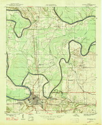 1947 Demopolis1947 Print · USGSDemopolis and its surroundings were defined by the convergence of major rivers and railroads in the late 1940s. Genealogists and historians can trace community life through sites like the Rosenwald Sch, the Arington Cem, and landmarks such as Merriwether Ferry.
 - 1948 Map of Mc Dowell, 1973 Print
 1948 Mc Dowell1973 Print · USGSSumter and Greene Counties are defined by the winding river and its early crossings in the late 1940s. Genealogists and historians can trace the foundations of rural life through landmarks like McDowell Ferry, Belmont Ch, and the Taylor Cem.3 unique versions available
 - 1949 Map of Mc Dowell
 1949 Mc Dowell1949 Print · USGSSumter County in the late 1940s is defined by its deep relationship with the winding Tombigbee River. Genealogists and historians can trace family roots through numerous local landmarks like Bucks Chapel Sch, Belmont Ch, and the historic McDowell Ferry.2 unique versions available
 - 1953 Map of Montgomery, 1964 Print
 1953 Montgomery1964 Print · USGSCentral Alabama's river-and-rail corridor is mapped here in the mid-fifties, showing the vital connections between the capital and the Black Belt. Genealogists and historians can trace rail depots and crossroads from Marion Junction to Wetumpka, alongside landmarks like Craig AFB.4 unique versions available
 - 1953 Map of Andalusia, 1965 Print
 1953 Andalusia1965 Print · USGSSouth Alabama in the mid-twentieth century remains a land of pine forests and river-fed settlements. You can trace the vital rail corridors of the Louisville & Nashville and locate regional centers such as Andalusia, Brewton, and Monroeville.3 unique versions available
 - 1953 Map of Hattiesburg, 1965 Print
 1953 Hattiesburg1965 Print · USGSSouth Mississippi and western Alabama are shown here during the mid-twentieth century as the timber and rail industries shaped the region. Genealogists and historians can trace rail lines like the Mississippi Central and locate rural centers such as Magee, Richton, and Mount Vernon.4 unique versions available
 - 1953 Map of Meridian, 1966 Print
 1953 Meridian1966 Print · USGSEast Central Mississippi and the Alabama borderlands are captured here during a period of steady growth and infrastructure expansion. Genealogists and historians can trace rail-town development along the Gulf Mobile & Ohio Railroad and find early settlements like Scooba, Pelahatchie, and De Kalb.2 unique versions available
 - 1956 Map of Montgomery
 1956 Montgomery1956 Print · USGSCentral Alabama in the mid-1950s shows a landscape defined by its great river systems and a booming military aviation presence. Genealogists and historians can trace the rail corridors of the Southern Railway and locate tactical bases like Maxwell AFB and Craig AFB.
 - 1957 Map of Meridian
 1957 Meridian1957 Print · USGSEast Central Mississippi and parts of Western Alabama come alive in the mid-1950s, centered on the transit hub of Meridian. Researchers can trace old rail lines like the Illinois Central and find historic sites such as the Choctaw Indian Reservation and Roosevelt State Park.
 - 1957 Map of Montgomery
 1957 Montgomery1957 Print · USGSCentral Alabama in the mid-fifties is defined by the winding Alabama River and a strategic network of military bases and rail lines. Trace family roots in Montgomery and Selma, or locate landmarks like Craig AFB and the State Capitol before the interstate era.
 - 1957 Map of Andalusia
 1957 Andalusia1957 Print · USGSSouthern Alabama in the mid-1950s was a landscape defined by timbered stretches and the rhythmic flow of the Alabama River. Researchers can trace the legacy of the rail era through the Central of Georgia tracks and the storied river bluffs at Choctaw Bluff.
 - 1958 Map of Hattiesburg
 1958 Hattiesburg1958 Print · USGSSoutheastern Mississippi's timber and rail networks are at their peak during the late fifties, centered on the growing hubs of Hattiesburg and Laurel. Researchers can trace old family landmarks like Sims Chapel, the Busbey Game Refuge, and the vanished stops along the Mississippi Central railroad.2 unique versions available
 - 1965 Map of Meridian
 1965 Meridian1965 Print · USGSEast Mississippi and West Alabama are mapped here in the mid-sixties as the region's modern highway and reservoir systems began to take shape. Researchers can trace rural lineages through local landmarks like Prince Chapel and Tuscahoma Landing, or follow the historic Gulf Mobile & Ohio rail lines.
 - 1968 Map of Thomaston East, 1971 Print
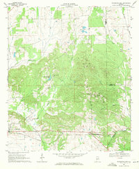 1968 Thomaston East1971 Print · USGSMarengo County during the late sixties is captured here in detail, showing a landscape of rural settlements and railroad corridors. Researchers can trace the Louisville and Nashville line and locate community landmarks like Bethel Hill Ch, St Johns Sch, and the town of McKinley.
 - 1968 Map of Uniontown West, 1971 Print
 1968 Uniontown West1971 Print · USGSUniontown and Faunsdale sit at the center of this late-sixties survey of Alabama's Black Belt, following the route of the SOUTHERN railroad. Researchers can trace family history through local landmarks like St Michaels Cem, Siddonsville, and Hatch High Sch.3 unique versions available
 - 1968 Map of Thomaston West, 1971 Print
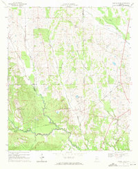
 1968 Thomaston West1971 Print · USGSMarengo County in the late sixties shows a landscape shaped by the Louisville and Nashville railroad and the winding Chickasaw Bogue. Genealogists can trace family roots through numerous rural landmarks like Half Chance, Cades Chapel Cem, and the County Training Sch.2 unique versions available
 - 1968 Map of Gallion, 1971 Print
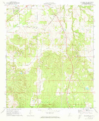
 1968 Gallion1971 Print · USGSGallion and the surrounding Marengo County countryside appear here in the late sixties, showing a landscape defined by small rural congregations and the Southern railway. Researchers can trace family history through several landmarks like St Pauls Ch, St James Ch, and the Allenville Cem.3 unique versions available
 - 1968 Map of Central Mills, 1971 Print
 1968 Central Mills1971 Print · USGSDallas and Perry counties are shown here in the late sixties, where the timber and rail economy shaped rural life. Genealogists can trace family landmarks and community centers like Central Mills, Shady Grove Ch, and the small settlement of Blalock.3 unique versions available
 - 1970 Map of Myrtlewood North, 1973 Print
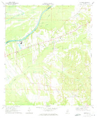
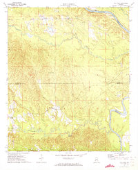
 1970 Myrtlewood North1973 Print · USGSMarengo County and its neighbors meet along the winding river bends of the Tombigbee in the late sixties. Genealogists and local historians can trace family locations near Myrtlewood, Hill Top, and country churches like New Macedonia Ch.
 - 1970 Map of Jefferson, 1973 Print
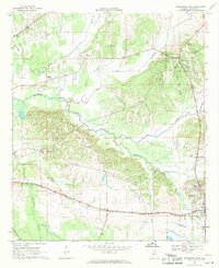
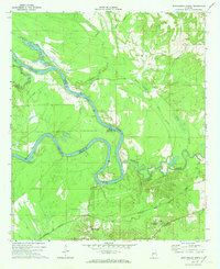
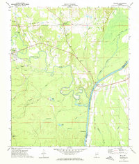
 1970 Jefferson1973 Print · USGSThe Tombigbee River valley in Marengo County comes into focus during the early seventies, detailing the rural communities of Jefferson and Moscow. Researchers can trace old rail lines like the Southern and find landmarks such as Essex Sch and Salt Well.3 unique versions available
 - 1970 Map of Old Spring Hill, 1973 Print
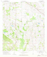
 1970 Old Spring Hill1973 Print · USGSMarengo County's rural character and church-centered communities are preserved here in the early seventies. Genealogists and historians can trace the locations of numerous landmarks like Old Spring Hill, Old Mt Canaan Ch, and Lake Miriam.2 unique versions available
 - 1970 Map of Linden, 1973 Print
 1970 Linden1973 Print · USGSMarengo County during the early 1970s shows the bustling county seat and its surrounding rail-connected rural communities. Genealogists can locate family landmarks like Jefferson Station, Pin Hook, and historic sites including Chalk Level Ch.4 unique versions available
 - 1971 Map of Whitfield, 1973 Print
 1971 Whitfield1973 Print · USGSChoctaw County’s rural river border comes into focus in the early 1970s as the Tombigbee meanders past local settlements. Genealogists can trace community roots at Bethlehem Cem and Edna, or locate the path of the Kinterbish Railroad Grade.
 - 1971 Map of Coatopa, 1974 Print
 1971 Coatopa1974 Print · USGSSumter and Marengo counties meet at the Tombigbee River in the early 1970s, where river culture and rail history intersect. Genealogists can trace local roots at Marys Chapel Cem, Mt Tabor Ch, and the crossing at Rooster Bridge.4 unique versions available
Showing maps 1-25 of 187
Top cities of Marengo County
- Demopolis historical maps
- Linden historical maps
- Thomaston historical maps
- Sweet Water historical maps
- Providence historical maps
- Faunsdale historical maps
See more
Frequently asked questions
- What are the different types of historical maps available for Marengo County?
- What is the oldest map of Marengo County?
- Where can I purchase historical maps of Marengo County for my home or office?
- Where can I download high-res historical maps of Marengo County?
- Are there historical topographic maps available for Marengo County?
- Is there historical aerial imagery available for Marengo County?
- Where are historical maps of Marengo County sourced from?