1970s Maps of Marengo County, Alabama
Explore 20 historic maps of Marengo County from the 1970s. These maps offer a rare glimpse into what life looked like during the 1970s — showing old roads, neighborhoods, homes, and landmarks that have changed or disappeared over time.
Whether you're researching your family's past, planning a metal detecting trip, or studying how Marengo County's landscape evolved across the 1970s, these high-resolution maps are a powerful tool for exploring the history of this region.
- Focus on a specific era: All maps on this page are from the 1970s, giving you a focused view of this time period.
- See what’s changed: Compare century-old streets, trails, and buildings to today's modern landscape using overlays and satellite layers.
- Research with precision: Use these maps for genealogy, historical research, land use analysis, or educational projects.
- View, download, or print: Maps are fully viewable online in high resolution, and can be downloaded or printed for your own records.
Start exploring Marengo County's history through authentic maps from the 1970s. This is your window into the past.
Marengo County, AL maps
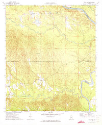
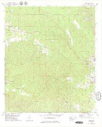
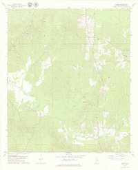
(20)- 1970 Map of Myrtlewood North, 1973 Print
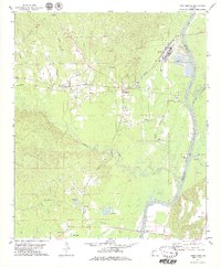
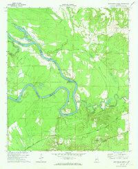 1970 Myrtlewood North1973 Print · USGSMarengo County and its neighbors meet along the winding river bends of the Tombigbee in the late sixties. Genealogists and local historians can trace family locations near Myrtlewood, Hill Top, and country churches like New Macedonia Ch.
 - 1970 Map of Jefferson, 1973 Print
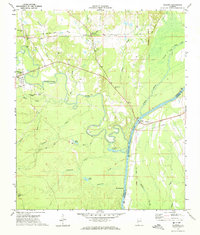
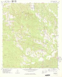
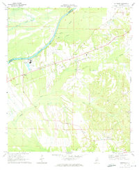 1970 Jefferson1973 Print · USGSThe Tombigbee River valley in Marengo County comes into focus during the early seventies, detailing the rural communities of Jefferson and Moscow. Researchers can trace old rail lines like the Southern and find landmarks such as Essex Sch and Salt Well.3 unique versions available
 - 1970 Map of Old Spring Hill, 1973 Print
 1970 Old Spring Hill1973 Print · USGSMarengo County's rural character and church-centered communities are preserved here in the early seventies. Genealogists and historians can trace the locations of numerous landmarks like Old Spring Hill, Old Mt Canaan Ch, and Lake Miriam.2 unique versions available
 - 1970 Map of Linden, 1973 Print
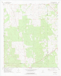
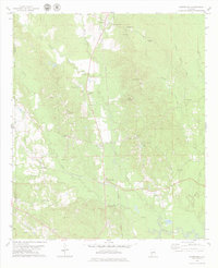
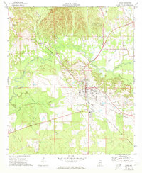 1970 Linden1973 Print · USGSMarengo County during the early 1970s shows the bustling county seat and its surrounding rail-connected rural communities. Genealogists can locate family landmarks like Jefferson Station, Pin Hook, and historic sites including Chalk Level Ch.4 unique versions available
 - 1971 Map of Whitfield, 1973 Print
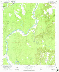
 1971 Whitfield1973 Print · USGSChoctaw County’s rural river border comes into focus in the early 1970s as the Tombigbee meanders past local settlements. Genealogists can trace community roots at Bethlehem Cem and Edna, or locate the path of the Kinterbish Railroad Grade.
 - 1971 Map of Coatopa, 1974 Print
 1971 Coatopa1974 Print · USGSSumter and Marengo counties meet at the Tombigbee River in the early 1970s, where river culture and rail history intersect. Genealogists can trace local roots at Marys Chapel Cem, Mt Tabor Ch, and the crossing at Rooster Bridge.4 unique versions available
 - 1972 Map of Woods Bluff, 1975 Print
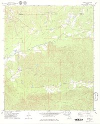
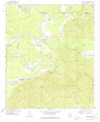 1972 Woods Bluff1975 Print · USGSThe Tombigbee River country at the start of the 1970s reveals a landscape of historic river landings and ancient boundaries. Researchers can trace family sites near Smyer and Woods Bluff, or locate the Old Indian Treaty Boundary and Witch Creek Ch.2 unique versions available
 - 1973 Map of Thomasville, 1977 Print
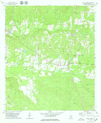
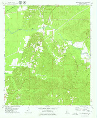
 1973 Thomasville1977 Print · USGSThomasville and its surrounding rail-side communities are captured here in the early 1970s as the town expanded near the SOUTHERN line. Genealogists and historians can trace family roots through numerous sites like Finley Crossing, Danzy Cem, and the historic Old Indian Treaty Bdy.2 unique versions available
 - 1978 Map of Pennington, 1979 Print
 1978 Pennington1979 Print · USGSThe Tombigbee River corridor in the late 1970s reveals a landscape of industrial river landings and rural churches. Genealogists and local historians can trace family-named sites like Watters Lake, Millwood Cem, and several historic congregations including Little Zion Ch.
 - 1978 Map of Surginer, 1979 Print
 1978 Surginer1979 Print · USGSMarengo and Wilcox Counties remained a landscape of quiet crossroads and creek-side settlements in the late seventies. Family researchers can trace the placement of local landmarks like Wesley Chapel, Arbor Cem, and the old rail siding at Magnolia Terminal.2 unique versions available
 - 1978 Map of Putnam, 1979 Print
 1978 Putnam1979 Print · USGSThe riverfronts of Marengo and Choctaw Counties come into focus during the late 1970s, centered on the Tombigbee River. Researchers can locate rural landmarks like Tuscahoma Landing, East Choctaw Sch, and the Putnam Cem.
 - 1978 Map of Sweet Water, 1979 Print
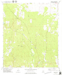
 1978 Sweet Water1979 Print · USGSMarengo County remained a landscape of tight-knit rural communities and family landmarks in the late seventies. Researchers can trace ancestral roots through sites like Shiloh Ch, Pruitt Cem, and the old settlement at Dixons Mills.2 unique versions available
 - 1978 Map of Bashi, 1979 Print
 1978 Bashi1979 Print · USGSThe border of Marengo and Clarke Counties is defined by the historical Old Indian Treaty Boundary in the 1970s. Researchers can trace rural life through sites like Tallahatta Springs, Glover, and Thomasville Academy.2 unique versions available
 - 1978 Map of Nanafalia, 1979 Print
 1978 Nanafalia1979 Print · USGSThe community of Nanafalia and the surrounding Marengo County timberlands appear here in the late seventies. Family historians can trace rural roots through the St Paul Cem, Hickory Grove Cem, and the old church at Nicholsville.2 unique versions available
 - 1978 Map of Flatwood, 1979 Print
 1978 Flatwood1979 Print · USGSMarengo and Wilcox counties appear here in the late seventies, showing a rural landscape defined by creek drainages and rail history. You can trace the Southern line alongside the Old Red Railroad Grade and locate the Goose Creek Cem.
 - 1978 Map of Myrtlewood South, 1979 Print
 1978 Myrtlewood South1979 Print · USGSMarengo County during the late seventies shows a rural landscape shaped by timber, rail, and water. Genealogists and local historians can trace family locations near Half Acre, James Chapel, and the Community Cem along the winding Beaver Creek.
 - 1978 Map of Morvin, 1979 Print
 1978 Morvin1979 Print · USGSThe rural borders of Clarke and Marengo Counties are documented here in the late seventies, showing the landscape just before modern expansion. Genealogists can trace family names and local landmarks like Campbell Cem, Walnut Grove Ch, and the historic Indian Treaty Boundary.2 unique versions available
 - 1978 Map of Miller, 1979 Print
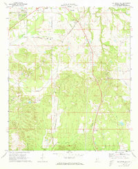
 1978 Miller1979 Print · USGSMarengo County, Alabama, is documented here in the late 1970s as a landscape of rural communities and intricate creek systems. Genealogists can locate family landmarks such as Rembert Cem, Campground Ch, and the small settlement of Octagon.
 - 1978 Map of Kimbrough, 1979 Print
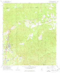
 1978 Kimbrough1979 Print · USGSWilcox County’s rural rail and river landscape is captured here in the late 1970s, centered on the crossing of the Southern and St Louis-San Francisco lines. Researchers can trace family sites like Epiphany Sch, Thornhill Cem, and the settlement of Anne Manie.
 - 1978 Map of Magnolia, 1979 Print
 1978 Magnolia1979 Print · USGSThe rural interior of Marengo County in the late seventies reveals a landscape of dispersed family settlements and small-town rail stops. Genealogists and historians can trace local landmarks like Octagon Station, Mooring Cem, and Shiloh Ch.
End of results
Showing maps 1-20 of 20
Top cities of Marengo County
- Demopolis historical maps
- Linden historical maps
- Thomaston historical maps
- Sweet Water historical maps
- Providence historical maps
- Faunsdale historical maps
See more
Frequently asked questions
- What are the different types of historical maps available for Marengo County?
- What is the oldest map of Marengo County?
- Where can I purchase historical maps of Marengo County for my home or office?
- Where can I download high-res historical maps of Marengo County?
- Are there historical topographic maps available for Marengo County?
- Is there historical aerial imagery available for Marengo County?
- Where are historical maps of Marengo County sourced from?