1970s Maps of Pike Road, Alabama
Explore 6 historic maps of Pike Road from the 1970s. These maps offer a rare glimpse into what life looked like during the 1970s — showing old roads, neighborhoods, homes, and landmarks that have changed or disappeared over time.
Whether you're researching your family's past, planning a metal detecting trip, or studying how Pike Road's landscape evolved across the 1970s, these high-resolution maps are a powerful tool for exploring the history of this region.
- Focus on a specific era: All maps on this page are from the 1970s, giving you a focused view of this time period.
- See what’s changed: Compare century-old streets, trails, and buildings to today's modern landscape using overlays and satellite layers.
- Research with precision: Use these maps for genealogy, historical research, land use analysis, or educational projects.
- View, download, or print: Maps are fully viewable online in high resolution, and can be downloaded or printed for your own records.
Start exploring Pike Road's history through authentic maps from the 1970s. This is your window into the past.
Pike Road, AL maps
(6)- 1971 Map of Davis Crossroads, 1974 Print
 1971 Davis Crossroads1974 Print · USGSMontgomery County was a landscape of quiet farming communities and family-named landmarks during the early seventies. Genealogists can trace rural homesteads near Hobbie Farm, find family burial sites like Underwood Cem, and locate country churches including Jericho Ch.2 unique versions available
 - 1971 Map of Chesson, 1974 Print
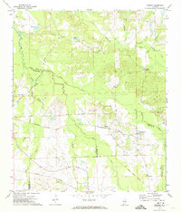 1971 Chesson1974 Print · USGSMacon County's rural landscape is captured here in the early seventies, where rail lines and treaty boundaries still define the local geography. Researchers can trace family roots at Mt Zion Ch, locate the settlement of Chesson, or follow the historic Indian Treaty Boundary.2 unique versions available
 - 1971 Map of Teasleys Mill, 1974 Print
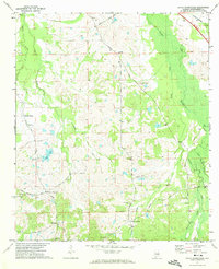
 1971 Teasleys Mill1974 Print · USGSMontgomery County’s rural countryside is captured in the early seventies as small farming communities and country roads defined the landscape. Genealogists can trace family footprints through numerous local landmarks like Elisabeth Ch, Teasleys Mill, and the Panhandle Cem.2 unique versions available
 - 1975 Map of Mount Meigs SE, 1977 Print
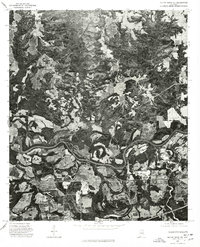
 1975 Mount Meigs SE1977 Print · USGSThe rural landscape east of Montgomery is captured in high detail in the mid-1970s, showcasing the agricultural patterns of central Alabama. Researchers can trace the exact footprints of settlements like Mount Meigs, Pike Road, and Waugh across the varied terrain.
 - 1975 Map of Mount Meigs SW, 1977 Print
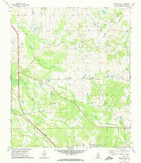
 1975 Mount Meigs SW1977 Print · USGSThe rural landscape east of Montgomery appears in this mid-1970s aerial survey just as highway development began to reshape the region. Researchers can trace land use patterns and property lines near the Interstate 85 corridor and surrounding agricultural tracts.
 - 1975 Map of Mount Meigs NE, 1977 Print
 1975 Mount Meigs NE1977 Print · USGSCovers Pike Road, including Montgomery, Emerald Mountain, and other nearby areas
End of results
Showing maps 1-6 of 6
Top cities near Pike Road
- Montgomery historical maps
- Wetumpka historical maps
- Tallassee historical maps
- Emerald Mountain historical maps
- Blue Ridge historical maps
- Elmore historical maps
See more
Top neighborhoods of Pike Road
- Knollwood historical maps
- Eastwood Villa historical maps
- Foxchase historical maps
- McDade historical maps
- Merry historical maps
- Foxwood historical maps
See more
Frequently asked questions
- What are the different types of historical maps available for Pike Road?
- What is the oldest map of Pike Road?
- Where can I purchase historical maps of Pike Road for my home or office?
- Where can I download high-res historical maps of Pike Road?
- Are there historical topographic maps available for Pike Road?
- Is there historical aerial imagery available for Pike Road?
- Where are historical maps of Pike Road sourced from?