Old Maps of Decatur, Alabama for Academic Research
Study the evolution of Decatur with 54 high-resolution historic maps. Whether you're teaching, researching, or modeling changes in land use, these maps provide essential visual documentation of urban, environmental, and geographic change.
- Analyze long-term change: Track patterns in development, transportation, and natural features.
- Ideal for environmental or urban studies: Support academic projects with primary historical map data.
- Use in the classroom or lab: Educators and researchers rely on these maps to bring historical context to life.
These maps are a powerful tool for teaching, research, and visualizing how Decatur has changed over the decades.
Decatur, AL maps
(54)- 1888 Map of Cullman
 1888 Cullman1888 Print · USGSCullman and Morgan counties are shown in the late 1880s as the railroad fueled growth across the Sand Mountain region. Genealogists can trace early homesteads and commerce at Sobotka's Mill, Fort Bluff, and the riverside town of Blountsville.
 - 1888 Map of Huntsville
 1888 Huntsville1888 Print · USGSMadison and Limestone counties in the late 1880s showcase a landscape defined by the Tennessee River and major early rail lines. Researchers can trace the layout of Huntsville or locate long-standing communities like Mooresville and Thompsons Mill.
 - 1892 Map of Cullman
 1892 Cullman1892 Print · USGSNorth-central Alabama's development is centered on the railroad corridor and rugged plateau country in the late nineteenth century. Genealogists can trace family footprints at Sobotka's Mill, along the historic Stout's Road, or near the remote Newsome Sinks.4 unique versions available
 - 1892 Map of Huntsville
 1892 Huntsville1892 Print · USGSNorth Alabama was a landscape of river ferries and rising rail hubs in the 1890s, caught here just as the region's industry began to modernize. Researchers can locate vanished landmarks like the Monte Sano Hotel and trace old family-named sites from Thompsons Mill to Lemans Ferry.6 unique versions available
 - 1936 Map of Hartselle
 1936 Hartselle1936 Print · USGSHartselle and the surrounding Morgan County countryside are captured here during the mid-1930s as the Tennessee Valley Authority began reshaping the landscape. Genealogists and local historians can trace rural communities through CCC Camp No 3485, Natural Bridge Sch, and Liberty Cem.
 - 1936 Map of Decatur
 1936 Decatur1936 Print · USGSDecatur and the Tennessee River valley are captured here during the transformative years of the Tennessee Valley Authority. Trace early neighborhoods and rural landmarks like Blackwell Cem, Priceville Sch, and the Brick Kilns.
 - 1936 Map of Stewart Cross Roads
 1936 Stewart Cross Roads1936 Print · USGSThe Tennessee River valley underwent a massive transformation in the mid-1930s as the new reservoir flooded the lowlands. You can trace submerged riverbanks and find upland landmarks like Stewart Cross Roads, Beulah Land, and St Luke Sch.
 - 1936 Map of Trinity
 1936 Trinity1936 Print · USGSThe Tennessee River valley near the Lawrence and Morgan county line is captured here just as the new reservoir system was taking shape. Genealogists can trace family names at Roselawn Cem, find old rural schools like Means Sch, and locate the historic Kirby Bridge.
 - 1936 Map of Tanner
 1936 Tanner1936 Print · USGSLimestone County is captured during the transformative years of the Tennessee Valley Authority project. Researchers can trace family sites and rural landmarks like Mooresville, Taylor Pride Cem, and the Alabama State Farm near the rising waters of Wheeler Reservoir.
 - 1938 Map of Tanner
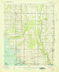 1938 Tanner1938 Print · USGSLimestone County in the late thirties shows a landscape transformed by the new Wheeler Reservoir and its rising waters. Genealogists can trace family holdings and community hubs like Anderson Plantation, Taylor Pride Cem, and Mooresville.
 - 1949 Map of Hartselle, 1970 Print
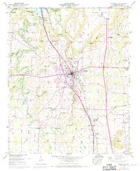 1949 Hartselle1970 Print · USGSMorgan County settlement and the expansion of the Tennessee River valley are documented here during the mid-twentieth century. Genealogists and local historians can locate family landmarks such as Shoal Creek Cem, Bethel Ch, and the Collins Sch.2 unique versions available
 - 1950 Map of Jones Crossroads
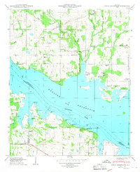 1950 Jones Crossroads1950 Print · USGSLimestone and Morgan counties meet along the wide waters of the Tennessee River in the post-war era. Genealogists and local historians can trace family plots at Neville Cem or locate community centers like Jones Crossroads and the Pine Ridge School.3 unique versions available
 - 1950 Map of Trinity
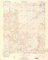 1950 Trinity1950 Print · USGSMid-century Morgan County is captured here as the Tennessee Valley Authority's influence reshaped the landscape near Trinity and Moulton Heights. Genealogists and historians can trace the locations of family burial grounds like Lile Cem, early schools such as Pleasant Hill School, and natural landmarks like San-Souci Cave.2 unique versions available
 - 1950 Map of Decatur, 1952 Print
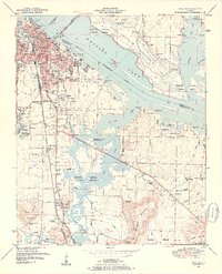 1950 Decatur1952 Print · USGSDecatur and the Tennessee River valley are shown here at mid-century, just as the local infrastructure was modernizing around the rail yards. Genealogists can trace family sites from Mooresville down to Burleson Mountain, including Blackwell Cem and Cave Spring Ch.3 unique versions available
 - 1951 Map of Hartselle
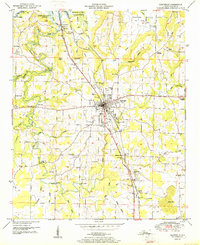 1951 Hartselle1951 Print · USGSMid-century Morgan County centers on the rail-and-road hub of Hartselle as it expands into the surrounding farmlands. Genealogists and researchers can trace family landmarks like Barkley Bridge, Clemons Crossroads, and the Liberty Cem.2 unique versions available
 - 1956 Map of Gadsden, 1966 Print
 1956 Gadsden1966 Print · USGSNorth Alabama in the mid-1950s shows a region transformed by river engineering and federal industry. Genealogists and local historians can trace the development of the Tennessee Valley through the growth of Huntsville, the sprawling Redstone Arsenal, and the expansive Guntersville Lake.3 unique versions available
 - 1958 Map of Gadsden
 1958 Gadsden1958 Print · USGSNorth Alabama comes alive in the late 1950s as the Tennessee Valley Authority’s massive river projects and the rise of the space industry reshaped the landscape. Researchers can trace the mid-century footprints of Huntsville, Redstone Arsenal, and the riverside rail networks of the Southern railroad.
 - 1960 Map of Gadsden
 1960 Gadsden1960 Print · USGSNorthern Alabama in the mid-1950s is defined by the mighty Tennessee River and its massive reservoirs. Trace the development of Huntsville and Redstone Arsenal or explore the vast William B Bankhead National Forest.2 unique versions available
 - 1962 Map of Trinity, 1975 Print
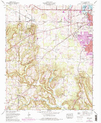 1962 Trinity1975 Print · USGSMorgan County settlement and the expansion of Decatur are captured in this mid-century survey as the suburbs met the rural hills. Genealogists can trace family names at Lile Cem, Fennell Cem, and Love Chapel along the Southern Railway.
 - 1963 Map of Gadsden
 1963 Gadsden1963 Print · USGSNorthern Alabama underwent a dramatic mid-century transformation as the Tennessee Valley became a hub for defense and industry. Researchers can trace the development of the Redstone Arsenal, the route of the Natchez Trace Parkway, and long-standing rail lines like the Southern Railway.
 - 1963 Map of Trinity, 1965 Print
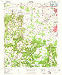 1963 Trinity1965 Print · USGSThe western edge of Decatur meets the ridgelines of the Tennessee Valley in the early 1960s as suburban growth began to reach the base of Trinity Mountain. Trace your family history through rural landmarks like Dancy Chapel, West Morgan Sch, and the Wimbley Cem.
 - 1963 Map of Tanner, 1966 Print
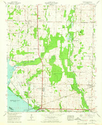 1963 Tanner1966 Print · USGSLimestone County's agrarian landscape meets the Tennessee River in the early sixties, as the region balances traditional farming with new infrastructure. Genealogists and historians can trace family land at Anderson Plantation or locate rural landmarks like Solomons Temple Cem and Mooresville.3 unique versions available
 - 1963 Map of Decatur, 1966 Print
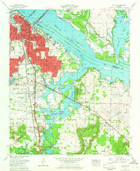 1963 Decatur1966 Print · USGSDecatur is shown as a bustling river city in the early sixties, bounded by the Tennessee River and expanding rail corridors. Genealogists can trace family landmarks like Mitchell Cemetery and Rountree Cemetery, or explore the early layouts of Austinville and Flint City.
 - 1975 Map of Decatur, 1976 Print
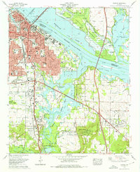 1975 Decatur1976 Print · USGSDecatur and the Tennessee River valley are shown in the mid-seventies during a period of steady southward expansion. Genealogists and historians can trace family locations at Blackwell Cem or Pisgah Cem, while locating the historic rail lines of the Southern and Louisville and Nashville.3 unique versions available
 - 1976 Map of Jones Crossroads, 1977 Print
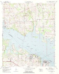 1976 Jones Crossroads1977 Print · USGSThe Tennessee River valley north of Decatur underwent significant industrial transformation by the mid-seventies. Researchers can trace family history through numerous burial sites like Malone Cem or locate the sprawling Browns Ferry Nuclear Plant.
Showing maps 1-25 of 54
Top cities near Decatur
- Huntsville historical maps
- Madison historical maps
- Athens historical maps
- Hartselle historical maps
- Priceville historical maps
- Trinity historical maps
See more
Top neighborhoods of Decatur
- Crowtown historical maps
- Albany historical maps
- West Decatur historical maps
- Burningtree Estates historical maps
- Burningtree Mountain historical maps
- Cedar Lake historical maps
See more
Frequently asked questions
- What are the different types of historical maps available for Decatur?
- What is the oldest map of Decatur?
- Where can I purchase historical maps of Decatur for my home or office?
- Where can I download high-res historical maps of Decatur?
- Are there historical topographic maps available for Decatur?
- Is there historical aerial imagery available for Decatur?
- Where are historical maps of Decatur sourced from?