1900s (20th Century) Maps of Oxford, Alabama
Explore 25 historic maps of Oxford from the 1900s (20th Century). These maps offer a rare glimpse into what life looked like during the 1900s — showing old roads, neighborhoods, homes, and landmarks that have changed or disappeared over time.
Whether you're researching your family's past, planning a metal detecting trip, or studying how Oxford's landscape evolved across the 1900s, these high-resolution maps are a powerful tool for exploring the history of this region.
- Focus on a specific era: All maps on this page are from the 1900s, giving you a focused view of this time period.
- See what’s changed: Compare century-old streets, trails, and buildings to today's modern landscape using overlays and satellite layers.
- Research with precision: Use these maps for genealogy, historical research, land use analysis, or educational projects.
- View, download, or print: Maps are fully viewable online in high resolution, and can be downloaded or printed for your own records.
Start exploring Oxford's history through authentic maps from the 1900s. This is your window into the past.
Oxford, AL maps
(25)- 1900 Map of Anniston
 1900 Anniston1900 Print · USGSNortheast Alabama thrived as a railroad and industrial crossroads at the turn of the century. Genealogists and researchers can trace family landmarks and early transport hubs from the Coosa River to Anniston, including Salt Creek Church and Fowler Ferry.6 unique versions available
 - 1947 Map of Oxford, 1953 Print
 1947 Oxford1953 Print · USGSThe Choccolocco Creek valley in the late 1940s shows the growth of Oxford and Hobson City near the foothills. Researchers can trace local landmarks like Oxford Lake, Trinity Ch, and the old Southern railroad line.2 unique versions available
 - 1947 Map of Anniston, 1953 Print
 1947 Anniston1953 Print · USGSAnniston and the surrounding Calhoun County hills appear here in the immediate post-war period as the city and military grounds expanded. Researchers can trace the layout of the Fort Mc Clellan Military Reservation, locate the Prisoner of War Camp, and find local landmarks like Thankful Schools.2 unique versions available
 - 1947 Map of Eastaboga, 1953 Print
 1947 Eastaboga1953 Print · USGSEastaboga and Lincoln appear at the transition from wartime mobilization to a peacetime economy in the late 1940s. Genealogists can locate family landmarks like Kiddstreet Ch, Union Springs Ch, and the Eastaboga Sch near the Southern tracks.4 unique versions available
 - 1947 Map of Ragland, 1953 Print
 1947 Ragland1953 Print · USGSIn the late 1940s, the Coosa River valley was a landscape of deep-rooted rural communities and growing military installations. Genealogists can trace family landmarks like Rhodes Chapel and old mills such as Martins Mill or Francis Mill.3 unique versions available
 - 1947 Map of Eulaton, 1953 Print
 1947 Eulaton1953 Print · USGSCalhoun County was a hub of military and rail activity in the years following World War II. Genealogists and historians can trace the intersection of small communities like Eulaton and Tarsus with the sprawling Anniston Ordnance Depot and New Bethel Cem.2 unique versions available
 - 1947 Map of Munford, 1953 Print
 1947 Munford1953 Print · USGSTalladega and Calhoun counties appear here in the late 1940s, showing a landscape defined by the intersection of military industrial sites and rural rail towns. Researchers can trace the old paths of the Louisville and Nashville railroad through Jenifer and locate schools like Sweet Home Sch.2 unique versions available
 - 1950 Map of Anniston, 1953 Print
 1950 Anniston1953 Print · USGSAnniston and its surrounding military installations dominate this mid-century Alabama survey during a period of significant regional growth. Researchers can trace the footprints of Fort McClellan, locate rural centers like Bynum and Munford, and find old local landmarks such as Wayside Community Ch and Oxford Lake.2 unique versions available
 - 1953 Map of Birmingham, 1964 Print
 1953 Birmingham1964 Print · USGSCentral Alabama at mid-century shows a landscape defined by industrial expansion and the iron-rich ridges surrounding Birmingham. Researchers can trace the extensive rail networks of the L & N RR or locate historic federal sites like the Anniston Ordnance Depot.4 unique versions available
 - 1953 Map of Atlanta, 1965 Print
 1953 Atlanta1965 Print · USGSThe growing Atlanta metro and the industrial corridors of Eastern Alabama are captured here during the mid-century transition. Researchers can trace the rail-to-road shift through hubs like Anniston and La Grange or locate sites within Fort McClellan.2 unique versions available
 - 1954 Map of Choccolocco, 1955 Print
 1954 Choccolocco1955 Print · USGSEastern Alabama in the mid-fifties is defined here by the intersection of military lands and national forest near the SOUTHERN railroad. Genealogists and historians can locate old landmarks like Whitesides Mill, Old Davisville, and the Pleasant Ridge Ch Cem.5 unique versions available
 - 1956 Map of Birmingham
 1956 Birmingham1956 Print · USGSCentral Alabama in the mid-fifties exhibits a landscape of growing cities and deep-rooted industrial corridors. Genealogists and historians can trace the development of suburban Mountain Brook or locate regional hubs like Sylacauga and Jasper.
 - 1956 Map of Munford, 1960 Print
 1956 Munford1960 Print · USGSTalladega County life in the mid-1950s centered on the rail corridors and small rural crossroads between the mountains and the national forest. Genealogists and historians can trace family locations near Munford, Jenifer, and Bynum, or locate local landmarks like Antioch Cem and Sweet Home Sch.4 unique versions available
 - 1956 Map of Oxford, 1960 Print
 1956 Oxford1960 Print · USGSOxford and Hobson City were expanding into the Alabama valley during the mid-fifties as the national forest remained a wild southern anchor. Genealogists can trace family footprints through numerous rural landmarks like Salt Creek Cem, Friendship Sch, and the County Training Sch.3 unique versions available
 - 1956 Map of Eulaton, 1960 Print
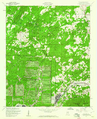 1956 Eulaton1960 Print · USGSCalhoun County's mid-century landscape is defined by the massive footprint of the Fort McClellan Military Reservation and industrial rail hubs. Researchers can trace family roots through rural landmarks like Wellborn Sch, New Mt Spheris Cem, and the old settlement at Eulaton.3 unique versions available
 - 1956 Map of Anniston, 1960 Print
 1956 Anniston1960 Print · USGSAnniston and the sprawling grounds of Fort Mc Clellan are captured here during the mid-fifties, showing the city's urban core and military expansion. Researchers can trace local landmarks like Edgemont Cemetery, the National Guard Armory, and the historic Weaver Cave.3 unique versions available
 - 1957 Map of Birmingham
 1957 Birmingham1957 Print · USGSNorth-Central Alabama in the mid-fifties is an industrial powerhouse centered on the steel valleys and sprawling iron ridges. Genealogists and historians can trace the rail-linked growth of Birmingham and Tuscaloosa, or locate rural landmarks like Talladega College and the Anniston Ordnance Depot.
 - 1957 Map of Atlanta
 1957 Atlanta1957 Print · USGSAtlanta and the Alabama borderlands appear here in the mid-fifties, capturing the region's post-war suburban and industrial transition. Trace the development of early transport hubs and military sites like Fort McPherson, Anniston, and the Kennesaw Mountain National Battlefield Park.
 - 1958 Map of Atlanta
 1958 Atlanta1958 Print · USGSMid-century Georgia and Alabama are shown in this regional study of the corridor between the Chattahoochee River and the Appalachian foothills. Local historians can trace the development of suburban Atlanta alongside vital landmarks like Stone Mountain, Dobbins AFB, and the Seaboard Air Line rail routes.
 - 1967 Map of Hollis Crossroads, 1970 Print
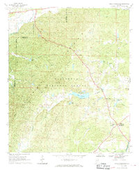 1967 Hollis Crossroads1970 Print · USGSIn the mid-1960s, these Cleburne County highlands remained a landscape of forest and small mountain communities. Genealogists can trace family footprints near Hollis Crossroads, Pleasant Grove Jr High Sch, and rural landmarks like Bethlehem Ch.3 unique versions available
 - 1975 Map of Oxford, 1977 Print
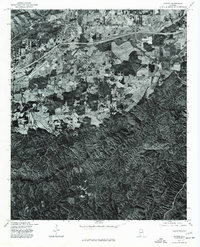 1975 Oxford1977 Print · USGSCalhoun County's transition from city to forest is captured in the mid-seventies just as the corridor between Anniston and Trinity was expanding. Genealogists and historians can trace the precise 1975 land use and the path of Choccolocco Creek.
 - 1975 Map of Choccolocco, 1977 Print
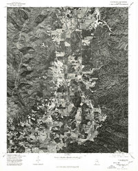 1975 Choccolocco1977 Print · USGSCalhoun County comes into focus in the mid-1970s through this aerial orthophotoquad of the valley landscape. Researchers can trace the exact footprint of farmsteads and homes near Choccolocco, Iron City, and the winding Choccolocco Creek.
 - 1975 Map of Hollis Crossroads, 1977 Print
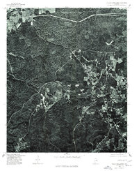 1975 Hollis Crossroads1977 Print · USGSHollis Crossroads and the timbered hills of Cleburne County appear as they were in the mid-seventies in this detailed orthophotograph. Genealogists and local historians can trace the rural road networks and land clearings around Five Points, Hollis Crossroads, and Lake Edmond.
 - 1981 Map of Anniston, 1982 Print
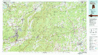 1981 Anniston1982 Print · USGSNortheast Alabama and the Georgia borderlands come alive in the early eighties, showing a landscape of heavy industry, military outposts, and mountain forests. Genealogists and historians can trace the development of towns like Anniston and Carrollton, or locate landmarks such as Whitesides Mill and Webster Chapel.2 unique versions available
 - 1984 Map of Birmingham North, 1985 Print
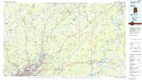 1984 Birmingham North1985 Print · USGSNorth Alabama in the mid-eighties shows the bustling intersection of the Appalachian foothills and the Deep South's industrial heart. Genealogists and historians can trace the paths of the Southern Railway and Seaboard System Railroad through towns like Oneonta, Leeds, and Springville.2 unique versions available
End of results
Showing maps 1-25 of 25
Top cities near Oxford
- Anniston historical maps
- Talladega historical maps
- Jacksonville historical maps
- Saks historical maps
- Lincoln historical maps
- Weaver historical maps
See more
Top neighborhoods of Oxford
- DeArmanville historical maps
- Oak Hill historical maps
- McKibben historical maps
- Gauldinville historical maps
- New Haven historical maps
- Bynum historical maps
See more
Frequently asked questions
- What are the different types of historical maps available for Oxford?
- What is the oldest map of Oxford?
- Where can I purchase historical maps of Oxford for my home or office?
- Where can I download high-res historical maps of Oxford?
- Are there historical topographic maps available for Oxford?
- Is there historical aerial imagery available for Oxford?
- Where are historical maps of Oxford sourced from?