1970s Maps of Tallapoosa County, Alabama
Explore 21 historic maps of Tallapoosa County from the 1970s. These maps offer a rare glimpse into what life looked like during the 1970s — showing old roads, neighborhoods, homes, and landmarks that have changed or disappeared over time.
Whether you're researching your family's past, planning a metal detecting trip, or studying how Tallapoosa County's landscape evolved across the 1970s, these high-resolution maps are a powerful tool for exploring the history of this region.
- Focus on a specific era: All maps on this page are from the 1970s, giving you a focused view of this time period.
- See what’s changed: Compare century-old streets, trails, and buildings to today's modern landscape using overlays and satellite layers.
- Research with precision: Use these maps for genealogy, historical research, land use analysis, or educational projects.
- View, download, or print: Maps are fully viewable online in high resolution, and can be downloaded or printed for your own records.
Start exploring Tallapoosa County's history through authentic maps from the 1970s. This is your window into the past.
Tallapoosa County, AL maps
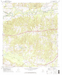
(21)- 1971 Map of Waverly
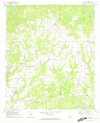
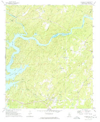
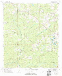 1971 Waverly1971 Print · USGSThe intersection of Lee, Chambers, and Tallapoosa counties in the early 1970s shows a landscape of rail-linked communities and rural crossroads. Genealogists can trace family footprints near Waverly, Gold Hill, and historic churches like Mt Traveler Ch or Macon Spring Ch.2 unique versions available
 - 1971 Map of Dadeville, 1973 Print
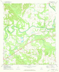
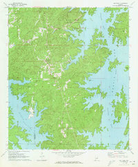
 1971 Dadeville1973 Print · USGSTallapoosa County's landscape in the early 1970s is defined by the reaching waters of Martin Lake and the established rail lines of the Central of Georgia. Genealogists can locate family landmarks like Spain Cem and Williams Cem, or trace rural congregations at Mt Zion Ch and Sandy Creek Ch.3 unique versions available
 - 1971 Map of Ponders, 1973 Print
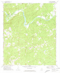
 1971 Ponders1973 Print · USGSIn the early seventies, the rural landscape of Tallapoosa County was defined by its relationship with Martin Lake and the winding Sougahatchee Creek. Researchers can trace family roots at Union Academy, Barnesville, and Pleasant Valley Ch.2 unique versions available
 - 1971 Map of Alexander City, 1973 Print
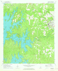
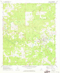
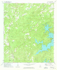
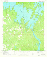
 1971 Alexander City1973 Print · USGSAlexander City and the northern shores of Martin Lake are captured here in the early seventies during a period of steady growth. Researchers can trace the town's expansion through sites like Alexander City, Russell High Sch, and Wind Creek State Park.3 unique versions available
 - 1971 Map of Carrville, 1973 Print
 1971 Carrville1973 Print · USGSNear the border of Tallapoosa and Macon counties in the early seventies, this landscape is defined by small crossroads settlements and creek-side industry. Trace the locations of Reeltown High Sch, the Broach Mill, and local gathering spots like the Drive-in Theater.2 unique versions available
 - 1971 Map of Buttston, 1973 Print
 1971 Buttston1973 Print · USGSTallapoosa County in the early seventies centers on the historic riverbend where the Tallapoosa River winds past Horseshoe Bend National Military Park. Researchers can trace old rural networks through the locations of Buttston, Easton, and the Battleground Monument.2 unique versions available
 - 1971 Map of Tallassee, 1973 Print
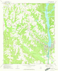 1971 Tallassee1973 Print · USGSThe Tallapoosa River corridor in the early 1970s reveals a landscape shaped by hydroelectric power and traditional rural settlements. Genealogists and local historians can trace family roots through landmarks like Rosehill Cem, Providence Ch, and the mills along Wallahatchee Creek.2 unique versions available
 - 1971 Map of Camp Hill, 1973 Print
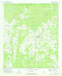
 1971 Camp Hill1973 Print · USGSTallapoosa County in the early seventies reveals a landscape of established rail towns and historic academies. Genealogists and historians can trace family sites at Baskins Chapel Cem or locate the grounds of the Lyman Ward Military Academy.2 unique versions available
 - 1971 Map of Equality, 1973 Print
 1971 Equality1973 Print · USGSThe Coosa County hill country meets the rising waters of the Tallapoosa during the early 1970s. Genealogists can trace family landmarks like Nixburg Cem and Shiloh Cem or locate the site of the historic Covered Br on Oakachoy Creek.2 unique versions available
 - 1971 Map of Shorter, 1973 Print
 1971 Shorter1973 Print · USGSThe Tallapoosa River country comes alive in the early seventies, showing a landscape of small towns and gravel works. Trace local history at Tysonville, the Cubahatchee Lookout Tower, and Wolfe High Sch.2 unique versions available
 - 1971 Map of Thornton, 1973 Print
 1971 Thornton1973 Print · USGSTallapoosa and Lee counties are captured here in the early seventies, showing a landscape of scattered rural settlements and winding creek bottoms. Genealogists can trace family connections through numerous country landmarks like New Hope Cem Ch, Thornton, and Antioch Ch.
 - 1971 Map of Notasulga, 1973 Print
 1971 Notasulga1973 Print · USGSNotasulga and its rural Alabama surroundings are captured here in the early 1970s, as the town thrived along the Western Railway of Alabama. Genealogists and local historians can locate many country landmarks, including McRitchie Mill, Bethlehem Cemetery, and Lockets Chapel.2 unique versions available
 - 1971 Map of La Place, 1973 Print
 1971 La Place1973 Print · USGSMacon County in the early seventies shows a landscape where military history and rural tradition meet along the Tallapoosa River. Researchers can locate the Tuskegee Air Force Base and numerous family churches like Bradford Chapel and Elam Ch.2 unique versions available
 - 1971 Map of Our Town, 1973 Print
 1971 Our Town1973 Print · USGSTallapoosa County and the winding shores of Martin Lake are captured here in the early seventies as recreation and local life converged. Genealogists can trace family names at Mt Zion Cem and Mask Cem or locate the rural settlement of Our Town.2 unique versions available
 - 1971 Map of Dudleyville, 1973 Print
 1971 Dudleyville1973 Print · USGSThe rural borderlands of Chambers and Tallapoosa counties are captured here in the early seventies, showing a landscape of traditional southern crossroads. Researchers can locate family homesteads near landmarks like Ozias Ch, Dudleyville, and the County Line Cem.
 - 1971 Map of Red Hill, 1973 Print
 1971 Red Hill1973 Print · USGSElmore County's winding shoreline and river valley appear here in the early seventies, centered on the infrastructure of Martin Dam. Researchers can trace old rural communities and landmarks like Watson Chapel, Red Hill, and the lakeside Church in the Pines.2 unique versions available
 - 1971 Map of Kellyton, 1973 Print
 1971 Kellyton1973 Print · USGSCentral Alabama's rural landscape is captured here in the early seventies, centered on the railroad community of Kellyton. Local historians can trace family roots through numerous sites like Socapatoy Cem, Bradford Ch, and Jordan Cem.2 unique versions available
 - 1971 Map of Jacksons Gap, 1974 Print
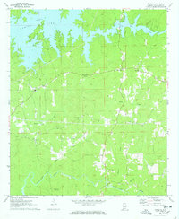
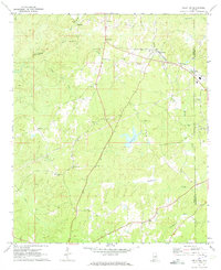
 1971 Jacksons Gap1974 Print · USGSThe Tallapoosa River and Martin Lake define this Alabama landscape in the early seventies as the region balanced rural tradition with growing lakeside recreation. Genealogists can trace family landmarks like Rocky Mount Ch, Fosheeton, and the Central of Georgia rail corridor.2 unique versions available
 - 1971 Map of Camp Hill SE, 1977 Print
 1971 Camp Hill SE1977 Print · USGSEastern Alabama's rural landscapes were still defined by local church congregations and steam-era rail lines in the early seventies. Genealogists can locate family landmarks like Plainview Sch, Jones Mill, and several community churches including Mt Sinai Ch.2 unique versions available
 - 1975 Map of Goodwater SE, 1977 Print
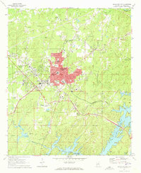
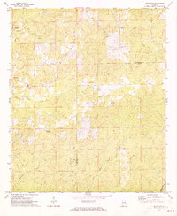
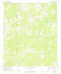
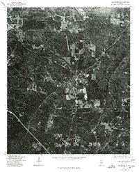 1975 Goodwater SE1977 Print · USGSCoosa County territory during the mid-seventies is revealed through high-resolution aerial imagery centered on the town of Goodwater. Researchers can trace the layout of the settlement and the clearings of nearby homesteads exactly as they appeared just after the war.
 - 1978 Map of La Grange, 1980 Print
 1978 La Grange1980 Print · USGSThe Alabama-Georgia borderlands are captured here in the late seventies, just as the newly formed West Point Lake reshaped the eastern landscape. Local historians can trace the Seaboard Coast Line rail corridor through hubs like Roanoke, Ashland, and Lineville.
End of results
Showing maps 1-21 of 21
Top cities of Tallapoosa County
- Alexander City historical maps
- Dadeville historical maps
- Camp Hill historical maps
- Reeltown historical maps
- New Site historical maps
- Jacksons' Gap historical maps
See more
Frequently asked questions
- What are the different types of historical maps available for Tallapoosa County?
- What is the oldest map of Tallapoosa County?
- Where can I purchase historical maps of Tallapoosa County for my home or office?
- Where can I download high-res historical maps of Tallapoosa County?
- Are there historical topographic maps available for Tallapoosa County?
- Is there historical aerial imagery available for Tallapoosa County?
- Where are historical maps of Tallapoosa County sourced from?