1980s Maps of Tallapoosa County, Alabama
Explore 7 historic maps of Tallapoosa County from the 1980s. These maps offer a rare glimpse into what life looked like during the 1980s — showing old roads, neighborhoods, homes, and landmarks that have changed or disappeared over time.
Whether you're researching your family's past, planning a metal detecting trip, or studying how Tallapoosa County's landscape evolved across the 1980s, these high-resolution maps are a powerful tool for exploring the history of this region.
- Focus on a specific era: All maps on this page are from the 1980s, giving you a focused view of this time period.
- See what’s changed: Compare century-old streets, trails, and buildings to today's modern landscape using overlays and satellite layers.
- Research with precision: Use these maps for genealogy, historical research, land use analysis, or educational projects.
- View, download, or print: Maps are fully viewable online in high resolution, and can be downloaded or printed for your own records.
Start exploring Tallapoosa County's history through authentic maps from the 1980s. This is your window into the past.
Tallapoosa County, AL maps
(7)- 1981 Map of Camp Hill SE
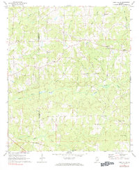 1981 Camp Hill SE1981 Print · USGSChambers County and eastern Tallapoosa County appear here in the early 1970s, showing a landscape of rural crossroads and historic congregations. Trace family roots at Mt Sinai Ch, New Harmony, or along the Central of Georgia rail line.
 - 1981 Map of Opelika, 1982 Print
 1981 Opelika1982 Print · USGSEast Alabama and West Georgia appear in the early 1980s as a region defined by massive river reservoirs and the storied textile corridor. Genealogists can trace family roots through the valley towns of Lanett and Fairfax or locate sites near Horseshoe Bend National Military Park.
 - 1981 Map of Tuskegee, 1982 Print
 1981 Tuskegee1982 Print · USGSMacon and Bullock counties are captured here in the early eighties, showcasing a landscape deeply tied to the railroad and the legacies of Tuskegee Institute. Researchers can locate specific sites from Moton Field to rural settlements along the Seaboard Coast Line like Hurtsboro and Pittsview.2 unique versions available
 - 1984 Map of Birmingham South, 1985 Print
 1984 Birmingham South1985 Print · USGSThe Birmingham metropolitan region and the Coosa River valley are shown here in the mid-eighties as suburban growth expanded south into the ridges. Genealogists and local historians can trace the development of communities from Bessemer to Sylacauga alongside the Lay Lake shoreline and the Talladega National Forest.2 unique versions available
 - 1986 Map of Clanton
 1986 Clanton1986 Print · USGSCentral Alabama’s river-driven landscape is captured here in the mid-eighties, centered on the growth of Clanton and the hydroelectric lakes of the Coosa River. Genealogists and historians can trace the Old Indian Treaty Boundary or locate landmarks like Sykes Mill and Collins Chapel.
 - 1987 Map of Goodwater
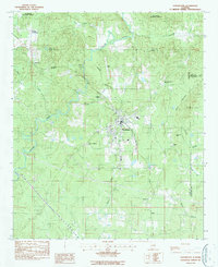 1987 Goodwater1987 Print · USGSThe town of Goodwater is documented in the late 1980s as a junction of rail and river in the heart of Coosa County. Researchers can trace family sites at Crestview Memorial Cem or locate community landmarks like Goodwater Academy and Marietta Ch.
 - 1987 Map of Clanton, 1990 Print
 1987 Clanton1990 Print · USGSCentral Alabama in the late eighties reveals a landscape of massive river reservoirs and forest reserves. Trace the rail-and-road corridors through Clanton and Wetumpka to find historic sites like Fort Toulouse and Collins Chapel.
End of results
Showing maps 1-7 of 7
Top cities of Tallapoosa County
- Alexander City historical maps
- Dadeville historical maps
- Camp Hill historical maps
- Reeltown historical maps
- New Site historical maps
- Jacksons' Gap historical maps
See more
Frequently asked questions
- What are the different types of historical maps available for Tallapoosa County?
- What is the oldest map of Tallapoosa County?
- Where can I purchase historical maps of Tallapoosa County for my home or office?
- Where can I download high-res historical maps of Tallapoosa County?
- Are there historical topographic maps available for Tallapoosa County?
- Is there historical aerial imagery available for Tallapoosa County?
- Where are historical maps of Tallapoosa County sourced from?