
1971 Map of Waverly
USGS Topo · Published 1971About this map
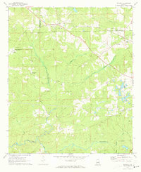
The Central Of Georgia railroad corridor anchors this 1971 study, cutting through the community of Waverly and connecting it to smaller outposts like Macedonia and Gold Hill. This area, where Lee, Chambers, and Tallapoosa counties converge, reveals a landscape defined by its rural intersections and religious landmarks. Local history is preserved in several community-named landmarks, such as Middle Brooks Crossroads and Rowells Crossroads, which served as essential gathering points for the surrounding agricultural tracts.
Find a feature on this map
30 named features on this map. Tap any name to fly to it.
Don’t see what you’re looking for? This feature index may not catch every label — zoom into the map to look around manually.
Map Details
Editions of this 1971 Waverly Map
2 editions found
Other maps of this area

1906 · Dadeville
USGS Topo · 1:125,000

1907 · Opelika
USGS Topo · 1:125,000

1909 · Opelika
USGS Topo · 1:125,000

1955 · Phenix City
USGS Topo · 1:250,000

1957 · Phenix City
USGS Topo · 1:250,000

1958 · Phenix City
USGS Topo · 1:250,000
1971 · Moorefield
USGS Topo · 1:24,000
1971 · Opelika West
USGS Topo · 1:24,000

1971 · Loachapoka
USGS Topo · 1:24,000
1971 · Camp Hill
USGS Topo · 1:24,000