2020s Maps of Tuscaloosa, Alabama
Explore 20 historic maps of Tuscaloosa from the 2020s. These maps offer a rare glimpse into what life looked like during the 2020s — showing old roads, neighborhoods, homes, and landmarks that have changed or disappeared over time.
Whether you're researching your family's past, planning a metal detecting trip, or studying how Tuscaloosa's landscape evolved across the 2020s, these high-resolution maps are a powerful tool for exploring the history of this region.
- Focus on a specific era: All maps on this page are from the 2020s, giving you a focused view of this time period.
- See what’s changed: Compare century-old streets, trails, and buildings to today's modern landscape using overlays and satellite layers.
- Research with precision: Use these maps for genealogy, historical research, land use analysis, or educational projects.
- View, download, or print: Maps are fully viewable online in high resolution, and can be downloaded or printed for your own records.
Start exploring Tuscaloosa's history through authentic maps from the 2020s. This is your window into the past.
Tuscaloosa, AL maps
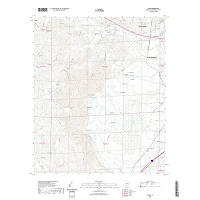
(20)- 2020 Map of Lake Nicol, 2020 Print
 2020 Lake Nicol2020 Print · USGSCovers Tuscaloosa, including Grand Arbor, Shamley Green, and other nearby areas
 - 2020 Map of Gin Creek, 2020 Print
 2020 Gin Creek2020 Print · USGSCovers Tuscaloosa, including Wenwood, Montgomery Lakes, and other nearby areas
 - 2020 Map of Tuscaloosa, 2020 Print
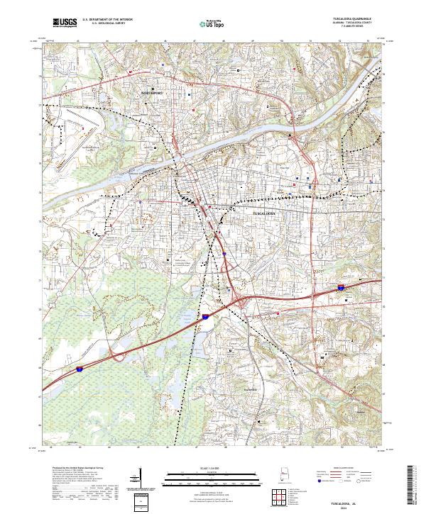
 2020 Tuscaloosa2020 Print · USGSCovers Tuscaloosa, including Northport, Bellwood, and other nearby areas
 - 2020 Map of Lake Tuscaloosa South, 2020 Print
 2020 Lake Tuscaloosa South2020 Print · USGSCovers Tuscaloosa, including Northport, Demarest, and other nearby areas
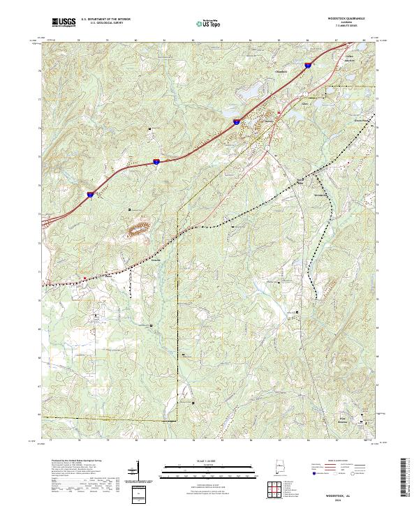
 - 2020 Map of Woodstock, 2020 Print
 2020 Woodstock2020 Print · USGSCovers Tuscaloosa, including Vance, Woodstock, and other nearby areas
 - 2020 Map of Cottondale, 2020 Print
 2020 Cottondale2020 Print · USGSCovers Tuscaloosa, including Holt, Cottondale, and other nearby areas
 - 2020 Map of Lake Tuscaloosa North, 2020 Print
 2020 Lake Tuscaloosa North2020 Print · USGSCovers Tuscaloosa, including Holly Springs Subdivision, Hagler Mill Estates, and other nearby areas
 - 2020 Map of Coaling, 2020 Print
 2020 Coaling2020 Print · USGSCovers Tuscaloosa, including Brookwood, Vance, and other nearby areas
 - 2020 Map of Coker, 2020 Print
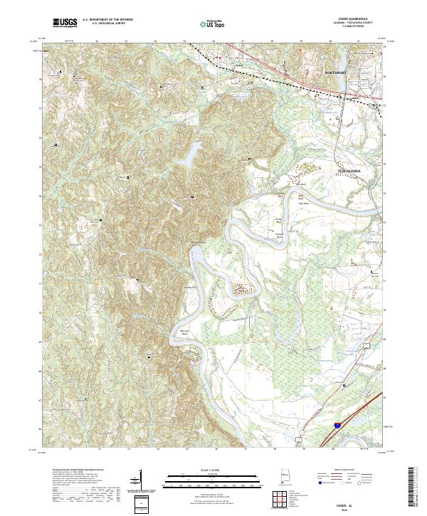
 2020 Coker2020 Print · USGSCovers Tuscaloosa, including Northport, Coker, and other nearby areas
 - 2021 Map of Englewood, 2021 Print
 2021 Englewood2021 Print · USGSCovers Tuscaloosa, including Moundville, Hinton Gardens, and other nearby areas
 - 2024 Map of Lake Nicol, 2024 Print
 2024 Lake Nicol2024 Print · USGSThe northern reaches of Tuscaloosa come into focus during the early 2020s, highlighting a landscape defined by the Black Warrior River. Genealogists and historians can trace early river crossings like Hollis Ferry and Wallace Ferry or locate family sites at Scales Cem.
 - 2024 Map of Lake Tuscaloosa North, 2024 Print
 2024 Lake Tuscaloosa North2024 Print · USGSThe North River valley north of Tuscaloosa is shown here as it appears today, defined by the winding waters of Lake Tuscaloosa. Researchers can trace deep local roots through numerous historic sites including the Old Prewett Slave Cem, Holly Springs Cem, and the quiet community of Samantha.
 - 2024 Map of Coker, 2024 Print
 2024 Coker2024 Print · USGSIn the 2020s, the landscape around the Black Warrior River near Coker remains a mix of deep river bends and rural family settlements. Genealogists can trace lineage through dozens of local burial sites like Old Cornelius Chapel Cem and Spring Hill Cem.
 - 2024 Map of Gin Creek, 2024 Print
 2024 Gin Creek2024 Print · USGSNorthern Tuscaloosa County’s ridge-and-hollow terrain is captured here in recent years, showing a landscape deeply rooted in family history. Genealogists can locate numerous family burial sites such as Traweek Cem and Hendrix Cem near the headwaters of Binion Creek.
 - 2024 Map of Woodstock, 2024 Print
 2024 Woodstock2024 Print · USGSThe northern Bibb County hills come into focus in this contemporary survey of the communities along the historic rail corridors. Genealogists and researchers can map dozens of burial sites like Hopewell Cem, Bibbville Cem, and the family-named Clements Cem.
 - 2024 Map of Lake Tuscaloosa South, 2024 Print
 2024 Lake Tuscaloosa South2024 Print · USGSTuscaloosa and Northport appear during their recent expansion near the shores of Lake Tuscaloosa. Genealogists and local researchers can trace family landmarks and older sites like Bethel Cem, Thompson Ford, and Sexton Bend across the changing suburban landscape.
 - 2024 Map of Tuscaloosa, 2024 Print
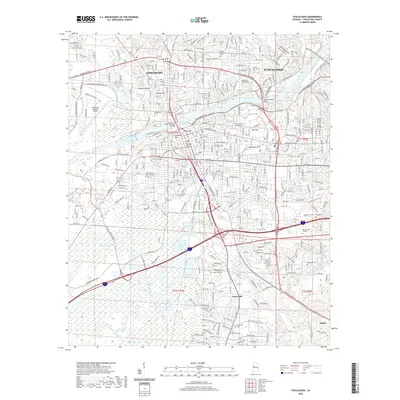
 2024 Tuscaloosa2024 Print · USGSTuscaloosa and Northport sit at a vital river crossing in this recent survey of the Black Warrior River valley. Genealogists and historians can locate numerous small burial grounds like Robertson Chapel Cem and Darden Cem alongside major landmarks like The University of Alabama.
 - 2024 Map of Coaling, 2024 Print
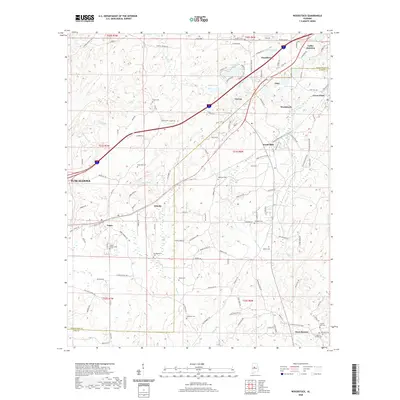
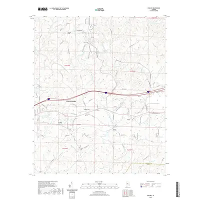
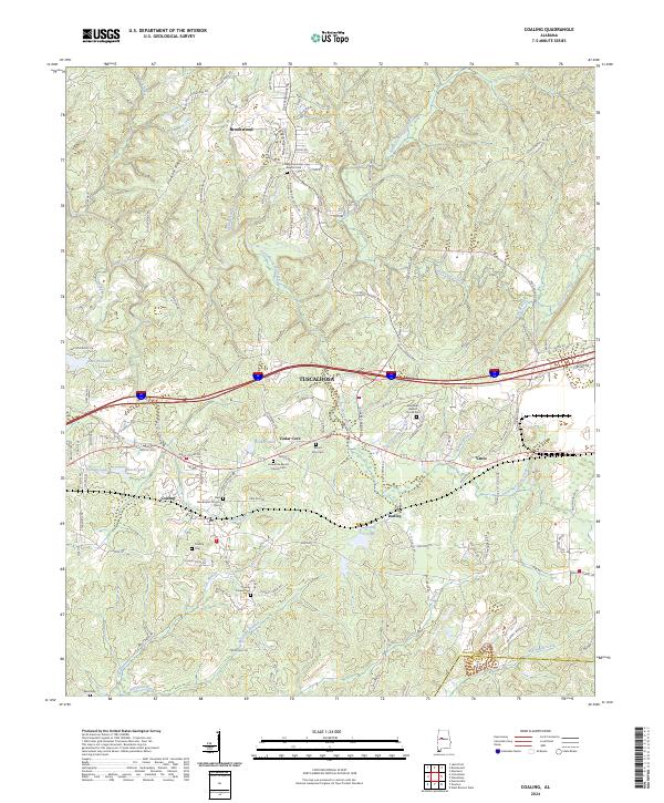 2024 Coaling2024 Print · USGSEastern Tuscaloosa County comes into focus in this contemporary survey, showing the traditional crossroads and rising industrial corridors of central Alabama. Genealogists can locate numerous local landmarks like Big Hurricane Baptist Cem, Thomas Chapel Cem, and the historic community of Cedar Cove.
 - 2024 Map of Englewood, 2024 Print
 2024 Englewood2024 Print · USGSTuscaloosa and the Black Warrior River corridor come alive in this recent survey of the Alabama heartland. Researchers can trace the rural communities of Hull and Maxwell or locate ancestral burial sites like Hulls Cem and Big Sandy Cem.
 - 2024 Map of Cottondale, 2024 Print
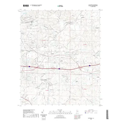
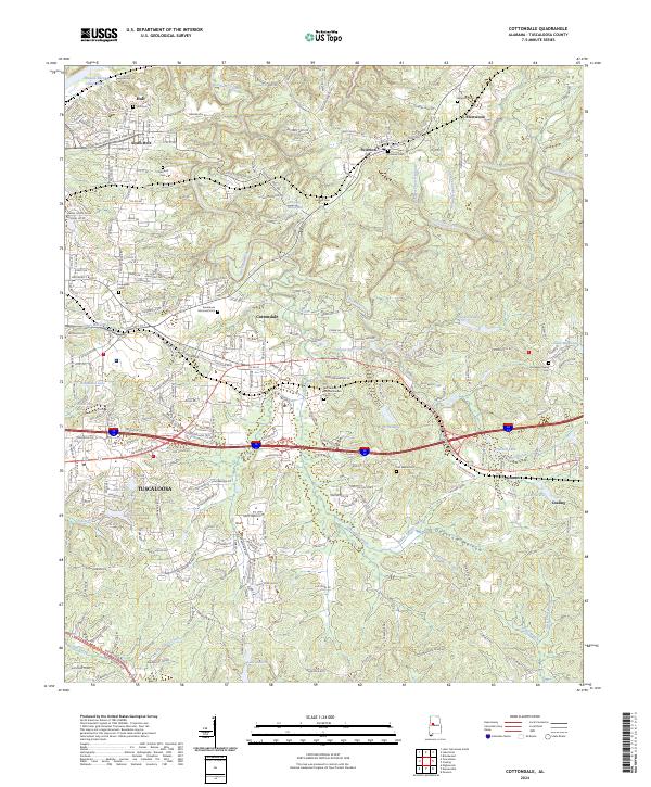 2024 Cottondale2024 Print · USGSEast of Tuscaloosa in the early twenty-first century, this area shows a landscape defined by industrial heritage and a dense network of country roads. Researchers can locate family landmarks like Ruhama Cemetery, Prudes Mill Pond, and the community of Cottondale.
End of results
Showing maps 1-20 of 20
Top cities near Tuscaloosa
- Northport historical maps
- Holt historical maps
- Cottondale historical maps
- Brookwood historical maps
- Vance historical maps
- Coaling historical maps
See more
Top neighborhoods of Tuscaloosa
- Driftwood Estates historical maps
- Dunbrook historical maps
- Four Winds historical maps
- Grand Arbor historical maps
- Shamley Green historical maps
- The Gates of Wellington historical maps
See more
Frequently asked questions
- What are the different types of historical maps available for Tuscaloosa?
- What is the oldest map of Tuscaloosa?
- Where can I purchase historical maps of Tuscaloosa for my home or office?
- Where can I download high-res historical maps of Tuscaloosa?
- Are there historical topographic maps available for Tuscaloosa?
- Is there historical aerial imagery available for Tuscaloosa?
- Where are historical maps of Tuscaloosa sourced from?