Old Maps of Newhalen, Alaska for Metal Detecting
Plan your next treasure hunt with 6 historic maps of Newhalen. Find old homesites, ghost towns, trails, and gathering spots that may be lost to time — perfect for identifying promising metal detecting locations.
- Locate forgotten sites: Uncover places like long-lost settlements, abandoned rail lines, or gathering spots.
- Plan better hunts: Use map overlays combined with LiDAR or satellite views to narrow in on historically rich areas.
- Made for detectorists: Thousands of hobbyists use these maps to discover relics, coins, and hidden history.
Use these historic maps to boost your research and find new opportunities beneath the surface of Newhalen.
Newhalen, AK maps
(6)- 1952 Map of Iliamna, 1953 Print
 1952 Iliamna1953 Print · USGSAlaska's interior and coastline meet in this early 1950s survey of the Lake Iliamna region. Researchers can trace remote settlements and camps such as Fish Village, Old Iliamna (Aband), and Hammerly Camp at the edge of the Katmai National Monument.4 unique versions available
 - 1954 Map of Iliamna C-6, 1964 Print
 1954 Iliamna C-61964 Print · USGSIliamna Lake’s north shore and the settlement of Newhalen are documented here in the mid-fifties, before major modern development. Researchers can trace the early footprint of the Iliamna Airfield and the resource planning at Power Site Reserve No 485.2 unique versions available
 - 1954 Map of Iliamna C-5, 1965 Print
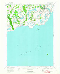
 1954 Iliamna C-51965 Print · USGSIliamna Lake’s vast shoreline in the mid-1950s remains a remote frontier shaped by water and wilderness. Trace the small outposts at Seversens, explore the islands of Eagle Bay Island, and locate the natural shelter of Snug Harbor.2 unique versions available
 - 1957 Map of Iliamna, 1965 Print
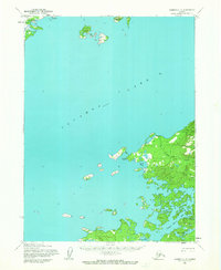
 1957 Iliamna1965 Print · USGSSouthwestern Alaska in the late fifties centers on the massive waters of Iliamna Lake and its surrounding villages. Trace family roots and old routes at Old Roadhouse, Newhalen, and the Kamishak (Site) near the edge of Katmai National Monument.7 unique versions available
 - 2018 Map of Iliamna C-5 NW, 2018 Print
 2018 Iliamna C-5 NW2018 Print · USGSThe northern shores of Iliamna Lake come into focus in the late 2010s, showing the early 21st-century footprint of lakeside settlements. Trace the local road network between Newhalen and Seversens or locate landmarks like Schoolhouse Lake.
 - 2019 Map of Iliamna C-6 NE, 2019 Print
 2019 Iliamna C-6 NE2019 Print · USGSThe village of Newhalen and the northern shores of Iliamna Lake are captured here in the early twenty-first century. Researchers can trace the town layout along Wassillie Lane and locate the Newhalen Graveyard near the banks of the Newhalen River.
End of results
Showing maps 1-6 of 6
Top cities near Newhalen
Frequently asked questions
- What are the different types of historical maps available for Newhalen?
- What is the oldest map of Newhalen?
- Where can I purchase historical maps of Newhalen for my home or office?
- Where can I download high-res historical maps of Newhalen?
- Are there historical topographic maps available for Newhalen?
- Is there historical aerial imagery available for Newhalen?
- Where are historical maps of Newhalen sourced from?