Old Maps of Atqasuk, Alaska for Metal Detecting
Plan your next treasure hunt with 12 historic maps of Atqasuk. Find old homesites, ghost towns, trails, and gathering spots that may be lost to time — perfect for identifying promising metal detecting locations.
- Locate forgotten sites: Uncover places like long-lost settlements, abandoned rail lines, or gathering spots.
- Plan better hunts: Use map overlays combined with LiDAR or satellite views to narrow in on historically rich areas.
- Made for detectorists: Thousands of hobbyists use these maps to discover relics, coins, and hidden history.
Use these historic maps to boost your research and find new opportunities beneath the surface of Atqasuk.
Atqasuk, AK maps
(12)- 1951 Map of Meade River
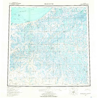
 1951 Meade River1951 Print · USGSThe North Slope coast and interior river systems are captured here in the early fifties during an era of intensified arctic exploration. You can locate the small settlement of Atkasuk, a nearby Coal Mine, and various Cabins along the banks of the Meade River.
 - 1955 Map of Meade River, 1966 Print
 1955 Meade River1966 Print · USGSThe Arctic coastline of Alaska's North Slope appears in the mid-1950s as a frontier of petroleum exploration and seasonal transit. Researchers can trace the Winter Trail past Niklavik to Meade Test Well No 1 within the sprawling Naval Petroleum Reserve No 4.3 unique versions available
 - 1955 Map of Meade River B-3, 1967 Print
 1955 Meade River B-31967 Print · USGSThe North Slope landscape in the mid-1950s reveals a network of arctic waterways and isolated outposts within the Naval Petroleum Reserve. Researchers can trace the layout of Atkasuk (Aban'd) and its river-side Mine, or locate remote landmarks like the Cabin and Landing Strip.3 unique versions available
 - 1955 Map of Meade River C-3, 1967 Print
 1955 Meade River C-31967 Print · USGSThe arctic North Slope appears in the mid-fifties as a maze of thaw lakes and winding rivers used for seasonal travel. Researchers can trace the Winter Trail past remote sites like Sod Hut (Ruins), a Cabin, and a Gas Seep.
 - 2013 Map of Meade River C-3 SE, 2013 Print
 2013 Meade River C-3 SE2013 Print · USGSCovers Atqasuk, including North Slope, United States, and other nearby areas
 - 2013 Map of Meade River B-3 NW, 2013 Print
 2013 Meade River B-3 NW2013 Print · USGSCovers Atqasuk, including North Slope, United States, and other nearby areas
 - 2013 Map of Meade River B-3 NE, 2013 Print
 2013 Meade River B-3 NE2013 Print · USGSCovers Atqasuk, including North Slope, United States, and other nearby areas
 - 2013 Map of Meade River C-3 SW, 2013 Print
 2013 Meade River C-3 SW2013 Print · USGSCovers Atqasuk, including North Slope, United States, and other nearby areas
 - 2020 Map of Meade River B-3 NW, 2020 Print
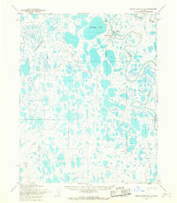
 2020 Meade River B-3 NW2020 Print · USGSThe North Slope of Alaska is captured here in the early twenty-first century, showing a landscape defined by water and permafrost. Researchers can trace the winding course of the Nigisaktuvik River or locate the shoreline of Ikmakrak Lake.
 - 2020 Map of Meade River B-3 NE, 2020 Print
 2020 Meade River B-3 NE2020 Print · USGSThe village of Atqasuk stands along the Meade River in this 2020 topographic study of the North Slope. Researchers can trace the local street plan and the logistics of the Atqasuk Edward Burnell Sr Memorial Airport and Ikmakrak Lake.
 - 2020 Map of Meade River C-3 SW, 2020 Print
 2020 Meade River C-3 SW2020 Print · USGSThe Arctic tundra of the North Slope appears in 2020 as a complex network of thaw lakes and winding waterways. Researchers can trace the meandering paths of the Meade River, Nigisaktuvik River, and Kucheak Cr through this remote wetland landscape.
 - 2020 Map of Meade River C-3 SE, 2020 Print
 2020 Meade River C-3 SE2020 Print · USGSThe Arctic tundra surrounding the village of Atqasuk comes into focus in this recent survey of the North Slope. Researchers can trace the junction of the Meade River and Usuktuk River, identifying the traditional waterways that define this remote landscape.
End of results
Showing maps 1-12 of 12
Frequently asked questions
- What are the different types of historical maps available for Atqasuk?
- What is the oldest map of Atqasuk?
- Where can I purchase historical maps of Atqasuk for my home or office?
- Where can I download high-res historical maps of Atqasuk?
- Are there historical topographic maps available for Atqasuk?
- Is there historical aerial imagery available for Atqasuk?
- Where are historical maps of Atqasuk sourced from?