
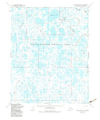
1955 Map of Meade River B-3
USGS Topo · Published 1967About this map
Meade River meanders through the North Slope of Alaska in the mid-1950s, defining a landscape dominated by thaw lakes and arctic waterways. This area, located within the Naval Petroleum Reserve No. 4, shows the isolated settlement of Atkasuk (Aban'd) and a nearby Mine situated along the riverbank. The terrain is crisscrossed by several prominent Tractor Trails and a traditional Trail system, indicating the seasonal transport routes essential for survival and resource exploration in this environment. Significant water features such as Kigakrak Lake and the Usuktuk River anchor the drainage network, while a lone Landing Strip provides a vital link to the outside world. Smaller structures including a Cabin and various Ruins suggest a history of seasonal habitation and subsistence, while names like Nigisaktuvuk River and Pikroka Creek reflect the indigenous geography of the region.
Find a feature on this map
21 named features on this map. Tap any name to fly to it.
Don’t see what you’re looking for? This feature index may not catch every label — zoom into the map to look around manually.
Map Details
Editions of this 1955 Meade River B-3 Map
3 editions found

Other maps of this area

1951 · Meade River
USGS Topo · 1:250,000

1955 · Meade River
USGS Topo · 1:250,000

1955 · Meade River A-3
USGS Topo · 1:63,360

1955 · Meade River A-2
USGS Topo · 1:63,360
1955 · Meade River A-4
USGS Topo · 1:63,360

1955 · Meade River B-2
USGS Topo · 1:63,360

1955 · Meade River C-3
USGS Topo · 1:63,360

1955 · Meade River B-4
USGS Topo · 1:63,360

1955 · Meade River C-4
USGS Topo · 1:63,360
1955 · Meade River C-2
USGS Topo · 1:63,360