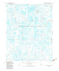
1955 Map of Meade River B-3
USGS Topo · Published 1983About this map
Atkasuk, also identified as Meade River, serves as the primary focal point of this mid-century survey of the Arctic coastal plain. Located within the National Petroleum Reserve in Alaska, the landscape is defined by an intricate network of lakes and meandering waterways including the Nigisaktukvik River and the Usuktuk River. The settlement is linked to the surrounding wilderness by a series of Tractor Trails that stretch across the tundra, indicating the importance of overland transport in an era before developed road infrastructure.
Find a feature on this map
15 named features on this map. Tap any name to fly to it.
Don’t see what you’re looking for? This feature index may not catch every label — zoom into the map to look around manually.
Map Details
Editions of this 1955 Meade River B-3 Map
3 editions found

Other maps of this area

1951 · Meade River
USGS Topo · 1:250,000

1955 · Meade River
USGS Topo · 1:250,000

1955 · Meade River A-3
USGS Topo · 1:63,360

1955 · Meade River B-3
USGS Topo · 1:63,360

1955 · Meade River A-2
USGS Topo · 1:63,360
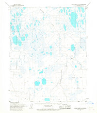
1955 · Meade River A-4
USGS Topo · 1:63,360

1955 · Meade River B-2
USGS Topo · 1:63,360

1955 · Meade River C-3
USGS Topo · 1:63,360

1955 · Meade River B-4
USGS Topo · 1:63,360

1955 · Meade River C-4
USGS Topo · 1:63,360