Old Maps of Circle, Alaska for Metal Detecting
Plan your next treasure hunt with 5 historic maps of Circle. Find old homesites, ghost towns, trails, and gathering spots that may be lost to time — perfect for identifying promising metal detecting locations.
- Locate forgotten sites: Uncover places like long-lost settlements, abandoned rail lines, or gathering spots.
- Plan better hunts: Use map overlays combined with LiDAR or satellite views to narrow in on historically rich areas.
- Made for detectorists: Thousands of hobbyists use these maps to discover relics, coins, and hidden history.
Use these historic maps to boost your research and find new opportunities beneath the surface of Circle.
Circle, AK maps
(5)- 1951 Map of Circle, 1952 Print
 1951 Circle1952 Print · USGSThe Steese Highway corridor in the early fifties reveals a landscape of mining camps and geothermal outposts. Trace the route through Eagle Summit to find Central House, Circle Hot Springs, and numerous Placer Mines along the creeks.4 unique versions available
 - 1955 Map of Circle D-1, 1959 Print
 1955 Circle D-11959 Print · USGSThe river settlement of Circle stands at the end of the Steese Highway in the mid-1950s. Researchers can trace the layout of the town along the Yukon River, including the local Cem and the early Airstrip that served the community.3 unique versions available
 - 1955 Map of Circle, 1961 Print
 1955 Circle1961 Print · USGSInterior Alaska in the mid-1950s is defined here by the Steese Highway and the remote outposts it connected. Researchers can trace early roadhouses and mining infrastructure at Miller House (PO), Twelvemile House, and the Placer Mine sites.8 unique versions available
 - 1964 Map of Circle
 1964 Circle1964 Print · USGSThe Alaskan interior at the height of the mid-century wilderness era is defined here by the river-fed settlements and high mountain passes. Researchers can trace the path of the Steese Highway to Circle, finding remote sites like Circle Hot Springs and Miller House.
 - 2018 Map of Circle D-1 SE, 2018 Print
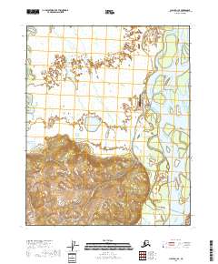 2018 Circle D-1 SE2018 Print · USGSThe riverbank settlement of Circle is captured here in the late 2010s at its position on the Yukon River. Researchers can trace the local infrastructure and water systems, from the Circle City Airport to the winding course of Birch Creek.
End of results
Showing maps 1-5 of 5
Frequently asked questions
- What are the different types of historical maps available for Circle?
- What is the oldest map of Circle?
- Where can I purchase historical maps of Circle for my home or office?
- Where can I download high-res historical maps of Circle?
- Are there historical topographic maps available for Circle?
- Is there historical aerial imagery available for Circle?
- Where are historical maps of Circle sourced from?