2000s (21st Century) Maps of Dillingham, Alaska
Explore 5 historic maps of Dillingham from the 2000s (21st Century). These maps offer a rare glimpse into what life looked like during the 2000s — showing old roads, neighborhoods, homes, and landmarks that have changed or disappeared over time.
Whether you're researching your family's past, planning a metal detecting trip, or studying how Dillingham's landscape evolved across the 2000s, these high-resolution maps are a powerful tool for exploring the history of this region.
- Focus on a specific era: All maps on this page are from the 2000s, giving you a focused view of this time period.
- See what’s changed: Compare century-old streets, trails, and buildings to today's modern landscape using overlays and satellite layers.
- Research with precision: Use these maps for genealogy, historical research, land use analysis, or educational projects.
- View, download, or print: Maps are fully viewable online in high resolution, and can be downloaded or printed for your own records.
Start exploring Dillingham's history through authentic maps from the 2000s. This is your window into the past.
Dillingham, AK maps
(5)- 2019 Map of Dillingham A-7 SE, 2019 Print
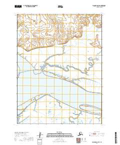 2019 Dillingham A-7 SE2019 Print · USGSCoastal Alaska where the rivers meet the bay is captured here in the late twenty-tens, showing a landscape defined by water and tide. Researchers can trace the shifting shorelines around Snag Point, the mouth of the Wood River, and the wide reaches of the Nushagak River.
 - 2019 Map of Nushagak Bay D-2 NW, 2019 Print
 2019 Nushagak Bay D-2 NW2019 Print · USGSThe coastal environment around Bristol Bay is captured here during the late 2010s. Genealogists and historians can trace the shoreline between Dillingham and Coffee Point or locate Antenna Road.
 - 2019 Map of Dillingham A-8 SE, 2019 Print
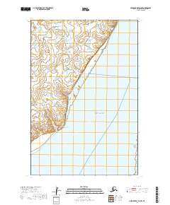
 2019 Dillingham A-8 SE2019 Print · USGSIn the Alaska wilderness during the late twenty-tens, the landscape remains defined by its natural water systems. Researchers and conservationists can trace the wandering path of the Snake River as it meanders through the wetlands of T13S R57W.
 - 2019 Map of Dillingham A-7 SW, 2019 Print
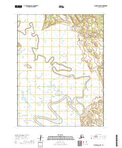
 2019 Dillingham A-7 SW2019 Print · USGSCovers Dillingham, including Nelsonville, Wood River, and other nearby areas
 - 2023 Map of Dillingham A-7 SW, 2023 Print
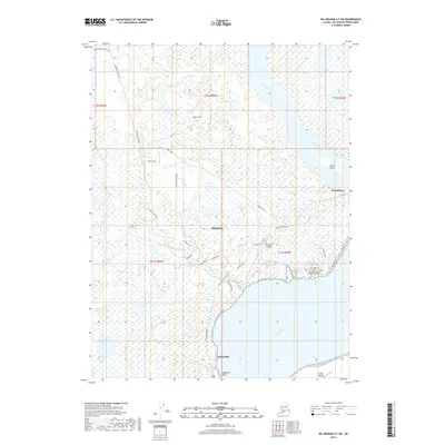
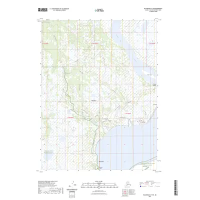 2023 Dillingham A-7 SW2023 Print · USGSDillingham and the surrounding coastal wetlands are captured here in the early twenty-first century, showing the town's modern footprint alongside the Bristol Bay shoreline. Researchers can trace the local road network and identify regional landmarks like Dillingham Airport, Nelsonville, and the Togiak National Wildlife Refuge.
End of results
Showing maps 1-5 of 5
Top cities near Dillingham
Top neighborhoods of Dillingham
Frequently asked questions
- What are the different types of historical maps available for Dillingham?
- What is the oldest map of Dillingham?
- Where can I purchase historical maps of Dillingham for my home or office?
- Where can I download high-res historical maps of Dillingham?
- Are there historical topographic maps available for Dillingham?
- Is there historical aerial imagery available for Dillingham?
- Where are historical maps of Dillingham sourced from?