Old Maps of Dillingham, Alaska for Metal Detecting
Plan your next treasure hunt with 14 historic maps of Dillingham. Find old homesites, ghost towns, trails, and gathering spots that may be lost to time — perfect for identifying promising metal detecting locations.
- Locate forgotten sites: Uncover places like long-lost settlements, abandoned rail lines, or gathering spots.
- Plan better hunts: Use map overlays combined with LiDAR or satellite views to narrow in on historically rich areas.
- Made for detectorists: Thousands of hobbyists use these maps to discover relics, coins, and hidden history.
Use these historic maps to boost your research and find new opportunities beneath the surface of Dillingham.
Dillingham, AK maps
(14)- 1945 Map of Nushagak Bay, 1954 Print
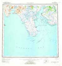
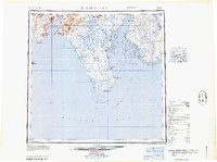
 1945 Nushagak Bay1954 Print · USGSNushagak Bay and the sprawling Alaskan coastline are captured in the mid-1940s, highlighting a landscape defined by salmon fishing and tidal waters. Researchers can locate remote outposts like Old Saltery, the busy Nushagak Cannery, and the coastal settlement of Clarks Point.
 - 1949 Map of Nushagak Bay
 1949 Nushagak Bay1949 Print · USGSCoastal Alaska at the height of the mid-century salmon industry reveals a landscape of isolated canneries and subsistence camps. You can trace the shorelines to find sites like Nushagak Cannery, the Old Saltery, and the remote Igushik Cannery along the river.2 unique versions available
 - 1951 Map of Dillingham, 1952 Print
 1951 Dillingham1952 Print · USGSDillingham and the Bristol Bay river systems are captured here in the early fifties, showing a remote landscape linked by water and seasonal camps. Researchers can trace early settlements and post offices at New Stuyahok, Ekwok, and Kvichak.
 - 1951 Map of Nushagak Bay, 1955 Print
 1951 Nushagak Bay1955 Print · USGSBristol Bay's eastern coastline is captured here in the early fifties, highlighting the salmon fishing and canning hubs of the era. Genealogists and historians can trace coastal settlements like Ekuk and Nushagak or locate the Igushik (Site).7 unique versions available
 - 1952 Map of Dillingham A-8, 1963 Print
 1952 Dillingham A-81963 Print · USGSSouthwest Alaska during the early fifties reveals a landscape defined by the shifting waters of Lake Nunavaugaluk. Researchers can trace the meandering Snake River and locate remote Cabins along the water's edge.2 unique versions available
 - 1952 Map of Dillingham A-7, 1963 Print
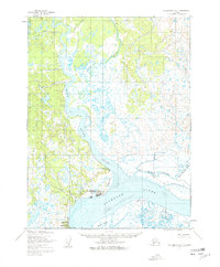 1952 Dillingham A-71963 Print · USGSDillingham and the surrounding Bristol Bay coastline are captured in the early fifties during a period of vital regional growth. Researchers can trace the layout of Dillingham, locate the Kanakanak hospital, and follow the Winter Trail through the tundra.2 unique versions available
 - 1952 Map of Nushagak Bay D-2, 1963 Print
 1952 Nushagak Bay D-21963 Print · USGSNushagak Bay in the early fifties shows a remote Alaskan coastline defined by maritime commerce and government outposts. Genealogists and historians can trace coastal settlements like Ekuk, the Santa Claus Ch, and the Kanakanak US Govt Hosp.2 unique versions available
 - 1954 Map of Dillingham, 1967 Print
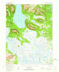
 1954 Dillingham1967 Print · USGSBristol Bay's interior river systems are mapped here in the mid-1950s, showing a landscape defined by water and winter travel. Researchers can trace remote settlements like Koliganek and Levelock or find family landmarks along the Nushagak River and Lake Aleknagik.3 unique versions available
 - 1964 Map of Nushagak Bay
 1964 Nushagak Bay1964 Print · USGSNushagak Bay and the Bristol Bay coastline appear in mid-century detail, capturing the seasonal fishing hubs and maritime hazards of the era. Researchers can trace historic cannery sites, coastal settlements like Ekuk, and the shifting sands of Ship Channel or Etolin Pt.
 - 2019 Map of Dillingham A-7 SE, 2019 Print
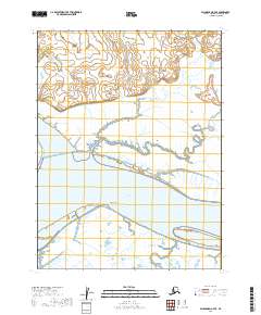 2019 Dillingham A-7 SE2019 Print · USGSCoastal Alaska where the rivers meet the bay is captured here in the late twenty-tens, showing a landscape defined by water and tide. Researchers can trace the shifting shorelines around Snag Point, the mouth of the Wood River, and the wide reaches of the Nushagak River.
 - 2019 Map of Nushagak Bay D-2 NW, 2019 Print
 2019 Nushagak Bay D-2 NW2019 Print · USGSThe coastal environment around Bristol Bay is captured here during the late 2010s. Genealogists and historians can trace the shoreline between Dillingham and Coffee Point or locate Antenna Road.
 - 2019 Map of Dillingham A-8 SE, 2019 Print
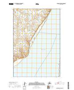
 2019 Dillingham A-8 SE2019 Print · USGSIn the Alaska wilderness during the late twenty-tens, the landscape remains defined by its natural water systems. Researchers and conservationists can trace the wandering path of the Snake River as it meanders through the wetlands of T13S R57W.
 - 2019 Map of Dillingham A-7 SW, 2019 Print
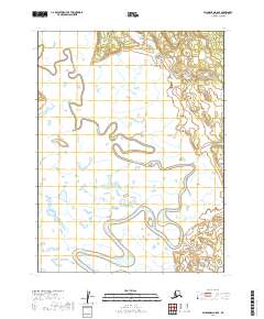
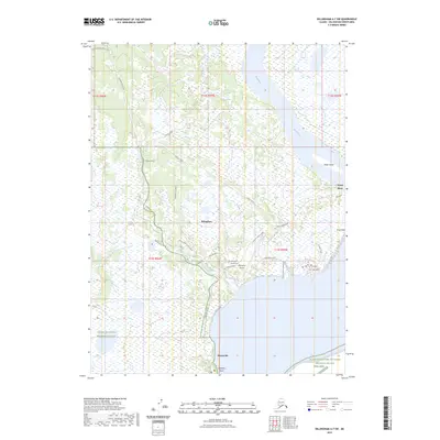
 2019 Dillingham A-7 SW2019 Print · USGSCovers Dillingham, including Nelsonville, Wood River, and other nearby areas
 - 2023 Map of Dillingham A-7 SW, 2023 Print
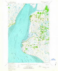
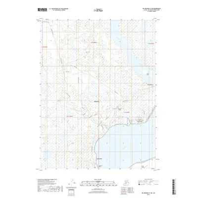
 2023 Dillingham A-7 SW2023 Print · USGSDillingham and the surrounding coastal wetlands are captured here in the early twenty-first century, showing the town's modern footprint alongside the Bristol Bay shoreline. Researchers can trace the local road network and identify regional landmarks like Dillingham Airport, Nelsonville, and the Togiak National Wildlife Refuge.
End of results
Showing maps 1-14 of 14
Top cities near Dillingham
Top neighborhoods of Dillingham
Frequently asked questions
- What are the different types of historical maps available for Dillingham?
- What is the oldest map of Dillingham?
- Where can I purchase historical maps of Dillingham for my home or office?
- Where can I download high-res historical maps of Dillingham?
- Are there historical topographic maps available for Dillingham?
- Is there historical aerial imagery available for Dillingham?
- Where are historical maps of Dillingham sourced from?