Old Maps of Umnak, Alaska for Academic Research
Study the evolution of Umnak with 3 high-resolution historic maps. Whether you're teaching, researching, or modeling changes in land use, these maps provide essential visual documentation of urban, environmental, and geographic change.
- Analyze long-term change: Track patterns in development, transportation, and natural features.
- Ideal for environmental or urban studies: Support academic projects with primary historical map data.
- Use in the classroom or lab: Educators and researchers rely on these maps to bring historical context to life.
These maps are a powerful tool for teaching, research, and visualizing how Umnak has changed over the decades.
Umnak, AK maps
(3)- 1951 Map of Umnak, 1952 Print
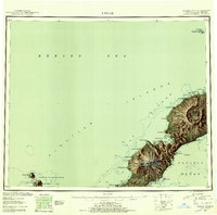 1951 Umnak1952 Print · USGSThe Aleutian landscape in the early fifties reveals a remote volcanic terrain at the edge of the Bering Sea. Researchers can trace landforms like Mt Vsevidof, the coastal features of Inanudak Bay, and isolated outposts such as Bogoslof Island.8 unique versions available
 - 1958 Map of Umnak
 1958 Umnak1958 Print · USGSUmnak Island and the eastern Aleutians are documented here in the mid-fifties, showing a landscape defined by volcanic activity and Cold War military installations. Researchers can trace the Air Force Base and island landmarks like Okmok Caldera and Mt Vsevidof.
 - 2021 Map of Umnak B-1 SW, 2021 Print
 2021 Umnak B-1 SW2021 Print · USGSUmnak Island’s remote interior is documented in this recent survey, capturing the island's steep volcanic topography as it reaches the sea. Researchers and hikers can trace the natural corridors through Hourglass Pass and Bottleneck Pass down to the Pacific Ocean.
End of results
Showing maps 1-3 of 3
Frequently asked questions
- What are the different types of historical maps available for Umnak?
- What is the oldest map of Umnak?
- Where can I purchase historical maps of Umnak for my home or office?
- Where can I download high-res historical maps of Umnak?
- Are there historical topographic maps available for Umnak?
- Is there historical aerial imagery available for Umnak?
- Where are historical maps of Umnak sourced from?