Old Maps of San Simon, Arizona for Academic Research
Study the evolution of San Simon with 15 high-resolution historic maps. Whether you're teaching, researching, or modeling changes in land use, these maps provide essential visual documentation of urban, environmental, and geographic change.
- Analyze long-term change: Track patterns in development, transportation, and natural features.
- Ideal for environmental or urban studies: Support academic projects with primary historical map data.
- Use in the classroom or lab: Educators and researchers rely on these maps to bring historical context to life.
These maps are a powerful tool for teaching, research, and visualizing how San Simon has changed over the decades.
San Simon, AZ maps
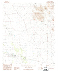
(15)- 1917 Map of San Simon
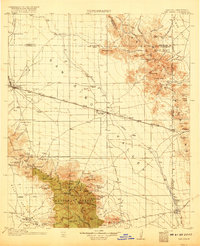 1917 San Simon1917 Print · USGSArizona and New Mexico ranching and rail history meet here during the years following the border surveys. Genealogists and historians can locate remote family sites like Posey Ranch, the historical Old Fort Bowie, and early copper or granite works at Willie Rose Mine.3 unique versions available
 - 1926 Map of Orange Butte
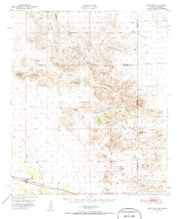
 1926 Orange Butte1926 Print · USGSCochise County's desert frontier comes into sharp focus during the mid-twenties, tracing the borderlands from the Peloncillo Mountains to the Animas Valley. Researchers can locate dozens of family-named landmarks like Lyall Ranch and Chamberlin Ranch, alongside working claims at Volcano Mine.
 - 1950 Map of San Simon
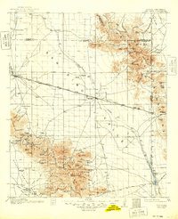
 1950 San Simon1950 Print · USGSThe high desert borderlands of Arizona and New Mexico are captured here at mid-century, following the line of the Southern Pacific railroad. Researchers can locate remote cattle operations and early landmarks like the Braidfoot Ranch, the Old Stage Station (Ruins), and the lonely Giddings Grave.2 unique versions available
 - 1951 Map of San Simon
 1951 San Simon1951 Print · USGSCrossing the Arizona-New Mexico border in the 1950s, this survey shows a high-desert landscape defined by the railroad and mountain passes. Trace the legacy of early travel and mining at the Old Stage Station (Ruins), Giddings Grave, and the Volcano Mine.
 - 1954 Map of Silver City, 1967 Print
 1954 Silver City1967 Print · USGSSoutheast Arizona and southwest New Mexico meet in this mid-century survey of the high desert and mountain mining districts. Local researchers can trace the rail lines through Lordsburg, the silver operations at Ash Peak Mines, and the limits of Fort Bayard Military Reservation.4 unique versions available
 - 1958 Map of Silver City
 1958 Silver City1958 Print · USGSSouthwestern New Mexico and eastern Arizona appear here in the mid-1950s, a period of intensive mining and rail activity. Trace the routes of the Southern Pacific RR through Lordsburg or locate historic operations at the Chino Mine and Santa Rita.
 - 1962 Map of Silver City
 1962 Silver City1962 Print · USGSThe high desert borderlands of New Mexico and Arizona come alive in this early sixties survey. Genealogists and historians can trace the mining economy through the Chino Mine, follow the rail routes of the Southern Pacific, or locate settlements like Virden and Bayard.
 - 1962 Map of San Simon, 1971 Print
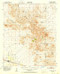
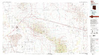
 1962 San Simon1971 Print · USGSThe Arizona-New Mexico borderlands come alive in this survey of the San Simon Valley and the Peloncillo Mountains as they appeared before the Great War. Genealogists and historians can trace the foundations of Old Fort Bowie, the SOUTHERN PACIFIC line, and family landmarks like Riggs Home Ranch.
 - 1987 Map of San Simon
 1987 San Simon1987 Print · USGSSan Simon in the late 1980s reveals a desert community built around agricultural and ranching infrastructure. Genealogists and local historians can trace the town layout near the Cotton Gin, the Rodeo Ground, and the USDA Check Station.
 - 1994 Map of Willcox
 1994 Willcox1994 Print · USGSSoutheast Arizona in the mid-nineties shows a landscape defined by expansive desert basins and rugged sky islands. Genealogists and historians can trace the rail corridor of the Southern Pacific through Willcox, Bowie, and the Kansas Settlement.2 unique versions available
 - 1998 Map of San Simon, 2003 Print
 1998 San Simon2003 Print · USGSSan Simon and the Cochise County desert are captured here at the end of the millennium, showing a landscape of agriculture and mountain wilderness. Genealogists and researchers can locate the town Cem, the central Rodeo Ground, and industrial markers like the Cotton Gin.
 - 2011 Map of San Simon, 2011 Print
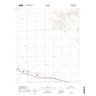
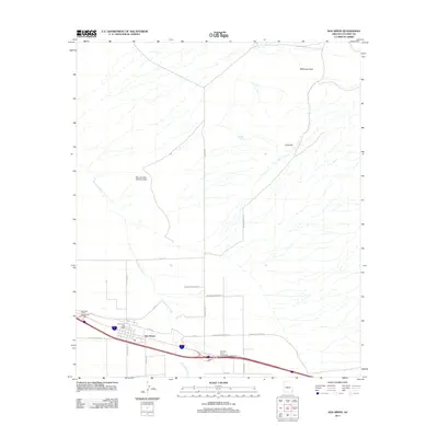 2011 San Simon2011 Print · USGSCovers San Simon, including Cochise County, United States, and other nearby areas
 - 2014 Map of San Simon, 2014 Print
 2014 San Simon2014 Print · USGSCovers San Simon, including Cochise County, United States, and other nearby areas
 - 2018 Map of San Simon, 2018 Print
 2018 San Simon2018 Print · USGSCovers San Simon, including Cochise County, United States, and other nearby areas
 - 2021 Map of San Simon, 2021 Print
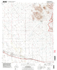
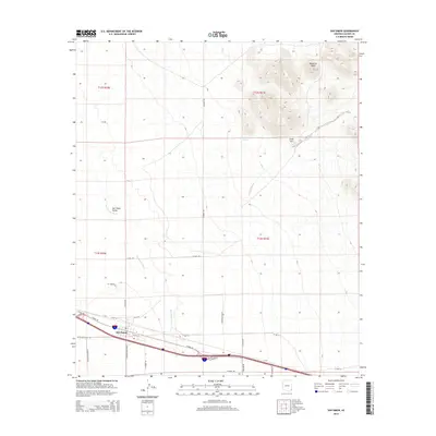
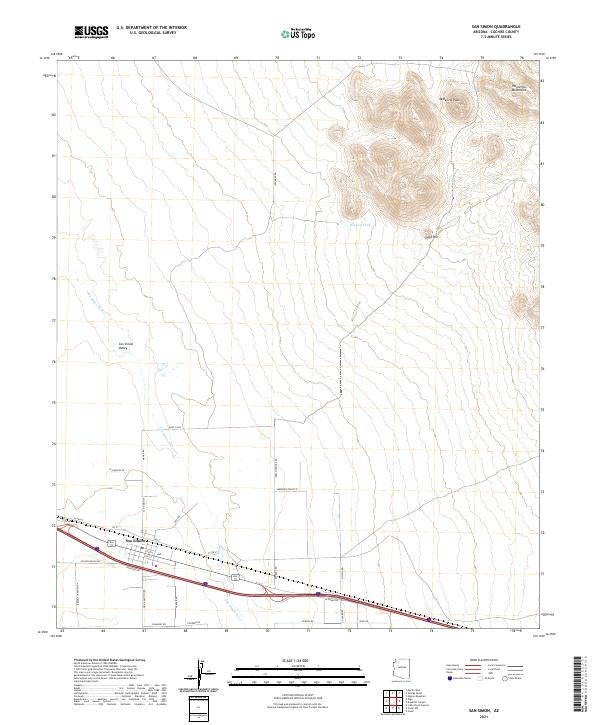 2021 San Simon2021 Print · USGSSoutheast Arizona's high desert landscape is shown here as it appeared in recent years, centered on the historic crossroads of the San Simon Valley. Genealogists and historians can trace the townsite of San Simon and its connection to the Peloncillo Mountains via Indian Springs Rd.
End of results
Showing maps 1-15 of 15
Frequently asked questions
- What are the different types of historical maps available for San Simon?
- What is the oldest map of San Simon?
- Where can I purchase historical maps of San Simon for my home or office?
- Where can I download high-res historical maps of San Simon?
- Are there historical topographic maps available for San Simon?
- Is there historical aerial imagery available for San Simon?
- Where are historical maps of San Simon sourced from?