1900s (20th Century) Maps of Grand Canyon Village, Arizona
Explore 9 historic maps of Grand Canyon Village from the 1900s (20th Century). These maps offer a rare glimpse into what life looked like during the 1900s — showing old roads, neighborhoods, homes, and landmarks that have changed or disappeared over time.
Whether you're researching your family's past, planning a metal detecting trip, or studying how Grand Canyon Village's landscape evolved across the 1900s, these high-resolution maps are a powerful tool for exploring the history of this region.
- Focus on a specific era: All maps on this page are from the 1900s, giving you a focused view of this time period.
- See what’s changed: Compare century-old streets, trails, and buildings to today's modern landscape using overlays and satellite layers.
- Research with precision: Use these maps for genealogy, historical research, land use analysis, or educational projects.
- View, download, or print: Maps are fully viewable online in high resolution, and can be downloaded or printed for your own records.
Start exploring Grand Canyon Village's history through authentic maps from the 1900s. This is your window into the past.
Grand Canyon Village, AZ maps
(9)- 1903 Map of Bright Angel
 1903 Bright Angel1903 Print · USGSCoconino County at the turn of the century shows the initial footprint of modern tourism as rail lines reach the canyon rim. Researchers can trace the original paths of the Bright Angel Trail and locate early sites like the El Tovar Hotel and Phantom Ranch.4 unique versions available
 - 1906 Map of Bright Angel
 1906 Bright Angel1906 Print · USGSArizona's most famous natural wonder is documented here in the early years of the century as the rail lines first reached the rim. Trace the early routes of the Bright Angel Trail and the Grand Canyon R. R. into the settlement of Grand Canyon.9 unique versions available
 - 1953 Map of Grand Canyon, 1967 Print
 1953 Grand Canyon1967 Print · USGSArizona's northern frontier is captured here in the mid-twentieth century, from the high plateaus to the desert basins. Trace early routes like Arizona 67, explore the isolated Moccasin settlement, or locate early landmarks such as Mount Trumbull.3 unique versions available
 - 1957 Map of Grand Canyon
 1957 Grand Canyon1957 Print · USGSNorthern Arizona in the mid-fifties presents a sparsely settled expanse of high plateaus and ranching outposts surrounding the great canyon. Genealogists and historians can trace family land at Diamond Butte Ranch, locate the Moccasin settlement, or study the magnesium works at Black Diamond Mine.
 - 1958 Map of Grand Canyon
 1958 Grand Canyon1958 Print · USGSNorthern Arizona in the late fifties was a landscape of remote cattle ranches and timber operations spanning from the Virgin Mountains to the Kaibab Forest. Researchers can locate family outposts like Bundy Ranch, trace the Temple Trail, or find the Parashant Lumber Mill.
 - 1960 Map of Grand Canyon
 1960 Grand Canyon1960 Print · USGSThe Arizona strip and the Colorado River corridor appear in the 1950s as a vast network of isolated plateaus and remote outposts. Researchers can trace historic ranching and tribal lands including Supai, the Kaibab Indian Reservation, and the Mt Trumbull Post Office.
 - 1962 Map of Bright Angel, 1963 Print
 1962 Bright Angel1963 Print · USGSThe South Rim and inner canyon are captured in the early sixties as the park's modern visitor infrastructure was taking shape. Genealogists and historians can trace the Atchison Topeka and Santa Fe rail line, Phantom Ranch, and the N P S Training Sch.7 unique versions available
 - 1984 Map of Grand Canyon
 1984 Grand Canyon1984 Print · USGSThe Grand Canyon and surrounding plateaus are mapped here in the mid-1980s, detailing a complex landscape of tribal lands and national park boundaries. Trace historic routes like the Bright Angel Trail or locate remote sites such as Supai and the Orphan Mine.2 unique versions available
 - 1988 Map of Grand Canyon
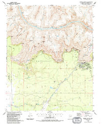 1988 Grand Canyon1988 Print · USGSThe South Rim and deep river gorges of Arizona are shown in the late 1980s, detailing the park's mid-century infrastructure and historic trails. Researchers can locate the Lost Orphan Mine, the Powell Memorial, and remote outposts like Indian Garden.2 unique versions available
End of results
Showing maps 1-9 of 9
Top cities near Grand Canyon Village
Frequently asked questions
- What are the different types of historical maps available for Grand Canyon Village?
- What is the oldest map of Grand Canyon Village?
- Where can I purchase historical maps of Grand Canyon Village for my home or office?
- Where can I download high-res historical maps of Grand Canyon Village?
- Are there historical topographic maps available for Grand Canyon Village?
- Is there historical aerial imagery available for Grand Canyon Village?
- Where are historical maps of Grand Canyon Village sourced from?