2000s (21st Century) Maps of Coffeepot, Arizona
Explore 5 historic maps of Coffeepot from the 2000s (21st Century). These maps offer a rare glimpse into what life looked like during the 2000s — showing old roads, neighborhoods, homes, and landmarks that have changed or disappeared over time.
Whether you're researching your family's past, planning a metal detecting trip, or studying how Coffeepot's landscape evolved across the 2000s, these high-resolution maps are a powerful tool for exploring the history of this region.
- Focus on a specific era: All maps on this page are from the 2000s, giving you a focused view of this time period.
- See what’s changed: Compare century-old streets, trails, and buildings to today's modern landscape using overlays and satellite layers.
- Research with precision: Use these maps for genealogy, historical research, land use analysis, or educational projects.
- View, download, or print: Maps are fully viewable online in high resolution, and can be downloaded or printed for your own records.
Start exploring Coffeepot's history through authentic maps from the 2000s. This is your window into the past.
Coffeepot, AZ maps
(5)- 2004 Map of Sheep Basin Mountain, 2006 Print
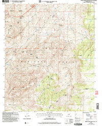 2004 Sheep Basin Mountain2006 Print · USGSThe high country of Gila County is seen here during the mid-2000s, showing a rugged landscape of ranching outposts and forest service infrastructure. You can trace early corridors like Pleasant Valley Road and locate remote camps and springs including Soldier Camp and Conway Spring.
 - 2011 Map of Sheep Basin Mountain, 2011 Print
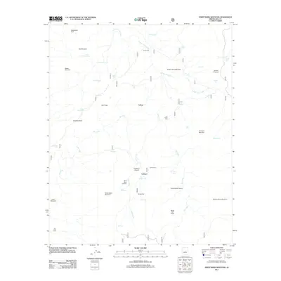 2011 Sheep Basin Mountain2011 Print · USGSCovers Coffeepot, including Gallups, Gila County, and other nearby areas
 - 2014 Map of Sheep Basin Mountain, 2014 Print
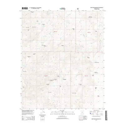 2014 Sheep Basin Mountain2014 Print · USGSCovers Coffeepot, including Gallups, Gila County, and other nearby areas
 - 2018 Map of Sheep Basin Mountain, 2018 Print
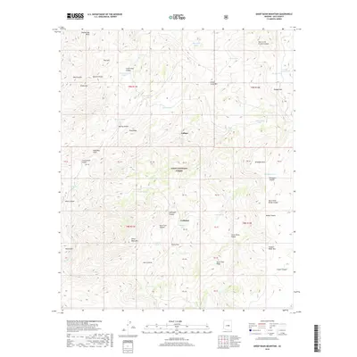 2018 Sheep Basin Mountain2018 Print · USGSCovers Coffeepot, including Gallups, Gila County, and other nearby areas
 - 2021 Map of Sheep Basin Mountain, 2021 Print
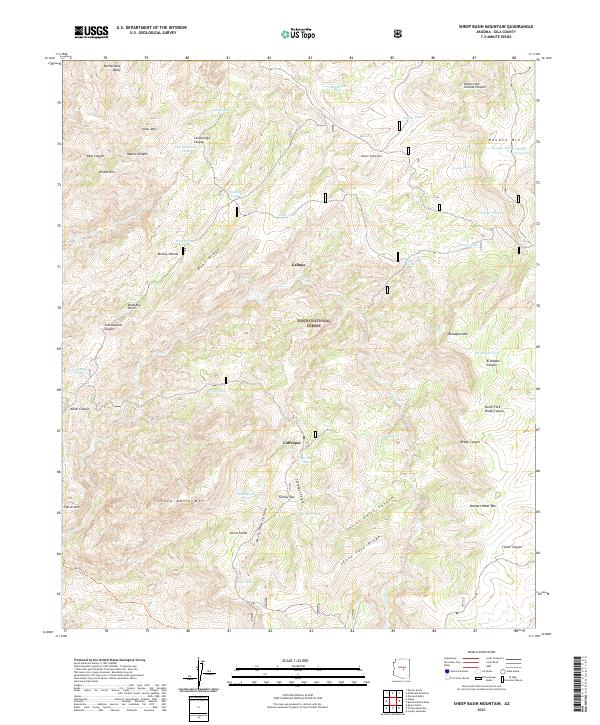 2021 Sheep Basin Mountain2021 Print · USGSGila County high country in the early twenty-first century remains a landscape of deep canyons and rugged peaks. Researchers can trace historic ranching infrastructure through water sources like Houdon Tank and follow the route of the Del Shay Trl near Sierra Ancha.
End of results
Showing maps 1-5 of 5
Top cities near Coffeepot
Frequently asked questions
- What are the different types of historical maps available for Coffeepot?
- What is the oldest map of Coffeepot?
- Where can I purchase historical maps of Coffeepot for my home or office?
- Where can I download high-res historical maps of Coffeepot?
- Are there historical topographic maps available for Coffeepot?
- Is there historical aerial imagery available for Coffeepot?
- Where are historical maps of Coffeepot sourced from?