Old Maps of Government Hill, Arizona for Genealogy
Trace your family roots with these historic maps of Government Hill. These high-res maps reveal old neighborhoods, homesites, landmarks, and streets — helping you uncover where your ancestors lived and how the area evolved over time.
- Explore historic neighborhoods: Identify where your relatives may have lived in the 1800s or 1900s.
- Compare maps over time: Trace the changes in streets, buildings, and landmarks for multi-generational research.
- Perfect for genealogy & ancestry research: Used by family historians and researchers to map out lineage and migration.
These maps are an incredible resource for exploring your personal connection to Government Hill's past.
Government Hill, AZ maps
- 1907 Map of Roosevelt, 1956 Print
 1907 Roosevelt1956 Print · USGSCentral Arizona at the birth of the reclamation era centers on the engineering of the Roosevelt Dam and the waters of the Salt River. Genealogists and historians can trace numerous early family holdings like Clanton's Ranch, the stage stop at Schells Station, and the remote settlement of Apacheria.2 unique versions available
 - 1909 Map of Four Peaks
 1909 Four Peaks1909 Print · USGSThe central Arizona wilderness at the start of the century reveals a land of isolated ranching outposts and rugged mountain passes. Researchers can trace the early cattle frontier at Sunflower Ranch, find the original Mormon Flats, and locate the historic Schells Station.2 unique versions available
 - 1912 Map of Roosevelt
 1912 Roosevelt1912 Print · USGSCentral Arizona is captured here during the transformative years following the completion of the Roosevelt Dam. You can trace early ranching homesteads such as Clines Ranch and Howell's Ranch or locate the site of Schell's Station.4 unique versions available
 - 1954 Map of Mesa, 1968 Print
 1954 Mesa1968 Print · USGSCentral Arizona in the mid-fifties reveals the rapid growth of the Valley of the Sun alongside the deep-rooted mining districts of the eastern mountains. Genealogists and researchers can trace the expansion of Mesa and Chandler or locate legacy operations at Inspiration Mine and the Magma Arizona railroad.4 unique versions available
 - 1957 Map of Mesa
 1957 Mesa1957 Print · USGSCentral Arizona's desert valleys and high-mountain mining districts come alive in the mid-fifties. Researchers can trace the early layout of Mesa and Phoenix or locate remote sites like Inspiration Mine and Arizona State College.
 - 1958 Map of Mesa
 1958 Mesa1958 Print · USGSMid-century Arizona comes alive in this survey of the valley and high desert, where urban growth begins to transform the landscape. Genealogists and researchers can trace the rail-and-mine economy through Inspiration Mine and old stops like Rittenhouse and Magma.
 - 1960 Map of Mesa
 1960 Mesa1960 Print · USGSThe Salt River Valley and Superstition wilderness are captured here during a era of rapid post-war growth. Researchers can trace the mid-century footprints of Williams AF Base and Arizona State College or locate the deep-rock shafts of the Old Dominion Mine and Magma Mine.
 - 1964 Map of Mesa
 1964 Mesa1964 Print · USGSCentral Arizona in the mid-1960s reveals a landscape defined by rapid desert urbanization and a massive copper mining industry. Genealogists and historians can trace the growth of Phoenix or explore the mining camps and operations at Miami Mine and Magma Mine.
 - 1964 Map of Theodore Roosevelt Dam, 1965 Print
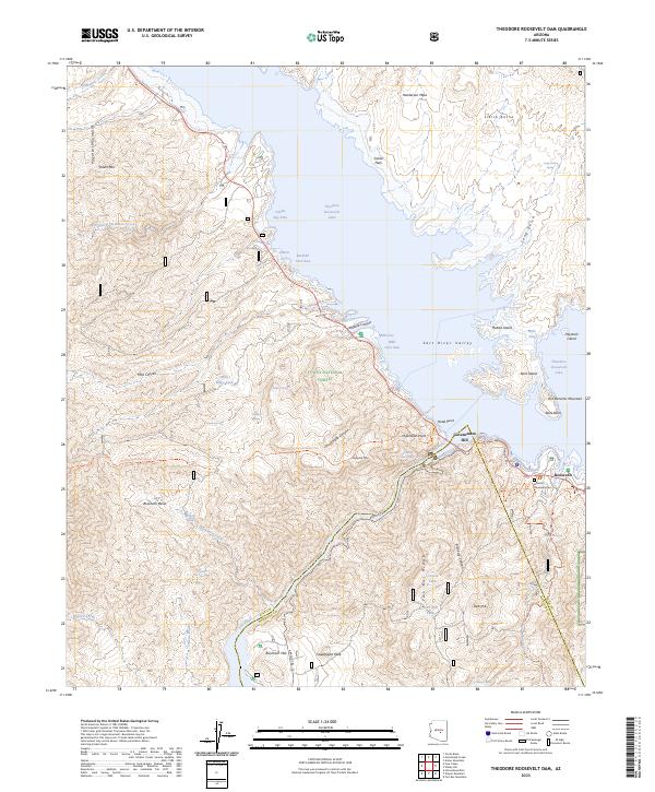
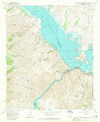 1964 Theodore Roosevelt Dam1965 Print · USGSThe Salt River Canyon at the height of the mid-century recreation boom shows a landscape transformed by the Theodore Roosevelt Dam. Trace the original winding path of the Apache Trail as it connects the town of Roosevelt to landmarks like Inspiration Point and Tonto National Monument.2 unique versions available
 - 1994 Map of Theodore Roosevelt Lake, 1995 Print
 1994 Theodore Roosevelt Lake1995 Print · USGSCentral Arizona in the early nineties reveals the sprawling growth of the Valley of the Sun against the high desert wilderness. Researchers can trace the development of Scottsdale and Carefree or locate remote outposts like Sunflower and Punkin Center near the Mazatzal Wilderness.3 unique versions available
 - 2004 Map of Theodore Roosevelt Dam, 2007 Print
 2004 Theodore Roosevelt Dam2007 Print · USGSGila County's massive reservoir and utility works are captured here in the early 2000s, showcasing the intersection of federal land management and desert recreation. Researchers can locate specific facilities like the Tonto Basin Ranger Station, the settlement of Roosevelt, and the rugged path of the Arizona Trail.
 - 2011 Map of Theodore Roosevelt Dam, 2011 Print
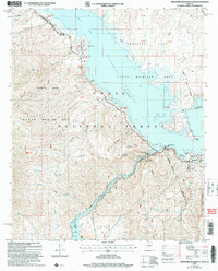
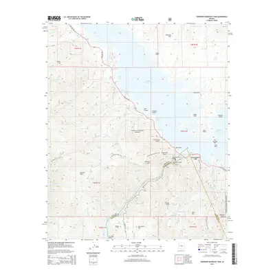
 2011 Theodore Roosevelt Dam2011 Print · USGSCovers Government Hill, including Roosevelt, Maricopa County, and other nearby areas
 - 2014 Map of Theodore Roosevelt Dam, 2014 Print
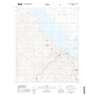
 2014 Theodore Roosevelt Dam2014 Print · USGSCovers Government Hill, including Roosevelt, Maricopa County, and other nearby areas
 - 2018 Map of Theodore Roosevelt Dam, 2018 Print
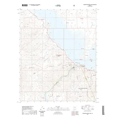
 2018 Theodore Roosevelt Dam2018 Print · USGSCovers Government Hill, including Roosevelt, Maricopa County, and other nearby areas
 - 2021 Map of Theodore Roosevelt Dam, 2021 Print
 2021 Theodore Roosevelt Dam2021 Print · USGSCovers Government Hill, including Roosevelt, Maricopa County, and other nearby areas
 - 2023 Map of Theodore Roosevelt Dam, 2023 Print
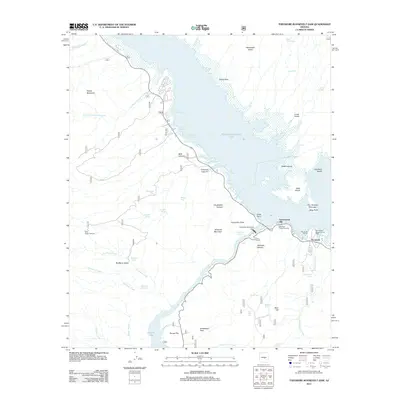
 2023 Theodore Roosevelt Dam2023 Print · USGSGila County's desert landscape and the massive reservoir are captured here during the early twenty-first century. Researchers can locate the Historic Roosevelt Cem near Roosevelt or trace the winding path of the Apache Trl and Arizona National Scenic Tr.
End of results
Showing maps 1-16
Frequently asked questions
- What are the different types of historical maps available for Government Hill?
- What is the oldest map of Government Hill?
- Where can I purchase historical maps of Government Hill for my home or office?
- Where can I download high-res historical maps of Government Hill?
- Are there historical topographic maps available for Government Hill?
- Is there historical aerial imagery available for Government Hill?
- Where are historical maps of Government Hill sourced from?