1940s Maps of Payson, Arizona
Explore 2 historic maps of Payson from the 1940s. These maps offer a rare glimpse into what life looked like during the 1940s — showing old roads, neighborhoods, homes, and landmarks that have changed or disappeared over time.
Whether you're researching your family's past, planning a metal detecting trip, or studying how Payson's landscape evolved across the 1940s, these high-resolution maps are a powerful tool for exploring the history of this region.
- Focus on a specific era: All maps on this page are from the 1940s, giving you a focused view of this time period.
- See what’s changed: Compare century-old streets, trails, and buildings to today's modern landscape using overlays and satellite layers.
- Research with precision: Use these maps for genealogy, historical research, land use analysis, or educational projects.
- View, download, or print: Maps are fully viewable online in high resolution, and can be downloaded or printed for your own records.
Start exploring Payson's history through authentic maps from the 1940s. This is your window into the past.
Payson, AZ maps
(2)- 1940 Map of Pine
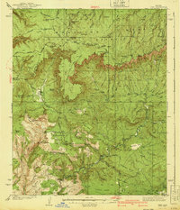 1940 Pine1940 Print · USGSThe northern Arizona highlands are captured here in the mid-1930s, showing the rugged divide of the Mogollon Rim. Local historians can trace early settlements at Pine and Strawberry, along with remote sites like Chase Ranch and the White Mtn Mine.
 - 1942 Map of Payson
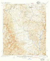 1942 Payson1942 Print · USGSThe Mazatzal Mountains and Tonto Creek watershed come alive in the mid-1930s, showing a landscape of mining claims and remote ranching. Trace old family names at the Bar T Bar Ranch, find historic Indian Ruins, or locate the Gisela Sch.2 unique versions available
End of results
Showing maps 1-2 of 2
Top cities near Payson
Top neighborhoods of Payson
Frequently asked questions
- What are the different types of historical maps available for Payson?
- What is the oldest map of Payson?
- Where can I purchase historical maps of Payson for my home or office?
- Where can I download high-res historical maps of Payson?
- Are there historical topographic maps available for Payson?
- Is there historical aerial imagery available for Payson?
- Where are historical maps of Payson sourced from?