2000s (21st Century) Maps of Riverside Acres, Arizona
Explore 5 historic maps of Riverside Acres from the 2000s (21st Century). These maps offer a rare glimpse into what life looked like during the 2000s — showing old roads, neighborhoods, homes, and landmarks that have changed or disappeared over time.
Whether you're researching your family's past, planning a metal detecting trip, or studying how Riverside Acres's landscape evolved across the 2000s, these high-resolution maps are a powerful tool for exploring the history of this region.
- Focus on a specific era: All maps on this page are from the 2000s, giving you a focused view of this time period.
- See what’s changed: Compare century-old streets, trails, and buildings to today's modern landscape using overlays and satellite layers.
- Research with precision: Use these maps for genealogy, historical research, land use analysis, or educational projects.
- View, download, or print: Maps are fully viewable online in high resolution, and can be downloaded or printed for your own records.
Start exploring Riverside Acres's history through authentic maps from the 2000s. This is your window into the past.
Riverside Acres, AZ maps
(5)- 2004 Map of Tonto Basin, 2007 Print
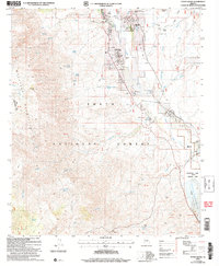 2004 Tonto Basin2007 Print · USGSTonto Basin and the slopes of the Mazatzal Mountains are captured in this early 21st-century survey of Gila County. Genealogists and historians can trace local life around Punkin Center and residential clusters near the waters of Theodore Roosevelt Lake.
 - 2011 Map of Tonto Basin, 2011 Print
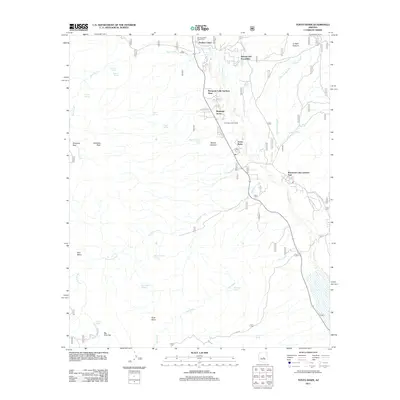 2011 Tonto Basin2011 Print · USGSCovers Riverside Acres, including Punkin Center, Rancho Del Escondido, and other nearby areas
 - 2014 Map of Tonto Basin, 2014 Print
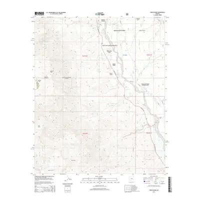 2014 Tonto Basin2014 Print · USGSCovers Riverside Acres, including Punkin Center, Rancho Del Escondido, and other nearby areas
 - 2018 Map of Tonto Basin, 2018 Print
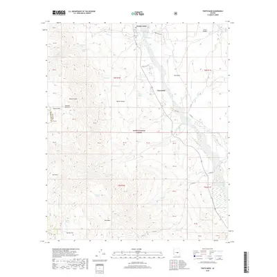 2018 Tonto Basin2018 Print · USGSCovers Riverside Acres, including Punkin Center, Rancho Del Escondido, and other nearby areas
 - 2021 Map of Tonto Basin, 2021 Print
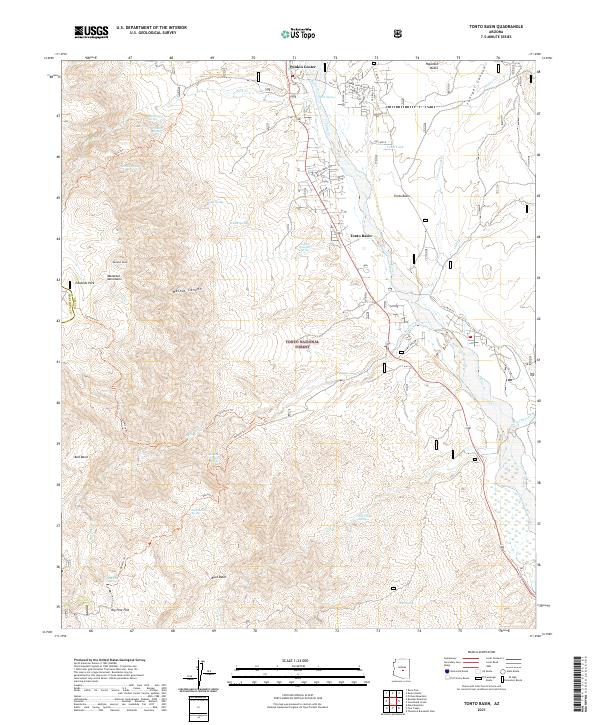 2021 Tonto Basin2021 Print · USGSGila County's high desert landscape comes into focus in the early 2020s as Tonto Creek winds past the settlements of Punkin Center and Tonto Basin. Map collectors and hikers can trace the Tonto Creek Trail and find remote sites like Big Pine Flat or Bull Basin.
End of results
Showing maps 1-5 of 5
Frequently asked questions
- What are the different types of historical maps available for Riverside Acres?
- What is the oldest map of Riverside Acres?
- Where can I purchase historical maps of Riverside Acres for my home or office?
- Where can I download high-res historical maps of Riverside Acres?
- Are there historical topographic maps available for Riverside Acres?
- Is there historical aerial imagery available for Riverside Acres?
- Where are historical maps of Riverside Acres sourced from?