1900s (20th Century) Maps of Cibola, Arizona
Explore 11 historic maps of Cibola from the 1900s (20th Century). These maps offer a rare glimpse into what life looked like during the 1900s — showing old roads, neighborhoods, homes, and landmarks that have changed or disappeared over time.
Whether you're researching your family's past, planning a metal detecting trip, or studying how Cibola's landscape evolved across the 1900s, these high-resolution maps are a powerful tool for exploring the history of this region.
- Focus on a specific era: All maps on this page are from the 1900s, giving you a focused view of this time period.
- See what’s changed: Compare century-old streets, trails, and buildings to today's modern landscape using overlays and satellite layers.
- Research with precision: Use these maps for genealogy, historical research, land use analysis, or educational projects.
- View, download, or print: Maps are fully viewable online in high resolution, and can be downloaded or printed for your own records.
Start exploring Cibola's history through authentic maps from the 1900s. This is your window into the past.
Cibola, AZ maps
(11)- 1942 Map of Blythe
 1942 Blythe1942 Print · USGSThe Lower Colorado River valley appears here in the early 1940s, showcasing the agricultural development of the Palo Verde Mesa alongside a booming mining industry. Researchers can locate remote desert outposts and extraction sites like Midland, the U S Gypsum Mine, and Nortons Landing.2 unique versions available
 - 1945 Map of Cibola
 1945 Cibola1945 Print · USGSThe Colorado River borderlands in the mid-1940s reveal a landscape of desert mining and valley agriculture. Researchers can trace the Cibola Road to the Hart Gold Mine or locate early settlements like Cibola and Hodges.
 - 1951 Map of Cibola, 1952 Print
 1951 Cibola1952 Print · USGSThe Colorado River borderlands in the early fifties are captured here as agriculture and mining define the local economy. Genealogists and historians can trace the legacy of Cibola, locate the Hart Gold Mine, or identify vanished landmarks like Taylor Ferry (Site).3 unique versions available
 - 1952 Map of Palo Verde, 1953 Print
 1952 Palo Verde1953 Print · USGSThe Palo Verde Valley on the California-Arizona border reveals an intricate mid-century irrigation network as farming expanded. Trace the footprints of Rannells (Site) and Taylor Ferry (Site) along the banks of the Colorado River.3 unique versions available
 - 1954 Map of Salton Sea
 1954 Salton Sea1954 Print · USGSThe Colorado River and Imperial Valley desert frontiers are captured here in the 1950s. Trace the irrigation networks of Calipatria and mining sites like Eagle Mountain Mine.
 - 1955 Map of Salton Sea
 1955 Salton Sea1955 Print · USGSThe Colorado River and Imperial Valley desert basins appear here during the mid-fifties, revealing a landscape of remote mines and agricultural irrigation. Genealogists and researchers can trace locations like the Parker Alien Reception Center Unit No 1, Blythe, and the Kane Springs School.2 unique versions available
 - 1959 Map of Salton Sea, 1968 Print
 1959 Salton Sea1968 Print · USGSThe Colorado River and Salton Sea basin are shown here during a decade of intense military and agricultural activity. Trace family roots in Blythe or Niland, and locate historical mining operations like the Eagle Mountain Mine and Red Cloud Mine.4 unique versions available
 - 1963 Map of Salton Sea
 1963 Salton Sea1963 Print · USGSThe Colorado Desert during the early sixties shows a landscape defined by massive water projects and Cold War military ranges. Trace the growth of Salton City and Brawley, or locate remote desert outposts like the Paymaster Mine and Desert Center.
 - 1965 Map of Salton Sea
 1965 Salton Sea1965 Print · USGSThe Colorado Desert and Imperial Valley are caught in a period of intense irrigation and military expansion during the mid-sixties. Researchers can trace the desert's industrial footprint through the Eagle Mountain Mine, the remote Desert Center, and the Salton Sea Test Base.
 - 1965 Map of Palo Verde, 1966 Print
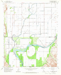 1965 Palo Verde1966 Print · USGSThe Colorado River borderlands in the mid-sixties reveal a landscape defined by industrial irrigation and desert crossings. You can trace the historic Bradshaw Trail, locate the Cibola Bridge, and explore the waterways of the Cibola National Wildlife Refuge.4 unique versions available
 - 1986 Map of Trigo Mts
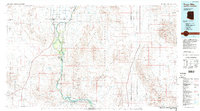 1986 Trigo Mts1986 Print · USGSThe Colorado River corridor is captured here in the mid-eighties as it winds between Arizona and California. Researchers can trace decades of desert enterprise through locations like Paymaster Mine, the Cibola National Wildlife Refuge, and Walters Camp.2 unique versions available
End of results
Showing maps 1-11 of 11
Top cities near Cibola
Frequently asked questions
- What are the different types of historical maps available for Cibola?
- What is the oldest map of Cibola?
- Where can I purchase historical maps of Cibola for my home or office?
- Where can I download high-res historical maps of Cibola?
- Are there historical topographic maps available for Cibola?
- Is there historical aerial imagery available for Cibola?
- Where are historical maps of Cibola sourced from?