1970s Maps of Goodyear, Arizona
Explore 12 historic maps of Goodyear from the 1970s. These maps offer a rare glimpse into what life looked like during the 1970s — showing old roads, neighborhoods, homes, and landmarks that have changed or disappeared over time.
Whether you're researching your family's past, planning a metal detecting trip, or studying how Goodyear's landscape evolved across the 1970s, these high-resolution maps are a powerful tool for exploring the history of this region.
- Focus on a specific era: All maps on this page are from the 1970s, giving you a focused view of this time period.
- See what’s changed: Compare century-old streets, trails, and buildings to today's modern landscape using overlays and satellite layers.
- Research with precision: Use these maps for genealogy, historical research, land use analysis, or educational projects.
- View, download, or print: Maps are fully viewable online in high resolution, and can be downloaded or printed for your own records.
Start exploring Goodyear's history through authentic maps from the 1970s. This is your window into the past.
Goodyear, AZ maps
(12)- 1971 Map of Phoenix
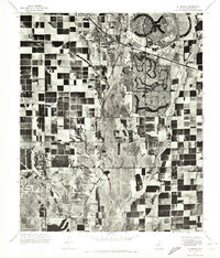
 1971 Phoenix1971 Print · USGSCentral Arizona at the start of the seventies shows a desert metropolis expanding toward the Sun Valley retirement boom. Trace the growth of Sun City and Glendale, or locate remote historic sites like the Vulture Gold Mine and Nottbusch Cemetery.
 - 1971 Map of El Mirage
 1971 El Mirage1971 Print · USGSMaricopa County underwent a dramatic transformation in the early seventies as planned retirement communities rose from the desert. Trace the early layouts of Sun City and Youngtown alongside the active flight lines of Luke Air Force Base.
 - 1971 Map of Perryville, 1972 Print
 1971 Perryville1972 Print · USGSAgricultural grids and desert irrigation define the Maricopa County landscape in the early seventies. Researchers can trace the layout of Perryville and Liberty or follow the natural course of the Gila River.
 - 1971 Map of Waddell, 1972 Print
 1971 Waddell1972 Print · USGSMaricopa County agriculture and military operations are captured in the early seventies, showing a landscape defined by desert irrigation. Trace the growth of Waddell and Citrus Park alongside the runways of Luke Air Force Base.
 - 1971 Map of Avondale SE, 1972 Print
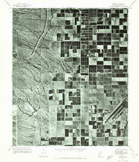
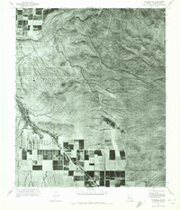
 1971 Avondale SE1972 Print · USGSMaricopa County during the early seventies reveals the raw desert landscape of the Gila River Valley. Researchers can trace the sharp ridgelines of the Sierra Estrella and the winding, braided course of the Gila River in this detailed aerial orthophoto.
 - 1971 Map of Tolleson, 1972 Print
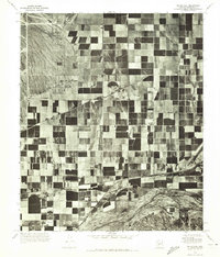
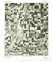 1971 Tolleson1972 Print · USGSMaricopa County's western valley is seen in a photographic transition during the early seventies, as desert agriculture met suburban expansion. Researchers can trace the layout of Tolleson and Avondale or follow the path of the Gila River.
 - 1971 Map of Montezuma Peak, 1972 Print
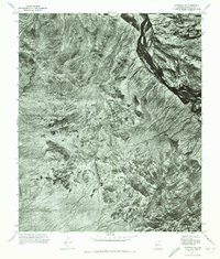
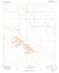
 1971 Montezuma Peak1972 Print · USGSThe desert landscape of Pinal and Maricopa counties is captured in the early 1970s through this detailed aerial survey. Researchers can trace the natural drainage patterns of the Santa Cruz Wash and the prominent heights of Montezuma Peak near the Gila River.
 - 1971 Map of Avondale SW, 1972 Print
 1971 Avondale SW1972 Print · USGSMaricopa County agriculture meets the desert at the start of the 1970s, where irrigated fields push against the rugged Sierra Estrella. Trace the desert drainages of Waterman Wash and Corgett Wash as they approach the Gila River.
 - 1971 Map of Enid, 1972 Print
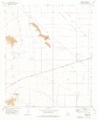
 1971 Enid1972 Print · USGSThe arid landscape near Enid is captured in the early seventies, showing the sharp line between desert drainage and irrigated fields. Genealogists and researchers can trace the rail corridor and the scattered structures of Palo Verde.
 - 1973 Map of Mobile, 1976 Print
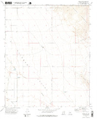
 1973 Mobile1976 Print · USGSThe arid Maricopa County desert in the early seventies reveals a landscape defined by historical transit and vital water points. Trace the legacy of the Butterfield Stage Route and locate early settlement features like the Mobile Cem and Mobile Well.2 unique versions available
 - 1973 Map of Mobile NE, 1976 Print
 1973 Mobile NE1976 Print · USGSMaricopa County's arid interior is captured here in the early 1970s, as the desert landscape meets the rising peaks of the Sierra Estrella. Genealogists and researchers can trace early water infrastructure and land use through labels like Big Bertha Tank, Waterman Wash, and the southern boundary of the Gila River Indian Reservation.2 unique versions available
 - 1973 Map of Mobile NW, 1977 Print
 1973 Mobile NW1977 Print · USGSThe Rainbow Valley region of Arizona is captured here in the early seventies as infrastructure began to cross the desert floor. Genealogists and researchers can trace local water rights and land use via Youngker Tank, the Landing Strip, and Waterman Wash.2 unique versions available
End of results
Showing maps 1-12 of 12
Top cities near Goodyear
- Phoenix historical maps
- Buckeye historical maps
- Avondale historical maps
- Maricopa historical maps
- Estrella historical maps
- Tolleson historical maps
See more
Top neighborhoods of Goodyear
- Litchfield historical maps
- Rainbow Valley historical maps
- Estrella historical maps
- Mobile historical maps
- Estrella Vista historical maps
- Las Ventanas historical maps
See more
Frequently asked questions
- What are the different types of historical maps available for Goodyear?
- What is the oldest map of Goodyear?
- Where can I purchase historical maps of Goodyear for my home or office?
- Where can I download high-res historical maps of Goodyear?
- Are there historical topographic maps available for Goodyear?
- Is there historical aerial imagery available for Goodyear?
- Where are historical maps of Goodyear sourced from?