2020s Maps of Goodyear, Arizona
Explore 11 historic maps of Goodyear from the 2020s. These maps offer a rare glimpse into what life looked like during the 2020s — showing old roads, neighborhoods, homes, and landmarks that have changed or disappeared over time.
Whether you're researching your family's past, planning a metal detecting trip, or studying how Goodyear's landscape evolved across the 2020s, these high-resolution maps are a powerful tool for exploring the history of this region.
- Focus on a specific era: All maps on this page are from the 2020s, giving you a focused view of this time period.
- See what’s changed: Compare century-old streets, trails, and buildings to today's modern landscape using overlays and satellite layers.
- Research with precision: Use these maps for genealogy, historical research, land use analysis, or educational projects.
- View, download, or print: Maps are fully viewable online in high resolution, and can be downloaded or printed for your own records.
Start exploring Goodyear's history through authentic maps from the 2020s. This is your window into the past.
Goodyear, AZ maps
(11)- 2021 Map of Mobile NE, 2021 Print
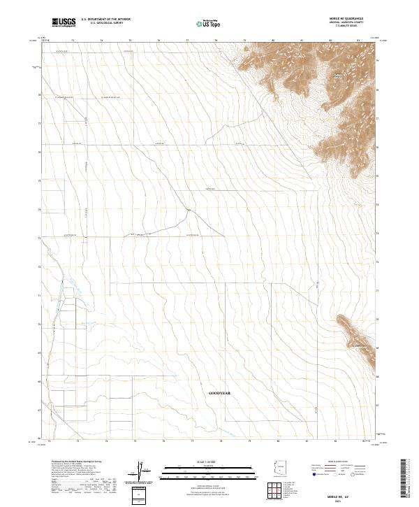 2021 Mobile NE2021 Print · USGSMaricopa County's southern desert expanse meets the rising mountain peaks in this 2021 study of the Gila River Valley area. Researchers can trace the drainage of Waterman Wash past local landmarks like Big Mac Tank and the high ridges of Sevenmile Mtn.
 - 2021 Map of Avondale SE, 2021 Print
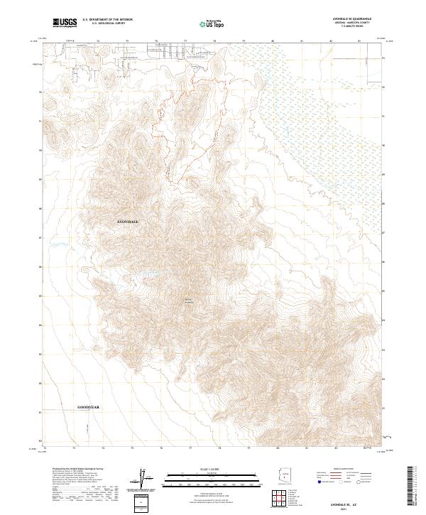 2021 Avondale SE2021 Print · USGSThe foothills of the Gila River Valley are captured here in 2021 as suburban expansion meets the desert. Researchers can trace the rugged topography of the Sierra Estrella and locate specific routes like Long Loop Trl and W Dragstrip Rd.
 - 2021 Map of Mobile NW, 2021 Print
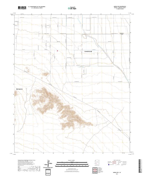 2021 Mobile NW2021 Print · USGSMaricopa County's southern valley transition is documented here in the early twenty-first century, where desert washes meet an expanding road grid. Trace the course of Waterman Wash past local landmarks like Youngker Tank and the settlement at Rainbow Valley.
 - 2021 Map of Avondale SW, 2021 Print
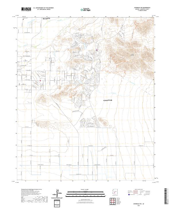 2021 Avondale SW2021 Print · USGSThe Gila River valley south of Buckeye and Goodyear reflects a landscape of desert peaks and modern growth in the early 2020s. Genealogists and researchers can locate the Liberty Cem and trace old routes like W Telegram Path near the Sierra Estrella range.
 - 2021 Map of Perryville, 2021 Print
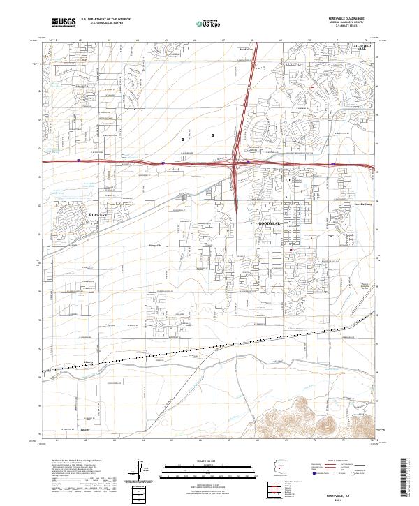 2021 Perryville2021 Print · USGSMaricopa County's western expansion is on full display in this modern survey of the desert landscape south of the White Tank Mountains. Genealogists and local researchers can trace the development of Goodyear and Buckeye alongside rural landmarks like Liberty and the Phoenix Goodyear Airport.
 - 2021 Map of Tolleson, 2021 Print
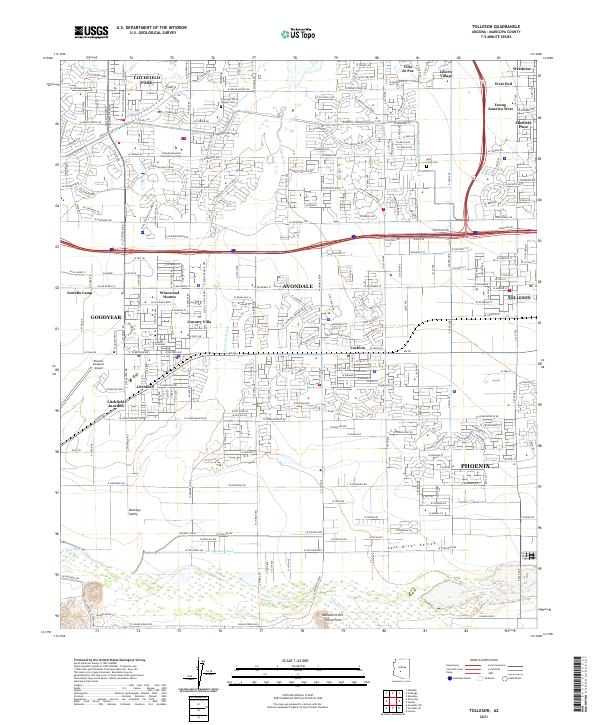 2021 Tolleson2021 Print · USGSThe West Valley at the start of the 2020s shows a complex landscape of rapid suburban growth and historic water infrastructure. Researchers can trace the original Initial Point near Monument Hill or locate early burial sites at Goodyear Farms Historic Cem.
 - 2021 Map of Enid, 2021 Print
 2021 Enid2021 Print · USGSPinal County's desert plains and foothills are captured here in the early twenty-first century, showing the intersection of mountain ranges and modern development. Researchers can locate small settlements like Enid and Heaton alongside private airfields including Hidden Valley Airport.
 - 2021 Map of Waddell, 2021 Print
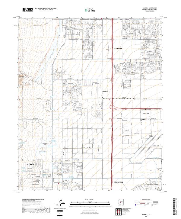 2021 Waddell2021 Print · USGSThe West Valley transitions from the rugged White Tank Mountains into the burgeoning residential grids of Surprise and Glendale in the early 2020s. Researchers can trace the desert drainage system through Waterfall Wash or locate the sprawling grounds of Luke Air Force Base.
 - 2021 Map of Montezuma Peak, 2021 Print
 2021 Montezuma Peak2021 Print · USGSThe Sierra Estrella mountains meet the agricultural plains of Pinal County in this modern survey. Researchers can trace the intersection of desert peaks and irrigation history through features like Montezuma Peak, Santa Cruz Ditch, and Goodyear.
 - 2021 Map of Mobile, 2021 Print
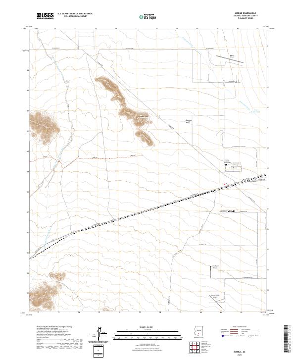 2021 Mobile2021 Print · USGSMaricopa County's southern desert reaches are documented here in the early 2020s, showing a landscape defined by isolated peaks and valley washes. Researchers can trace the layout of the Mobile settlement and locate rural landmarks like Galilee Baptist Church and the Mobile Airport.
 - 2021 Map of El Mirage, 2021 Print
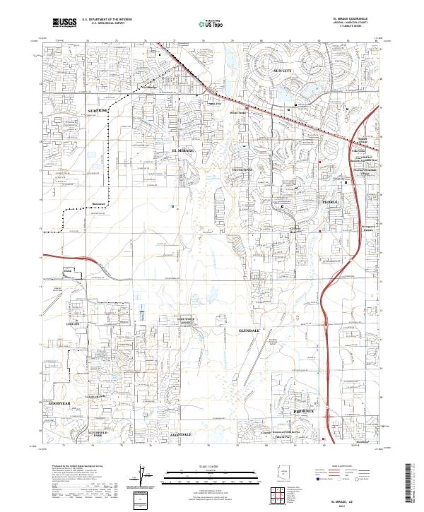 2021 El Mirage2021 Print · USGSThe West Valley of the Phoenix metro area is shown during a period of rapid development. Genealogists and local historians can trace legacy sites like Sunwest Cem or the industrial and residential shifts around Goldbadge and Bumstead.
End of results
Showing maps 1-11 of 11
Top cities near Goodyear
- Phoenix historical maps
- Buckeye historical maps
- Avondale historical maps
- Maricopa historical maps
- Estrella historical maps
- Tolleson historical maps
See more
Top neighborhoods of Goodyear
- Litchfield historical maps
- Rainbow Valley historical maps
- Estrella historical maps
- Mobile historical maps
- Estrella Vista historical maps
- Las Ventanas historical maps
See more
Frequently asked questions
- What are the different types of historical maps available for Goodyear?
- What is the oldest map of Goodyear?
- Where can I purchase historical maps of Goodyear for my home or office?
- Where can I download high-res historical maps of Goodyear?
- Are there historical topographic maps available for Goodyear?
- Is there historical aerial imagery available for Goodyear?
- Where are historical maps of Goodyear sourced from?