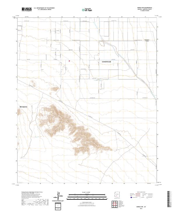
2021 Map of Mobile NW
USGS Topo · Published 2021About this map
Waterman Wash carves a winding path through this corner of the Sonoran desert, defining the drainage patterns south of Goodyear and Buckeye. The landscape reflects a transition from the structured agricultural grid and rural residential development of Rainbow Valley in the north to the increasingly mountainous terrain that dominates the southern half of the quadrangle. Significant water management for local ranching or wildlife is evident through features like Youngker Tank and Plug Tank. This modern survey illustrates the expansive road network that has been laid out across the valley floor, including major thoroughfares like W Hunt Hwy and Baseline Rd, which contrast sharply with the natural contours of the rising peaks to the south. The intersection of desert hydrology and modern expansion is clearly visible where Waterman Wash intersects the local road grid.
Find a feature on this map
45 named features on this map. Tap any name to fly to it.
Don’t see what you’re looking for? This feature index may not catch every label — zoom into the map to look around manually.
Map Details
Editions of this 2021 Mobile NW Map
This is the sole edition of this map. No revisions or reprints were ever made.
Other maps of this area

1946 · Avondale
USGS Topo · 1:62,500

1948 · Cashion
USGS Topo · 1:62,500

1951 · Mobile
USGS Topo · 1:62,500

1951 · Cotton Center
USGS Topo · 1:62,500

1954 · Phoenix
USGS Topo · 1:250,000

1957 · Phoenix
USGS Topo · 1:250,000

1957 · Avondale SW
USGS Topo · 1:24,000
1957 · Avondale SE
USGS Topo · 1:24,000

1958 · Phoenix
USGS Topo · 1:250,000

1958 · Buckeye
USGS Topo · 1:24,000