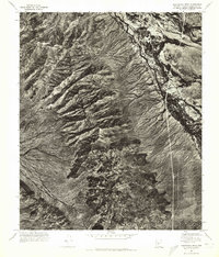
1971 Map of Montezuma Peak
USGS Topo · Published 1972About this map
Montezuma Peak dominates the high ground of the Sierra Estrella in this 1971 orthophotomosaic, providing a stark visual record of the desert landscape south of Phoenix before modern suburban expansion reached this specific corridor. The aerial photography captures the sharp transition from the complex ridgelines of the peak down to the braided channel of the Gila River. In the northeastern corner of the sheet, the Santa Cruz Wash joins the river system, carving through a landscape that shows emerging patterns of land use and early infrastructure alongside these ancient watercourses. This study of Pinal and Maricopa counties is particularly valuable for its unvarnished view of the natural terrain and the distinct alluvial fans spreading from the mountain base.
Find a feature on this map
3 named features on this map. Tap any name to fly to it.
Don’t see what you’re looking for? This feature index may not catch every label — zoom into the map to look around manually.
Map Details
Editions of this 1971 Montezuma Peak Map
This is the sole edition of this map. No revisions or reprints were ever made.
Other maps of this area

1912 · Phoenix
USGS Topo · 1:62,500

1913 · Maricopa
USGS Topo · 1:62,500

1914 · Phoenix
USGS Topo · 1:62,500

1915 · Maricopa
USGS Topo · 1:62,500

1946 · Avondale
USGS Topo · 1:62,500

1948 · Cashion
USGS Topo · 1:62,500

1951 · Mobile
USGS Topo · 1:62,500

1952 · Maricopa
USGS Topo · 1:24,000

1952 · Lone Butte
USGS Topo · 1:24,000

1952 · Laveen
USGS Topo · 1:24,000