1970s Maps of Silva Mountain, Phoenix
Explore 3 historic maps of Silva Mountain from the 1970s. These maps offer a rare glimpse into what life looked like during the 1970s — showing old roads, neighborhoods, homes, and landmarks that have changed or disappeared over time.
Whether you're researching your family's past, planning a metal detecting trip, or studying how Silva Mountain's landscape evolved across the 1970s, these high-resolution maps are a powerful tool for exploring the history of this region.
- Focus on a specific era: All maps on this page are from the 1970s, giving you a focused view of this time period.
- See what’s changed: Compare century-old streets, trails, and buildings to today's modern landscape using overlays and satellite layers.
- Research with precision: Use these maps for genealogy, historical research, land use analysis, or educational projects.
- View, download, or print: Maps are fully viewable online in high resolution, and can be downloaded or printed for your own records.
Start exploring Silva Mountain's history through authentic maps from the 1970s. This is your window into the past.
Silva Mountain, Phoenix maps
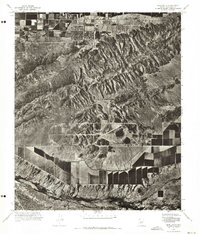
(3)- 1971 Map of Phoenix
 1971 Phoenix1971 Print · USGSCentral Arizona at the start of the seventies shows a desert metropolis expanding toward the Sun Valley retirement boom. Trace the growth of Sun City and Glendale, or locate remote historic sites like the Vulture Gold Mine and Nottbusch Cemetery.
 - 1971 Map of Lone Butte, 1972 Print
 1971 Lone Butte1972 Print · USGSMaricopa County's southern desert reaches are captured in the early 1970s, showcasing the intersection of natural peaks and industrial testing. Trace the development of the Phoenix Proving Grounds and the rugged terrain of South Mountain.
 - 1971 Map of Phoenix, 1972 Print
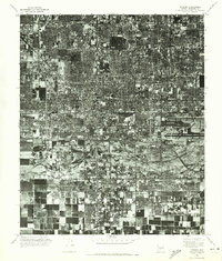 1971 Phoenix1972 Print · USGSCentral Arizona's urban heart is captured in the early seventies, showing the rapid transformation of the desert landscape. Genealogists and historians can trace the evolution of Phoenix and South Phoenix along the banks of the Salt River.
End of results
Showing maps 1-3 of 3
Frequently asked questions
- What are the different types of historical maps available for Silva Mountain?
- What is the oldest map of Silva Mountain?
- Where can I purchase historical maps of Silva Mountain for my home or office?
- Where can I download high-res historical maps of Silva Mountain?
- Are there historical topographic maps available for Silva Mountain?
- Is there historical aerial imagery available for Silva Mountain?
- Where are historical maps of Silva Mountain sourced from?