2020s Maps of Chukut Kuk District, Arizona
Explore 18 historic maps of Chukut Kuk District from the 2020s. These maps offer a rare glimpse into what life looked like during the 2020s — showing old roads, neighborhoods, homes, and landmarks that have changed or disappeared over time.
Whether you're researching your family's past, planning a metal detecting trip, or studying how Chukut Kuk District's landscape evolved across the 2020s, these high-resolution maps are a powerful tool for exploring the history of this region.
- Focus on a specific era: All maps on this page are from the 2020s, giving you a focused view of this time period.
- See what’s changed: Compare century-old streets, trails, and buildings to today's modern landscape using overlays and satellite layers.
- Research with precision: Use these maps for genealogy, historical research, land use analysis, or educational projects.
- View, download, or print: Maps are fully viewable online in high resolution, and can be downloaded or printed for your own records.
Start exploring Chukut Kuk District's history through authentic maps from the 2020s. This is your window into the past.
Chukut Kuk District, AZ maps
(18)- 2021 Map of South Komelik, 2021 Print
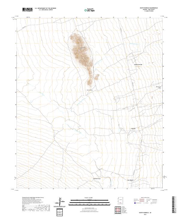 2021 South Komelik2021 Print · USGSSouthern Arizona desert life is documented here in the early twenty-first century, showing the enduring structure of rural Pima County. Genealogists and historians can trace the roads connecting South Komelik, Choulic, and San Miguel near the base of Las Animas Mtn.
 - 2021 Map of Caponera Peak, 2021 Print
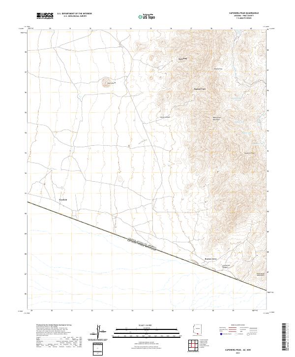 2021 Caponera Peak2021 Print · USGSThe Arizona-Mexico borderland comes alive in this 2021 study of Pima County's remote desert and mountain terrain. Researchers can trace the international boundary line and locate isolated outposts like Sapano Vaya, Newfield, and the peaks of the Baboquivari Mountains.
 - 2021 Map of La Lesna Mountains, 2021 Print
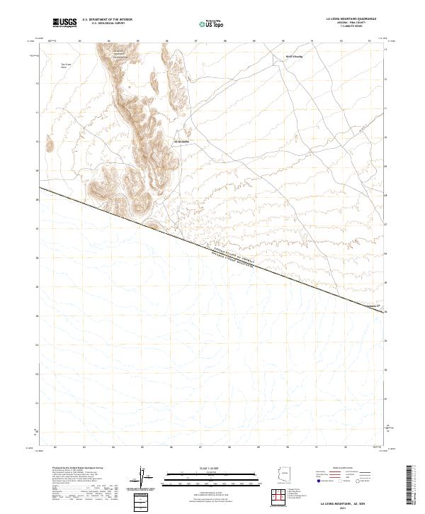 2021 La Lesna Mountains2021 Print · USGSThe Arizona-Mexico borderlands come into focus in this contemporary survey of the Tohono O'odham Nation. Local historians and researchers can trace the roads connecting Ak Komelik, Sivili Chuchg, and Tatum Vo beneath the shadows of La Lesna Peak.
 - 2021 Map of Papago Farms, 2021 Print
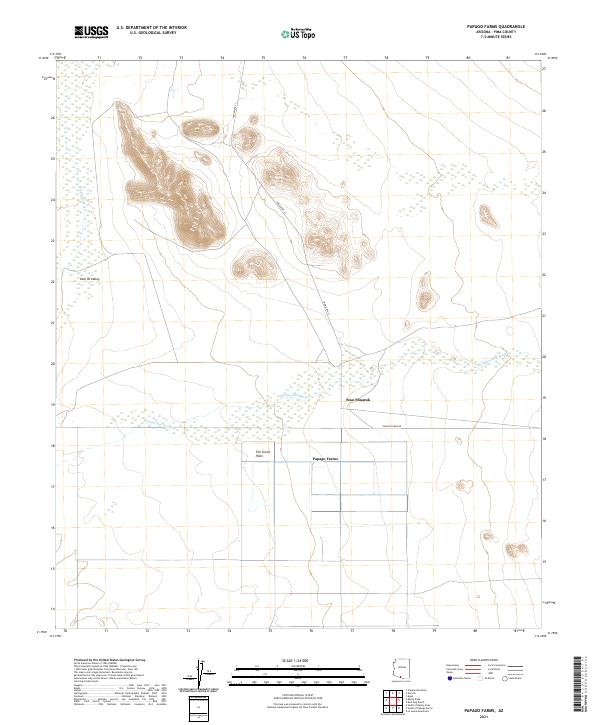 2021 Papago Farms2021 Print · USGSArizona's borderlands are captured here in the early twenty-first century, showing the intersection of desert agriculture and traditional desert terrain. Researchers can trace the layout of Papago Farms and follow the paths of Chukut Kuk Wash and Indian Rte 21.
 - 2021 Map of San Miguel, 2021 Print
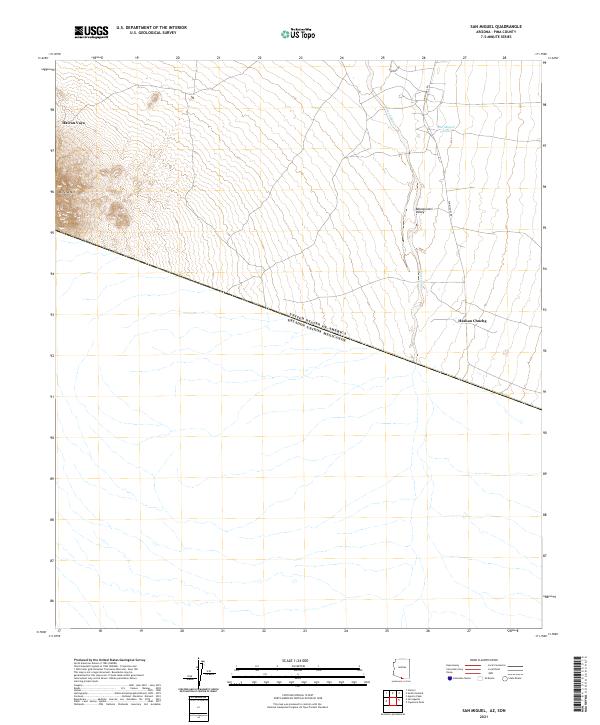 2021 San Miguel2021 Print · USGSThe Arizona borderlands meet the Mexican frontier in this modern survey of the remote Sonoran landscape. Researchers can trace rural roads like Noriego Rd and locate indigenous settlements such as Haivan Vaya and Hashan Chuchg.
 - 2021 Map of Chukut Kuk, 2021 Print
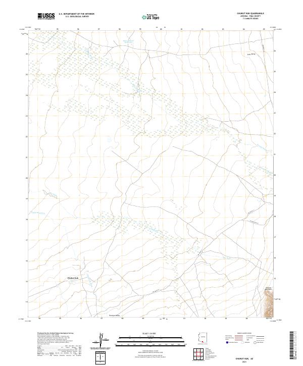 2021 Chukut Kuk2021 Print · USGSSettlement patterns in the Pima County desert are centered around Chukut Kuk in the early 2020s. Researchers can trace seasonal water flow through Big Wash and the rise of the Alvarez Mountains near Indian Rte 20.
 - 2021 Map of South of Bailey Peak, 2021 Print
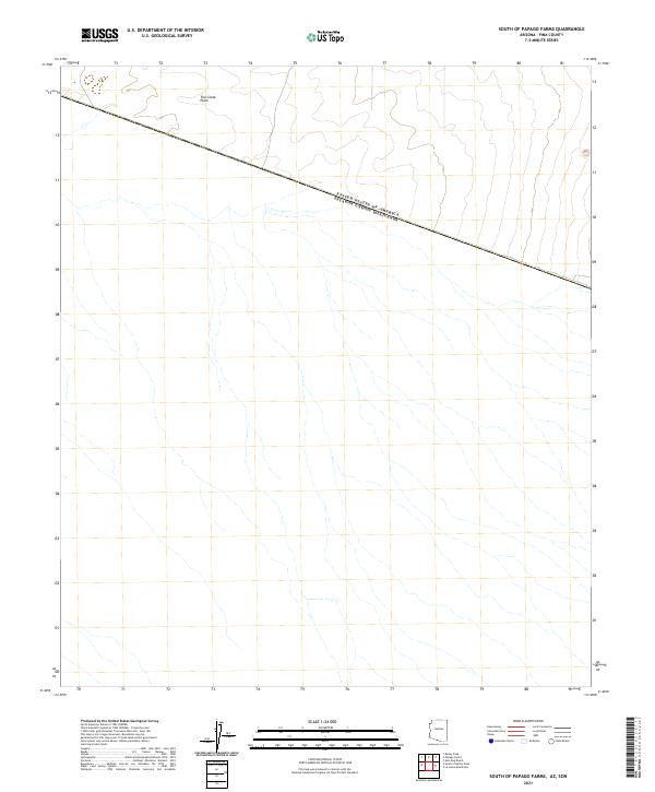
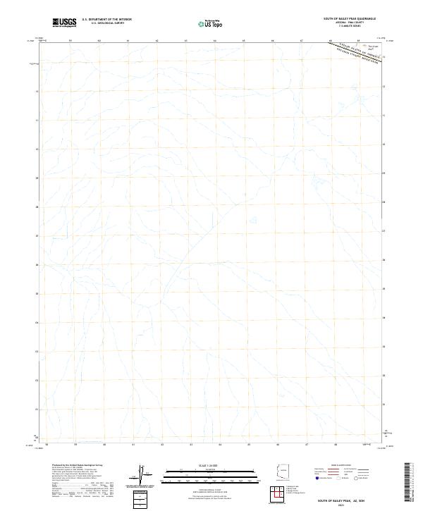 2021 South of Bailey Peak2021 Print · USGSThe international boundary in southern Pima County is captured here during the 2020s, showing the intersection of political borders and desert geography. Historians can trace the line between United States of America and Mexico as it crosses the expanse of The Great Plain.
 - 2021 Map of Kom Vo, 2021 Print
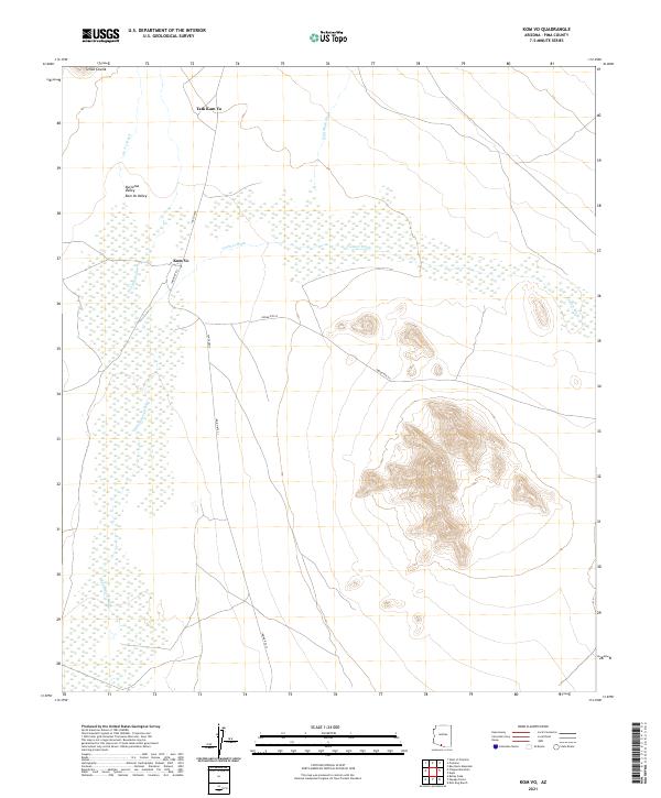 2021 Kom Vo2021 Print · USGSPima County's desert floor is captured here in the early twenty-first century, showing the enduring settlement patterns of the Tohono O'odham Nation. Researchers can trace the layout of Kom Vo and Schuk Cowlik along the banks of the Vamori Wash and San Simon Wash.
 - 2021 Map of Cowlic, 2021 Print
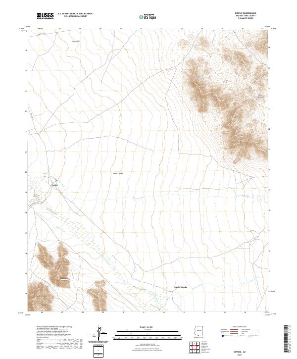 2021 Cowlic2021 Print · USGSHigh desert valleys and mountain ranges define this Pima County landscape in 2021. Researchers can trace the routes of Indian Rte 20 and locate settlements like Cowlic and Vopolo Havoka among the desert washes.
 - 2021 Map of Vamori, 2021 Print
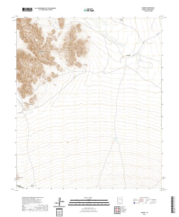 2021 Vamori2021 Print · USGSThe southern Arizona desert near the international border comes into focus in this recent survey. Researchers can trace the paths of Indian Rte 2 to Vamori or locate landmarks like Alvarez Mountains and Vamur Tank.
 - 2021 Map of Bailey Peak, 2021 Print
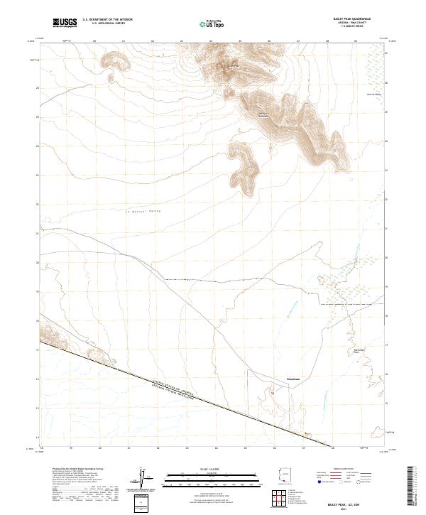 2021 Bailey Peak2021 Print · USGSThe Arizona borderlands at the start of the 2020s are captured here, showing the remote desert terrain where the U.S. meets Mexico. Researchers can trace the drainage of the Chukut Kuk Wash near Shaotkam or study the topography of Bailey Peak and the Mesquite Mountains.
 - 2021 Map of South of Papago Farms, 2021 Print
 2021 South of Papago Farms2021 Print · USGSThe international boundary between Arizona and Mexico bisects this desert region during the early 2020s. Researchers can trace the border line across The Great Plain and locate the junction of T19S R1W and T20S R1E.
 - 2021 Map of Kupk, 2021 Print
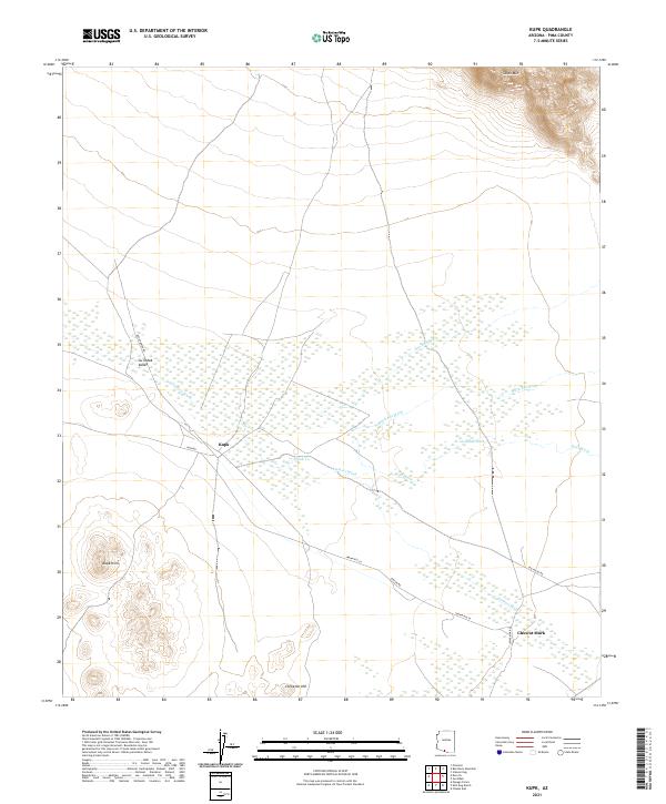 2021 Kupk2021 Print · USGSPima County's desert floor is captured in this recent survey, showing the relationship between seasonal watercourses and local settlements. Genealogists and desert historians can locate rural clusters like Kupk and Chuwut Murk along routes such as Indian Rte 24.
 - 2021 Map of Aguirre Peak, 2021 Print
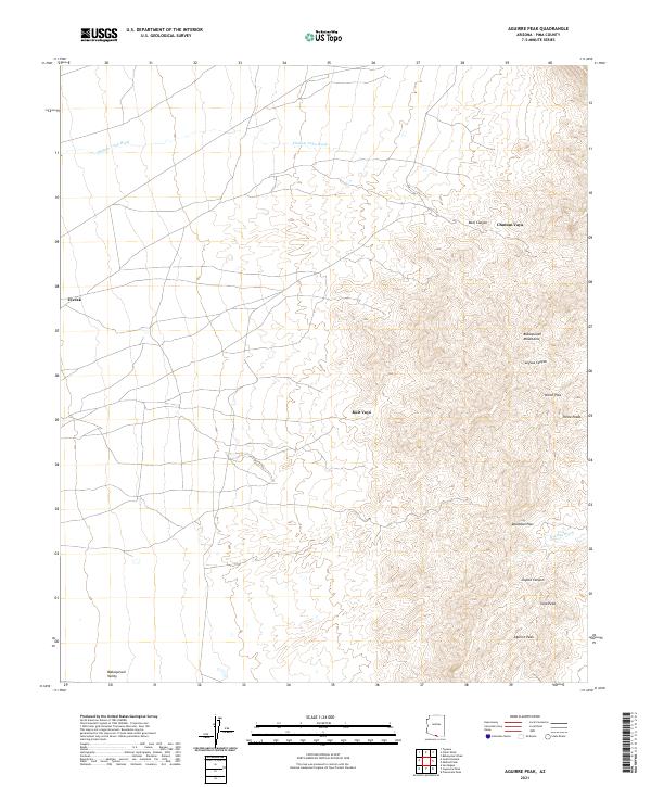 2021 Aguirre Peak2021 Print · USGSThe high desert of Pima County comes into focus in this recent survey, showcasing the sharp peaks and deep drainages of the southern Arizona landscape. Genealogists and desert historians can trace remote settlements like Utevak and Chutum Vaya or locate landmarks such as Deadman Pass.
 - 2021 Map of Kots Kug Ranch, 2021 Print
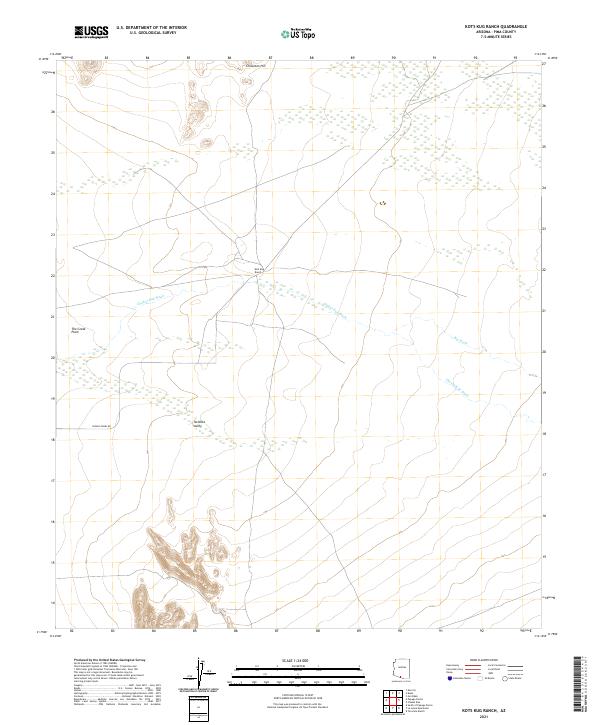 2021 Kots Kug Ranch2021 Print · USGSSouthern Arizona ranching territory and desert basins are detailed in this recent survey. Local researchers can trace the drainages of Chukut Kuk Wash and Big Wash as they meet near Kots Kug Ranch and the southern Tecolote Valley.
 - 2021 Map of Presumido Peak, 2021 Print
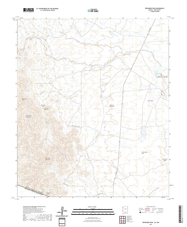 2021 Presumido Peak2021 Print · USGSThe Arizona borderlands south of Tucson appear in sharp detail during the early 2020s, showing the dramatic rise of the Baboquivari Mountains. Trace the high-desert drainages of Gallineta Wash or locate local landmarks like Aguirre Lake and Presumido Peak.
 - 2021 Map of San Agustin, 2021 Print
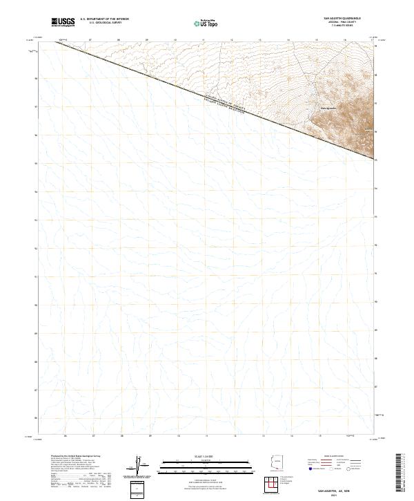 2021 San Agustin2021 Print · USGSPima County at the international border is captured here in a contemporary survey of the Arizona desert. Trace the remote settlement at San Agustin and high points like Horse Peak and Morena Mtn near the boundary with Estados Unidos Mexicanos.
 - 2021 Map of Tecolote Ranch, 2021 Print
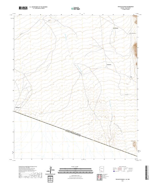 2021 Tecolote Ranch2021 Print · USGSThe Arizona-Mexico border landscape comes into focus in this recent survey of rural Pima County. Researchers can trace the layout of small settlements like Vakamok, Itak, and Tatum Vo alongside the long reach of the Chukut Kuk Wash.
End of results
Showing maps 1-18 of 18
Top cities near Chukut Kuk District
Top neighborhoods of Chukut Kuk District
- San Rafael historical maps
- San Miguel historical maps
- Sivili Chuchg historical maps
- Haivan Vaya historical maps
- Tatkum Vo historical maps
- San Agustin historical maps
See more
Frequently asked questions
- What are the different types of historical maps available for Chukut Kuk District?
- What is the oldest map of Chukut Kuk District?
- Where can I purchase historical maps of Chukut Kuk District for my home or office?
- Where can I download high-res historical maps of Chukut Kuk District?
- Are there historical topographic maps available for Chukut Kuk District?
- Is there historical aerial imagery available for Chukut Kuk District?
- Where are historical maps of Chukut Kuk District sourced from?