1980s Maps of Chukut Kuk District, Arizona
Explore 10 historic maps of Chukut Kuk District from the 1980s. These maps offer a rare glimpse into what life looked like during the 1980s — showing old roads, neighborhoods, homes, and landmarks that have changed or disappeared over time.
Whether you're researching your family's past, planning a metal detecting trip, or studying how Chukut Kuk District's landscape evolved across the 1980s, these high-resolution maps are a powerful tool for exploring the history of this region.
- Focus on a specific era: All maps on this page are from the 1980s, giving you a focused view of this time period.
- See what’s changed: Compare century-old streets, trails, and buildings to today's modern landscape using overlays and satellite layers.
- Research with precision: Use these maps for genealogy, historical research, land use analysis, or educational projects.
- View, download, or print: Maps are fully viewable online in high resolution, and can be downloaded or printed for your own records.
Start exploring Chukut Kuk District's history through authentic maps from the 1980s. This is your window into the past.
Chukut Kuk District, AZ maps
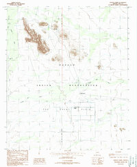
(10)- 1988 Map of Chukut Kuk
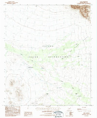
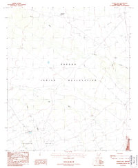 1988 Chukut Kuk1988 Print · USGSThe Papago Indian Reservation comes into focus during the late eighties, showing a landscape defined by water management and desert ranching. Genealogists and historians can locate remote outposts like Chukut Kuk, Vamori, and Tecolote Ranch.
 - 1988 Map of Kom Vo
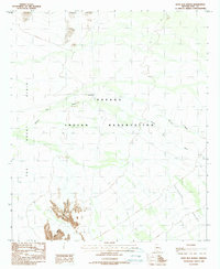
 1988 Kom Vo1988 Print · USGSIn the Pima County desert during the 1980s, this area of the Papago Indian Reservation highlights traditional land use and water management. Researchers can locate remote settlements like Kom Vo and Tatk Kam Vo alongside desert Check Dams.
 - 1988 Map of South of Bailey Peak
 1988 South of Bailey Peak1988 Print · USGSThe Arizona-Sonora borderlands come into focus in the late 1980s, documenting the rugged mountains and cross-border settlements of Pima County. Genealogists and researchers can trace the reach of the Papago Indian Reservation and locate local landmarks like Rancho Lilón and Sonoita.
 - 1988 Map of Tecolote Ranch
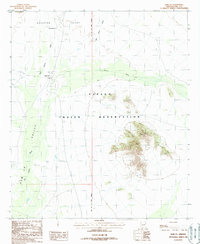
 1988 Tecolote Ranch1988 Print · USGSThe Arizona borderlands within the Papago Indian Reservation appear in high detail during the late eighties. Researchers can locate former settlements like San Rafael (Site) and trace water features like Chukut Kuk Wash.
 - 1988 Map of Kupk
 1988 Kupk1988 Print · USGSThe Papago Indian Reservation in the late eighties reveals a desert landscape of traditional settlements and mission outposts. Researchers can trace the layout of Kupk, find the Chicli Vo (Site), and locate missions such as St Francis Mission.
 - 1988 Map of Kots Kug Ranch
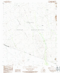
 1988 Kots Kug Ranch1988 Print · USGSThe Papago Indian Reservation in the late 1980s reveals a ranching landscape shaped by desert hydrology and remote topography. Researchers can trace land use through features like the Kots Kug Ranch, a local Cem, and infrastructure such as a Corral and Check Dams.
 - 1988 Map of South of Papago Farms
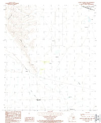
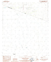 1988 South of Papago Farms1988 Print · USGSThe Arizona-Sonora borderlands come into focus in the late 1980s, documenting the crossing point of the Pima County line and the international boundary. Genealogists and historians can trace small settlements and landmarks like El Panama, Panamá, and Sonoita.
 - 1988 Map of Bailey Peak
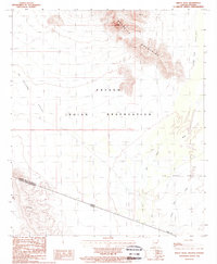 1988 Bailey Peak1988 Print · USGSThe Arizona-Sonora borderlands come into focus in the late 1980s, centered on the Papago Indian Reservation. Trace the high desert terrain from Bailey Peak across The Great Plain to the international boundary at El Conejo.
 - 1988 Map of Papago Farms
 1988 Papago Farms1988 Print · USGSArizona's desert borderlands come into focus in the late 1980s, documenting a remote intersection of tribal land and agricultural development. Researchers can trace the layout of Papago Farms, find the cemetery at Stan Shuatuk, and locate the Landing Strip on The Great Plain.
 - 1988 Map of La Lesna Mountains
 1988 La Lesna Mountains1988 Print · USGSThe Arizona-Sonora borderlands come into focus in the late eighties, documenting the remote reaches of the Papago Indian Reservation. Researchers can trace the desert trails connecting Ak Komelik, Sivili Chuchg, and the foothills of La Lesna Peak.
End of results
Showing maps 1-10 of 10
Top cities near Chukut Kuk District
Top neighborhoods of Chukut Kuk District
- San Rafael historical maps
- San Miguel historical maps
- Sivili Chuchg historical maps
- Haivan Vaya historical maps
- Tatkum Vo historical maps
- San Agustin historical maps
See more
Frequently asked questions
- What are the different types of historical maps available for Chukut Kuk District?
- What is the oldest map of Chukut Kuk District?
- Where can I purchase historical maps of Chukut Kuk District for my home or office?
- Where can I download high-res historical maps of Chukut Kuk District?
- Are there historical topographic maps available for Chukut Kuk District?
- Is there historical aerial imagery available for Chukut Kuk District?
- Where are historical maps of Chukut Kuk District sourced from?