Old Maps of Chukut Kuk District, Arizona for Metal Detecting
Plan your next treasure hunt with 123 historic maps of Chukut Kuk District. Find old homesites, ghost towns, trails, and gathering spots that may be lost to time — perfect for identifying promising metal detecting locations.
- Locate forgotten sites: Uncover places like long-lost settlements, abandoned rail lines, or gathering spots.
- Plan better hunts: Use map overlays combined with LiDAR or satellite views to narrow in on historically rich areas.
- Made for detectorists: Thousands of hobbyists use these maps to discover relics, coins, and hidden history.
Use these historic maps to boost your research and find new opportunities beneath the surface of Chukut Kuk District.
Chukut Kuk District, AZ maps
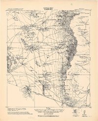
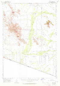
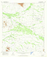
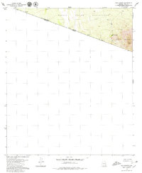
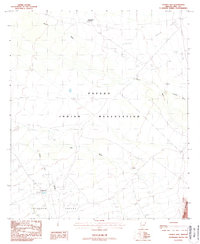
(123)- 1941 Map of Presumido Peak
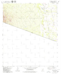
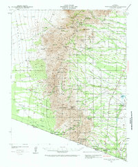 1941 Presumido Peak1941 Print · USGSThe Arizona borderlands in the early 1940s are defined here by cattle ranching and tribal lands along the international line. Researchers can trace historic properties like Rancho de la Osa and Buenos Aires Ranch or locate the Site of Old Indian Fort near Sasabe.2 unique versions available
 - 1941 Map of Vamori, 1958 Print
 1941 Vamori1958 Print · USGSTraditional O'odham life in the early 1940s is mapped here across the desert expanses of the Papago Indian Reservation. Genealogists and historians can locate remote settlements and family landmarks including San Miguel, Ak Chut Vaya, and San Agustin Ranch.3 unique versions available
 - 1941 Map of Sells, 1969 Print
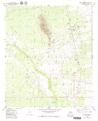
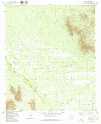
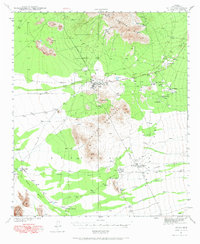 1941 Sells1969 Print · USGSThe Papago Indian Reservation in the early 1940s reveals a desert landscape of ancestral villages and active mining. Trace family roots and desert trails through Sells, Topawa, and the historic San Solano Mission.
 - 1943 Map of Sells
 1943 Sells1943 Print · USGSThe Papago Indian Reservation in the early 1940s reveals a desert landscape of traditional settlements and active mining. Genealogists and historians can trace family roots through the San Solano Mission, Topawa P O, and villages like Artesa or Ali Chuk Son.4 unique versions available
 - 1943 Map of Fresnal
 1943 Fresnal1943 Print · USGSSouthern Arizona’s borderlands and tribal territories are captured here in the 1940s, shortly after the height of early mining efforts. Researchers can trace ancestral connections in villages like Indian Oasis or locate vanished industrial sites like the Golden Age Mine & Mill.
 - 1943 Map of Presumido Peak
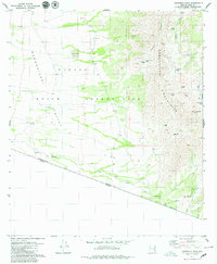
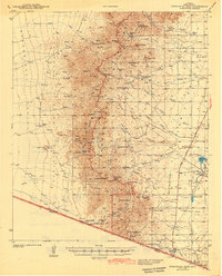 1943 Presumido Peak1943 Print · USGSSouthern Arizona’s borderlands are mapped here in the early 1940s, showing the high ranching country and tribal lands of Pima County. Researchers can trace historic family holdings like Rancho de la Osa and Santa Margarita Ranch or locate the Site of Old Indian Fort.2 unique versions available
 - 1943 Map of Vamori
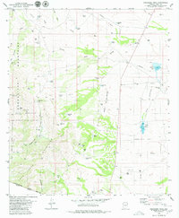
 1943 Vamori1943 Print · USGSThe Papago Indian Reservation and the international border define this high-desert region during the early 1940s. Genealogists and historians can trace indigenous settlements and ranching outposts like Vamori, San Miguel, and the San Agustin Ranch.2 unique versions available
 - 1954 Map of Sonoyta
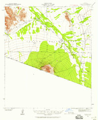
 1954 Sonoyta1954 Print · USGSThe Arizona-Sonora borderlands come into focus in the 1950s, showing a landscape of volcanic craters and remote desert outposts. Trace the cattle-ranching and Indigenous history of the region through sites like Cervantls Well and Ali Ak Chin.
 - 1956 Map of Nogales, 1963 Print
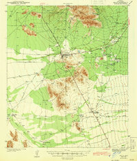
 1956 Nogales1963 Print · USGSSouthern Arizona in the mid-fifties is captured here from the Papago tribal lands to the San Pedro valley. Genealogists and historians can trace border settlements like Sasabe, the legacy of Tombstone, and old mining sites including the Mary G Mine.4 unique versions available
 - 1958 Map of Nogales
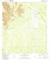
 1958 Nogales1958 Print · USGSSouthern Arizona in the late fifties was a landscape of international borders and high-desert outposts, dominated by the Huachuca Mountains and the Papago Indian Reservation. Local historians can trace old mining camps like Ruby and Greaterville or locate historic military grounds at the Fort Huachuca Military Reservation.
 - 1959 Map of Nogales
 1959 Nogales1959 Print · USGSThe Southern Arizona borderlands appear in the late fifties as a complex landscape of military ranges, tribal lands, and high-desert mining towns. Local historians can trace the Southern Pacific rail lines connecting Tombstone and Benson or locate family ranches such as Canoa Ranch.
 - 1963 Map of Kom Vo, 1964 Print
 1963 Kom Vo1964 Print · USGSThe southern border of the Papago Indian Reservation is captured in the early 1960s, showing a land shaped by isolated wells and ancient paths. Genealogists and historians can trace the residents of Kom Vo and Vamori, or locate specific sites like Petroglyphs and Papago Farms.2 unique versions available
 - 1963 Map of Gu Oidak, 1964 Print
 1963 Gu Oidak1964 Print · USGSThe Papago Indian Reservation comes into focus during the early sixties, showing a landscape of traditional settlements and desert missions. Researchers can trace the layout of Gu Oidak, locate the St Francis Mission near Vamori, or find the Petroglyphs in the southern hills.2 unique versions available
 - 1963 Map of La Lesna Mts., 1964 Print
 1963 La Lesna Mts.1964 Print · USGSThe Sonoran Desert borderlands are captured here in the early sixties, showing the remote ranching and indigenous life within the Papago Indian Reservation. Researchers can locate historic cattle stations like Toros Ranch and unique sites such as the San Rafael Ruins and Sivili Chuchg.2 unique versions available
 - 1963 Map of Lukeville, 1964 Print
 1963 Lukeville1964 Print · USGSThe Arizona-Mexico borderlands come into focus in this early 1960s survey, detailing the desert infrastructure of the Papago Indian Reservation. Researchers can locate remote sites like the Milton Mine, San Rafael Ruins, and the border crossing at Lukeville.2 unique versions available
 - 1979 Map of San Miguel
 1979 San Miguel1979 Print · USGSThe Papago Indian Reservation and the Baboquivari Valley meet the international border in the late seventies. Researchers can trace remote desert settlements and essential water infrastructure at San Miguel, Hashan Chuehg, and the Queen of Angels Mission.2 unique versions available
 - 1979 Map of Caponera Peak
 1979 Caponera Peak1979 Print · USGSIn the late seventies, this section of the Arizona-Mexico border reveals a network of indigenous sites and high-desert landmarks. Researchers can trace the Los Encinos Trail, locate the Buenos Aires Ruins, and find isolated village sites like Nachi Kulik.3 unique versions available
 - 1979 Map of South Komelik
 1979 South Komelik1979 Print · USGSThe Papago Indian Reservation is captured in the late seventies, showing a landscape of desert washes and isolated peaks. Trace ancestral roots and desert life near South Komelik, Choulic, and the cemeteries at Supi Oidak.
 - 1979 Map of Aguirre Peak
 1979 Aguirre Peak1979 Print · USGSThe Papago Indian Reservation in the late seventies reveals a landscape of desert washes and high peaks. Genealogists and local historians can locate early settlement sites like Kuit Vaya (Site) and family-named landmarks such as Charlo Juan Well.3 unique versions available
 - 1979 Map of San Agustin
 1979 San Agustin1979 Print · USGSThe Arizona-Sonora borderlands come into focus in the late seventies, showing the remote desert reaches of the Papago Indian Reservation. Researchers can trace old routes like the Jeep Trail leading toward Morena Mountain and the San Agustin well.
 - 1979 Map of Cowlic, 1980 Print
 1979 Cowlic1980 Print · USGSThe Papago Indian Reservation in the late seventies reveals a landscape of desert ranching and traditional Tohono O'odham settlements. Researchers can trace the layout of Cowlic, find the Cem, and locate the historic Vopolo Havoka (Site) near the Alvarez Mts.2 unique versions available
 - 1979 Map of Presumido Peak, 1980 Print
 1979 Presumido Peak1980 Print · USGSThe high-desert borderlands of Pima County are shown here in the late 1970s, as ranching culture remained the primary influence on the landscape. Genealogists and historians can trace family-named outposts and water features like Buenos Aires Ranch, Aros Ranch, and McGrail Tank.2 unique versions available
 - 1979 Map of Vamori, 1980 Print
 1979 Vamori1980 Print · USGSThe high desert of the Pima borderlands is captured here in the late seventies, showing the traditional settlements of the Tohono O'odham people. Researchers can trace the layout of Vamori and Itak, and find landmarks like Ram Boo Ranch and Wamul Tank.
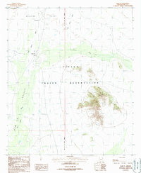
 - 1988 Map of Chukut Kuk
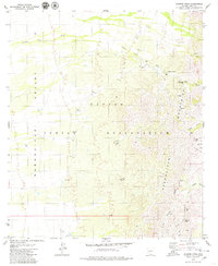
 1988 Chukut Kuk1988 Print · USGSThe Papago Indian Reservation comes into focus during the late eighties, showing a landscape defined by water management and desert ranching. Genealogists and historians can locate remote outposts like Chukut Kuk, Vamori, and Tecolote Ranch.
 - 1988 Map of Kom Vo
 1988 Kom Vo1988 Print · USGSIn the Pima County desert during the 1980s, this area of the Papago Indian Reservation highlights traditional land use and water management. Researchers can locate remote settlements like Kom Vo and Tatk Kam Vo alongside desert Check Dams.
Showing maps 1-25 of 123
Top cities near Chukut Kuk District
Top neighborhoods of Chukut Kuk District
- San Rafael historical maps
- San Miguel historical maps
- Sivili Chuchg historical maps
- Haivan Vaya historical maps
- Tatkum Vo historical maps
- San Agustin historical maps
See more
Frequently asked questions
- What are the different types of historical maps available for Chukut Kuk District?
- What is the oldest map of Chukut Kuk District?
- Where can I purchase historical maps of Chukut Kuk District for my home or office?
- Where can I download high-res historical maps of Chukut Kuk District?
- Are there historical topographic maps available for Chukut Kuk District?
- Is there historical aerial imagery available for Chukut Kuk District?
- Where are historical maps of Chukut Kuk District sourced from?