Old Maps of Hickiwan, Arizona for Academic Research
Study the evolution of Hickiwan with 150 high-resolution historic maps. Whether you're teaching, researching, or modeling changes in land use, these maps provide essential visual documentation of urban, environmental, and geographic change.
- Analyze long-term change: Track patterns in development, transportation, and natural features.
- Ideal for environmental or urban studies: Support academic projects with primary historical map data.
- Use in the classroom or lab: Educators and researchers rely on these maps to bring historical context to life.
These maps are a powerful tool for teaching, research, and visualizing how Hickiwan has changed over the decades.
Hickiwan, AZ maps
(150)- 1932 Map of Ajo, 1958 Print
 1932 Ajo1958 Print · USGSThe copper-rich Arizona desert comes alive in the early 1930s, centered on the massive pit and surrounding worker communities. Trace the rail lines of the Tucson Cornelia and Gila Bend RR or locate the historic Indian Cem and New Cornelia Mines.
 - 1934 Map of Ajo
 1934 Ajo1934 Print · USGSArizona's copper mining heartland comes into focus in the 1930s as industrial development expands across the desert. Genealogists and historians can trace local life at Mexican Town, locate the Indian Cem, or follow the Old Sonoita Road past remote sites like Bates Well.2 unique versions available
 - 1941 Map of Vekol Mountains
 1941 Vekol Mountains1941 Print · USGSMining activity and tribal settlements characterize this desert region in the late 1930s. Genealogists and historians can trace indigenous communities at Sif Vaya and Kohatk alongside early mineral prospects like the Vekol Mine and Reward Mine.
 - 1942 Map of Vekol Mountains
 1942 Vekol Mountains1942 Print · USGSThe high desert of southern Arizona comes into focus during the late 1930s as a hub for mineral exploration and tribal settlement. Miners and genealogists can trace the locations of the Vekol Mine, Copperosity Mine, and the settlement of Sif Vaya.
 - 1953 Map of Ajo, 1971 Print
 1953 Ajo1971 Print · USGSThe Arizona desert at mid-century reveals a landscape of massive copper mines, tribal reservations, and military testing grounds. Genealogists and historians can trace rail stopovers like Dateland and Mohawk or locate remote sites like the Reward Mine and Gu Achi (Santa Rosa).2 unique versions available
 - 1957 Map of Ajo
 1957 Ajo1957 Print · USGSSouthern Arizona in the fifties reveals a landscape of massive copper mines, remote desert wells, and tribal reservations. Genealogists and historians can trace old cattle outposts like Whitewing Ranch, the Tracy's Trading Post, and the copper works at Ajo.
 - 1958 Map of Ajo
 1958 Ajo1958 Print · USGSThe high desert of Pima and Yuma Counties during the late fifties shows a landscape of remote copper mines and military flight paths. Researchers can trace the Southern Pacific Railroad through Gila Bend and find heritage sites like O'Neills Grave or the Christmas Gift Mine.2 unique versions available
 - 1958 Map of Kaka, 1959 Print
 1958 Kaka1959 Print · USGSThe Papago Indian Reservation and the rugged Sand Tank Mountains are captured in the late fifties, showing the remote settlement of Kaka. Researchers can locate the village Cemetery, old desert water sources like Moi Vaya Spring Well, and isolated Jeep Trails.2 unique versions available
 - 1958 Map of Hat Mountain, 1959 Print
 1958 Hat Mountain1959 Print · USGSThe high desert south of Gila Bend in the late fifties was a landscape of military range lands and tribal territories. Researchers can trace the mid-century footprint of the Williams Air Force Base Military Reservation and historic sites like Chiulikam (Site).3 unique versions available
 - 1962 Map of Ajo
 1962 Ajo1962 Print · USGSSouthern Arizona in the early sixties was a landscape of deep-desert mining, military airfields, and tribal lands. Researchers can trace the Cornelia Mine near Ajo, remote outposts like Trays Trading Post, and the path of the Devils Highway.
 - 1963 Map of Ajo
 1963 Ajo1963 Print · USGSSouthwestern Arizona in the early sixties reveals a landscape of desert ranches and remote mining outposts. Trace the historic Southern Pacific line or locate isolated landmarks like O'Neils Grave and Tracy's Trading Post.
 - 1963 Map of Ajo, 1964 Print
 1963 Ajo1964 Print · USGSMid-century copper mining and desert railroading are captured here as the industrial footprint of Ajo reached its peak. Researchers can trace the layout of Mexican Town, the massive New Cornelia Mine works, and the Tucson Cornelia and Gila Bend Railroad line.2 unique versions available
 - 1963 Map of Sikort Chuapo Mts, 1964 Print
 1963 Sikort Chuapo Mts1964 Print · USGSThe Papago Indian Reservation and its surrounding mountain ranges are captured here in the early sixties, showing a landscape defined by desert water sources. Researchers can trace the locations of Sikort Chuapo Well, Hoa Murk, and scattered prospects near Rocky Point Junction.2 unique versions available
 - 1963 Map of Mt. Ajo, 1964 Print
 1963 Mt. Ajo1964 Print · USGSSouthern Arizona in the early sixties reveals a landscape of tribal villages and desert monuments shaped by the Ajo Range. Genealogists and historians can locate remote settlements like Schuchuli and Gu Vo, or trace landmarks like the Surprise Mine and Kerwo Day Sch.2 unique versions available
 - 1963 Map of Gu Achi, 1964 Print
 1963 Gu Achi1964 Print · USGSIn the early 1960s, the heart of the Papago Indian Reservation was a landscape of remote desert villages and high-mountain mines. Researchers can trace traditional settlements like Anegam and Ali Oidak, or locate mining sites such as the Oro Grande Mine and Montezona Mine.2 unique versions available
 - 1963 Map of Cimarron Peak, 1964 Print
 1963 Cimarron Peak1964 Print · USGSThe Papago Indian Reservation in the early sixties remains a landscape of isolated peaks and desert washes. Genealogists and researchers can trace local landmarks like Hickiwan, the Cem at Tatria Toak, and the remote Window Mtn Well.
 - 1963 Map of Pisinimo, 1964 Print
 1963 Pisinimo1964 Print · USGSThe Papago Indian Reservation in the early sixties is captured here as a landscape of desert washes and remote O'odham villages. Genealogists and historians can trace traditional settlements and vital water sources like Pisinimo, Wahak Hotrontk, and Schuk Cowlik.2 unique versions available
 - 1963 Map of Vekol Mountains, 1965 Print
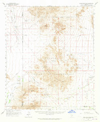 1963 Vekol Mountains1965 Print · USGSThe Papago Indian Reservation comes into focus during the early sixties, revealing a desert landscape where mining history and indigenous settlements overlap. Researchers can trace historic extraction at the Vekol Mine (Ruins) and Reward Mine, or locate small communities like Kohatk and Sif Vaya.2 unique versions available
 - 1967 Map of Ajo
 1967 Ajo1967 Print · USGSSouthern Arizona in the mid-1960s is depicted here as a landscape of military aviation and deep-desert ranching. Trace the historical mining operations at Vekol Mine or follow the Southern Pacific rail line through Gila Bend and Dateland.
 - 1980 Map of Ajo, 1996 Print
 1980 Ajo1996 Print · USGSIn the Sonoran Desert during the early 1980s, mining operations and tribal lands shaped the landscape of Pima County. Researchers can trace the development of Ajo and Why, locate desert outposts like San Simon Well, and identify old workings at the Bluebird Mine.
 - 1981 Map of Copperosity Hills
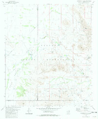 1981 Copperosity Hills1981 Print · USGSThe Papago Indian Reservation comes into focus during the early eighties, showing a landscape defined by desert mining and ancient habitation. Researchers can trace the heritage of the Kohatk village or locate historic workings like the Vekol Mine and Copperosity Mine.
 - 1981 Map of Gila Bend, 1996 Print
 1981 Gila Bend1996 Print · USGSSouthern Arizona in the early eighties reveals a vast desert corridor shaped by military ranges, indigenous lands, and historical mining. Genealogists and historians can trace rail-side settlements like Theba and Piedra or locate the historic Vekol Mine and Reward Mine.
 - 1982 Map of Ajo
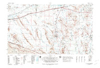 1982 Ajo1982 Print · USGSThe Arizona-Sonora borderlands come into focus in the early eighties, showcasing a landscape of desert mining towns and expansive tribal lands. Trace the Southern Pacific rail line through Gila Bend or explore the remote settlements of Ajo and Lukeville.
 - 1986 Map of Kaka
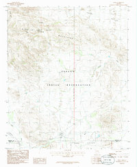 1986 Kaka1986 Print · USGSThe settlement of Kaka and its surrounding desert valleys are captured in the mid-1980s when military airspace and tribal land intersected. Genealogists and historians can locate the Kaka community and nearby Cem, or trace the seasonal flow of Kohatk Wash.
 - 1986 Map of Johnson Well
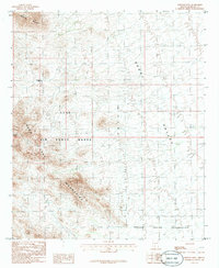 1986 Johnson Well1986 Print · USGSThe high desert of southern Arizona during the mid-1980s reveals a landscape of rugged peaks and military ranges. Trace old landmarks like Johnson Well and Bender Spring near the borders of the Papago Indian Reservation.
Showing maps 1-25 of 150
Top neighborhoods of Hickiwan
- Ventana historical maps
- Chiulikam historical maps
- Moivayi historical maps
- Stoa Pitk historical maps
- Hotason Vo historical maps
- Kaka historical maps
See more
Frequently asked questions
- What are the different types of historical maps available for Hickiwan?
- What is the oldest map of Hickiwan?
- Where can I purchase historical maps of Hickiwan for my home or office?
- Where can I download high-res historical maps of Hickiwan?
- Are there historical topographic maps available for Hickiwan?
- Is there historical aerial imagery available for Hickiwan?
- Where are historical maps of Hickiwan sourced from?