1990s Maps of Hickiwan, Arizona
Explore 34 historic maps of Hickiwan from the 1990s. These maps offer a rare glimpse into what life looked like during the 1990s — showing old roads, neighborhoods, homes, and landmarks that have changed or disappeared over time.
Whether you're researching your family's past, planning a metal detecting trip, or studying how Hickiwan's landscape evolved across the 1990s, these high-resolution maps are a powerful tool for exploring the history of this region.
- Focus on a specific era: All maps on this page are from the 1990s, giving you a focused view of this time period.
- See what’s changed: Compare century-old streets, trails, and buildings to today's modern landscape using overlays and satellite layers.
- Research with precision: Use these maps for genealogy, historical research, land use analysis, or educational projects.
- View, download, or print: Maps are fully viewable online in high resolution, and can be downloaded or printed for your own records.
Start exploring Hickiwan's history through authentic maps from the 1990s. This is your window into the past.
Hickiwan, AZ maps
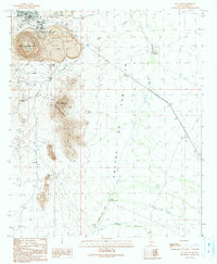
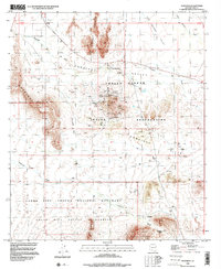
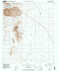
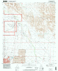
(34)- 1990 Map of Window Mountain
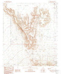
 1990 Window Mountain1990 Print · USGSThe Papago Indian Reservation in Pima County is captured here in the late twentieth century, showing a desert landscape of deep valleys and isolated peaks. Researchers can identify cultural locations like Oit Ihuk (Site) and geographical landmarks like Window Mountain and its Natural Arch.
 - 1990 Map of Ventana
 1990 Ventana1990 Print · USGSThe Papago Indian Reservation in southern Arizona is depicted here in the late twentieth century, centered on the settlement of Ventana. Researchers can locate mining sites like the Isabella Mine and distinctive cultural landmarks such as Ventana Cave and a local Cemetery.
 - 1990 Map of West of Wahak Hotrontk
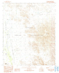
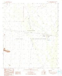 1990 West of Wahak Hotrontk1990 Print · USGSThe Pima County desert in the 1990s reveals a landscape of communal infrastructure within the Papago Indian Reservation. Local history researchers can trace the water systems of the Quijotoa Valley through landmarks like the San Simon High Sch, Corral, and Check Dams.
 - 1990 Map of Hotason Vo
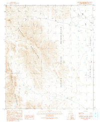
 1990 Hotason Vo1990 Print · USGSIn the Sonoran Desert of the 1990s, this area of the Papago Indian Reservation centers on the local settlements of Hotason Vo and Chagit Vo. Researchers can trace old mining efforts at Little Chief Mine or locate the small cemetery and Check Dams that mark the local landscape.
 - 1990 Map of Gunsight
 1990 Gunsight1990 Print · USGSThe Pima County desert landscape in the 1990s reveals a complex intersection of tribal lands and protected wilderness. Researchers can trace historic mining operations like the Surprise Mine, locate the Gunsight Cemetery, and map old water sources like Lewis Well.
 - 1990 Map of Sikort Chuapo, 1991 Print
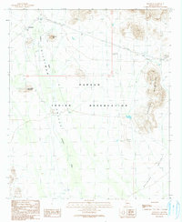
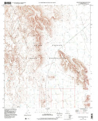
 1990 Sikort Chuapo1991 Print · USGSThe Papago Indian Reservation is captured here in the late twentieth century, showing the intersection of traditional landscapes and desert settlement. Local historians can trace the specific layout of Why and locate rural landmarks like a Cem and isolated Prospects in the Pozo Redondo Mountains.
 - 1990 Map of Cimarron Peak, 1991 Print
 1990 Cimarron Peak1991 Print · USGSThe Papago Indian Reservation is captured in the late twentieth century, showing a desert landscape of peaks and washes. Genealogists and historians can locate the site of Tatai Toak (Site), the settlement at Emika, and a small Cem near Roadrunner Mountain.
 - 1990 Map of Ajo South, 1991 Print
 1990 Ajo South1991 Print · USGSIn the Sonoran Desert during the early nineties, the copper mining industry and rugged mountain topography define the landscape south of the town center. Researchers can trace the massive New Cornelia Mine and find landmarks like Locomotive Rock or the Curley Sch.
 - 1990 Map of West of Ventana, 1991 Print
 1990 West of Ventana1991 Print · USGSThe high desert of the Sonoran region is captured in the early nineties, showing a landscape defined by traditional land boundaries and seasonal washes. Researchers can trace the Gila and Salt River Meridian across the Papago Indian Reservation and locate the San Simon Wash.
 - 1990 Map of Childs Mountain, 1991 Print
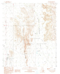
 1990 Childs Mountain1991 Print · USGSPima County's arid frontier is mapped here in the early 1990s as it transitions from the Air Force range into protected wilderness. Researchers can locate the settlement of Gibson and trace desert water sources like Pozo Salado and Dunns Well among scattered Prospects.
 - 1990 Map of Vaya Chin, 1991 Print
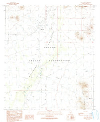 1990 Vaya Chin1991 Print · USGSThe Papago Indian Reservation in the early nineties reveals a landscape of desert survival and meticulous water management. Researchers can trace the layout of Vaya Chin, find the local Cem, and locate ranching infrastructure like the Corral and numerous Check Dams.
 - 1990 Map of Hickiwan, 1991 Print
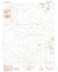
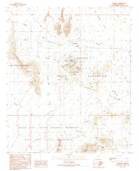
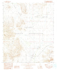
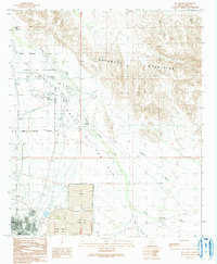
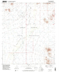
 1990 Hickiwan1991 Print · USGSThe settlement of Hickiwan is captured here during the late twentieth century, showing the life and landscape of the Papago Indian Reservation. Researchers can trace the desert water systems and mineral exploration at Mine Shafts Adit Prospect or along the Hickiwan Wash.
 - 1990 Map of Ajo North, 1991 Print
 1990 Ajo North1991 Print · USGSNear the close of the century, the Arizona desert north of Ajo was a landscape of military boundaries and industrial tailing ponds. Researchers can trace the layout of the Barry M Goldwater Air Force Range and local landmarks like Childs, the Ajo Country Club, and the Cem.
 - 1990 Map of Gakolik Mountains, 1991 Print
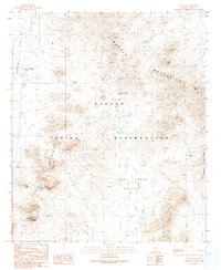
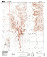
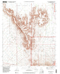
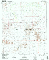
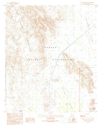 1990 Gakolik Mountains1991 Print · USGSThe Papago Indian Reservation and its desert ranges are captured in the early 1990s as they appeared following decades of aerial survey. Researchers can trace the layout of the Hotason Vo settlement and explore the terrain of the Sikort Chuapo Mountains and Hickiwan Valley.
 - 1990 Map of Coffeepot Mountain, 1991 Print
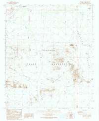
 1990 Coffeepot Mountain1991 Print · USGSThe Papago Indian Reservation is captured here in the early 1990s as a desert landscape shaped by dramatic ranges and seasonal washes. Researchers can locate the settlement of Stoa Pitk, find the site of Graves, and trace water features like Hickiwan Wash.
 - 1990 Map of Burro Gap, 1991 Print
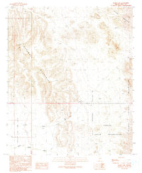 1990 Burro Gap1991 Print · USGSThe high desert of Pima County was captured in the early nineties, showing a landscape of tribal lands and mountain gaps. Researchers can locate remote features like Coffeepot Well, the Natural Arch, and the intersection of Tenmile Wash and Sikort Chuapo Wash.
 - 1996 Map of Gunsight, 2000 Print
 1996 Gunsight2000 Print · USGSThe Tohono O'odham nation and the Organ Pipe Cactus wilderness meet here in the late twentieth century. Genealogists and historians can trace mining sites like the Surprise Mine and the community at Schuchuli near the Gunsight Cemetery.
 - 1996 Map of Sikort Chuapo, 2000 Print
 1996 Sikort Chuapo2000 Print · USGSThe Tohono O'odham Reservation landscape in the 1990s centers on the remote crossroads of Why and the peaks of the Pozo Redondo range. Genealogists and desert historians can trace local landmarks like Sikort Chuapo, the Mobile Home Park, and a solitary Grave near the mountains.
 - 1996 Map of Ajo South, 2000 Print
 1996 Ajo South2000 Print · USGSSouthern Pima County appears in the mid-1990s as a landscape defined by massive industrial extraction and desert isolation. Researchers can trace the massive New Cornelia Mine works, find the local High Sch in Ajo, and locate landmarks like Locomotive Rock.
 - 1996 Map of Childs Mountain, 2000 Print
 1996 Childs Mountain2000 Print · USGSThe Pima County desert as it appeared in the late nineties showcases a landscape shaped by military activity and conservation. Researchers can trace the boundaries of the Cabeza Prieta National Wildlife Refuge alongside local landmarks like Pozo Salado and Dunns Well.
 - 1996 Map of Ajo North, 2000 Print
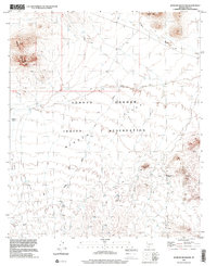
 1996 Ajo North2000 Print · USGSIn the mid-nineties, this Pima County landscape shows the meeting point of desert wilderness and large-scale mining industry. Researchers can trace the layout of Ajo and Gibson alongside the massive Tailings Pond and the Ajo Municipal Airport.
 - 1996 Map of Gakolik Mountains, 2000 Print
 1996 Gakolik Mountains2000 Print · USGSThe Tohono O'odham nation in the mid-nineties is documented here, showing the dramatic rise of the Gakolik Mountains above the desert floor. Researchers can trace the sparse desert outposts at Hotason Vo and the Corral near Hickiwan Valley.
 - 1996 Map of Hotason Vo, 2000 Print
 1996 Hotason Vo2000 Print · USGSWithin the Tohono O'odham Indian Reservation during the late nineties, this map documents a traditional desert landscape centered on community and resource extraction. Trace old mining operations at Little Chief Mine and find the small settlements of Hotason Vo and Chagit Vo.
 - 1996 Map of Window Mountain, 2001 Print
 1996 Window Mountain2001 Print · USGSThe high desert of the Tohono O'odham nation is recorded here during the late twentieth century. Researchers can locate archaeological points like Oit Ihuk (Site) and geological landmarks such as Window Mountain and its Natural Arch.
 - 1996 Map of Vaya Chin, 2001 Print
 1996 Vaya Chin2001 Print · USGSIn the late nineties, the Tohono O'odham Indian Reservation maintained a quiet ranching presence in the Arizona desert. Genealogists and researchers can trace local landmarks like Vaya Chin, the nearby Cem, and isolated desert outposts such as Window Mountain Well.
Showing maps 1-25 of 34
Top neighborhoods of Hickiwan
- Ventana historical maps
- Chiulikam historical maps
- Moivayi historical maps
- Stoa Pitk historical maps
- Hotason Vo historical maps
- Kaka historical maps
See more
Frequently asked questions
- What are the different types of historical maps available for Hickiwan?
- What is the oldest map of Hickiwan?
- Where can I purchase historical maps of Hickiwan for my home or office?
- Where can I download high-res historical maps of Hickiwan?
- Are there historical topographic maps available for Hickiwan?
- Is there historical aerial imagery available for Hickiwan?
- Where are historical maps of Hickiwan sourced from?