Old Maps of Tortolita, Arizona for Academic Research
Study the evolution of Tortolita with 16 high-resolution historic maps. Whether you're teaching, researching, or modeling changes in land use, these maps provide essential visual documentation of urban, environmental, and geographic change.
- Analyze long-term change: Track patterns in development, transportation, and natural features.
- Ideal for environmental or urban studies: Support academic projects with primary historical map data.
- Use in the classroom or lab: Educators and researchers rely on these maps to bring historical context to life.
These maps are a powerful tool for teaching, research, and visualizing how Tortolita has changed over the decades.
Tortolita, AZ maps
(16)- 1934 Map of Tucson Mountains
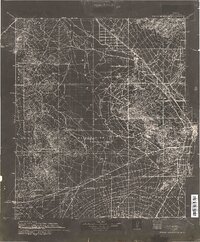 1934 Tucson Mountains1934 Print · USGSThe desert northwest of Tucson comes into focus during the mid-1930s, showing the early footprints of the Papago Indian Reservation and the railroad corridor. Genealogists and historians can trace family-named sites and ranching outposts like Maisi Ayra Ranch, Rodriguez, and the Maish Roadside Mine.
 - 1947 Map of Cortaro
 1947 Cortaro1947 Print · USGSPima County in the late 1940s showcases a desert landscape of ranching, mining, and expanding aviation infrastructure. Trace family ranching roots at Oasis Ranch or explore early aviation at the U S Army Landing Field and Silver Bell Airport.
 - 1956 Map of Tucson, 1967 Print
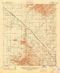
 1956 Tucson1967 Print · USGSPost-war Southern Arizona comes into focus as the copper and aviation industries expand around Tucson. Trace family roots in South Tucson or locate early mining sites like the San Manuel Mine and Silver Bell Mine near the Santa Cruz River.3 unique versions available
 - 1957 Map of Cortaro, 1959 Print
 1957 Cortaro1959 Print · USGSThe Santa Cruz Valley in the late fifties shows a landscape of developing irrigation and cattle ranching between mountain ranges. Genealogists and historians can trace family-named properties like T-Bench-Bar Ranch, local mining at Gila Monster Mine, and early school sites such as Laguna School.2 unique versions available
 - 1958 Map of Tucson
 1958 Tucson1958 Print · USGSSouthern Arizona in the late fifties reveals a landscape of desert agriculture and rising military aviation. Trace the rail lines of the Southern Pacific or locate the historic San Xavier Del Bac Mission and the Casa Grande Natl Mon.
 - 1959 Map of Tucson
 1959 Tucson1959 Print · USGSSouthern Arizona in the late fifties shows a landscape of military growth and desert industry. Genealogists and historians can trace the footprint of Davis-Monthan Air Force Base and old mining sites like the San Manuel Mine near Mammoth.2 unique versions available
 - 1962 Map of Tucson
 1962 Tucson1962 Print · USGSSouthern Arizona in the early sixties showcases a landscape defined by burgeoning desert cities and massive military installations. Researchers can trace tribal settlements like Schuchk, legacy mining sites at Silver Bell Mine, and the early footprint of Davis-Monthan Air Force Base.
 - 1964 Map of Tucson
 1964 Tucson1964 Print · USGSSouthern Arizona in the mid-1960s shows a landscape of burgeoning desert cities and industrial-scale copper mining. Researchers can trace the development of Tucson and its outlying mining districts, including the Silver Bell Mine and San Manuel Mine.
 - 1968 Map of Ruelas Canyon, 1969 Print
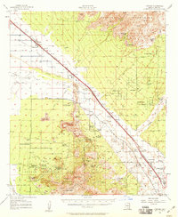
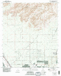
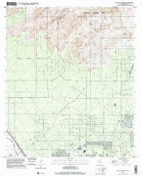
 1968 Ruelas Canyon1969 Print · USGSArizona's desert ranching culture meets the expanding road networks of Pima County in the late sixties. Genealogists and historians can trace family-named properties like Jurko Ranch and Oasis Ranch or follow the Southern Pacific railroad along the Santa Cruz River.3 unique versions available
 - 1992 Map of Ruelas Canyon, 1995 Print
 1992 Ruelas Canyon1995 Print · USGSThe Pima County desert as it appeared in the early nineties shows the growing suburbs of Maraña meeting the rugged Tortolita Mountains. Local historians can trace old landmarks like the Cem near the Santa Cruz River and the rural Landing Strip out by Canada del Oro.
 - 1994 Map of Silver Bell Mountains
 1994 Silver Bell Mountains1994 Print · USGSSouthern Arizona in the mid-nineties shows a land of transition between desert wilderness, tribal lands, and the growing Tucson suburbs. Genealogists and historians can trace settlements like San Luis and Ko Vaya, or follow the industrial legacy of the Silver Bell Mine.2 unique versions available
 - 1996 Map of Ruelas Canyon, 2002 Print
 1996 Ruelas Canyon2002 Print · USGSThe northern Tucson periphery enters a period of significant suburban expansion in the late nineties. Trace the growth of Oro Valley and its surrounding desert parks, from the rugged heights of Tortolita Mountain Park to the banks of the Santa Cruz River.
 - 2011 Map of Ruelas Canyon, 2011 Print
 2011 Ruelas Canyon2011 Print · USGSCovers Tortolita, including Marana, Oro Valley, and other nearby areas
 - 2014 Map of Ruelas Canyon, 2014 Print
 2014 Ruelas Canyon2014 Print · USGSCovers Tortolita, including Marana, Oro Valley, and other nearby areas
 - 2018 Map of Ruelas Canyon, 2018 Print
 2018 Ruelas Canyon2018 Print · USGSCovers Tortolita, including Marana, Oro Valley, and other nearby areas
 - 2021 Map of Ruelas Canyon, 2021 Print
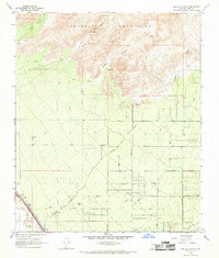
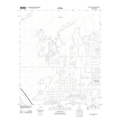
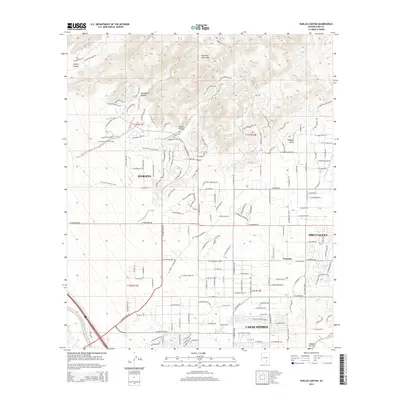
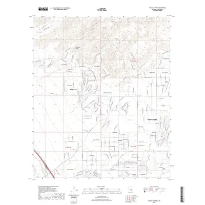
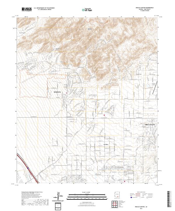 2021 Ruelas Canyon2021 Print · USGSThe foothills of the Tortolita Mountains meet the expanding Tucson suburbs in the early 2020s. Genealogists and local historians can trace the development of Marana and Oro Valley alongside desert features like Ruelas Canyon and La Cholla Airpark.
End of results
Showing maps 1-16 of 16
Top cities near Tortolita
- Tucson historical maps
- Marana historical maps
- Oro Valley historical maps
- Saddlebrooke historical maps
- Picture Rocks historical maps
- Catalina historical maps
See more
Frequently asked questions
- What are the different types of historical maps available for Tortolita?
- What is the oldest map of Tortolita?
- Where can I purchase historical maps of Tortolita for my home or office?
- Where can I download high-res historical maps of Tortolita?
- Are there historical topographic maps available for Tortolita?
- Is there historical aerial imagery available for Tortolita?
- Where are historical maps of Tortolita sourced from?