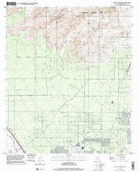
1996 Map of Ruelas Canyon
USGS Topo · Published 2002About this map
Tortolita Mountain Park dominates the northern high ground of this Pima County landscape, where deep incisions like Ruelas Canyon and Cochie Canyon drain toward the southwest. The terrain transitions from these steep mountain flanks into a structured grid of residential development and suburban infrastructure. The growing community of Oro Valley occupies the southeastern corner, bordered by Cañada del Oro, while the southwestern reaches are defined by the Santa Cruz River corridor. Evidence of the area's mid-century utility and recreation is visible in the Landing Strip, several Golf Courses, and Arthur Pack Regional Park. Local history and genealogy researchers will find specific landmarks such as a Cem near the river and various Prospects in the foothills, reflecting both the spiritual and industrial footprints of earlier inhabitants in the Sonoran desert.
Find a feature on this map
35 named features on this map. Tap any name to fly to it.
Don’t see what you’re looking for? This feature index may not catch every label — zoom into the map to look around manually.
Map Details
Editions of this 1996 Ruelas Canyon Map
This is the sole edition of this map. No revisions or reprints were ever made.
Other maps of this area

1904 · Tucson
USGS Topo · 1:125,000

1905 · Tucson
USGS Topo · 1:125,000

1911 · Winkelman
USGS Topo · 1:125,000

1913 · Winkelman
USGS Topo · 1:125,000

1934 · Tucson Mountains
USGS Topo · 1:125,000

1934 · Newman Peak
USGS Topo · 1:125,000

1947 · Cortaro
USGS Topo · 1:62,500

1956 · Tucson
USGS Topo · 1:250,000

1957 · Cortaro
USGS Topo · 1:62,500
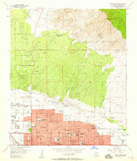
1957 · Tucson North
USGS Topo · 1:24,000