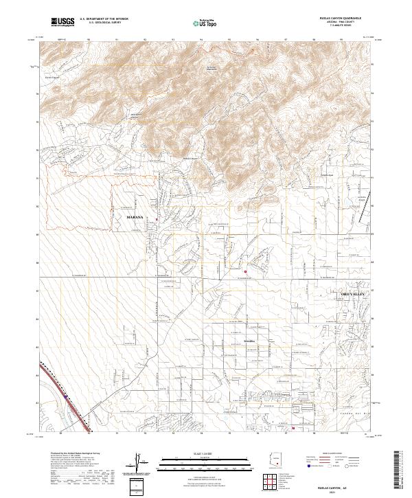
2021 Map of Ruelas Canyon
USGS Topo · Published 2021About this map
The Tortolita Mountains dominate the northern landscape of this Pima County quadrangle, where the rugged desert terrain meets the expanding residential and recreational corridors of Marana and Oro Valley. This 2021 survey illustrates a sophisticated network of modern trail systems and residential developments carved into the bajadas, such as the Tortolita Preserve Loop Trl and various canyons including Ruelas Canyon and Wild Burro Canyon. The southeastern portion of the map shows the proximity of La Cholla Airpark to the shifting course of the Cañada del Oro. Along the southwestern edge, the Santa Cruz River corridor contrasts with the high-elevation peaks of Cochie Canyon. This map provides a detailed view of the modern interface between protected desert wilderness and the suburban growth of the northern Tucson metro area, specifically the community of Tortolita.
Find a feature on this map
192 named features on this map. Tap any name to fly to it.
Don’t see what you’re looking for? This feature index may not catch every label — zoom into the map to look around manually.
Map Details
Editions of this 2021 Ruelas Canyon Map
This is the sole edition of this map. No revisions or reprints were ever made.
Other maps of this area

1904 · Tucson
USGS Topo · 1:125,000

1905 · Tucson
USGS Topo · 1:125,000

1911 · Winkelman
USGS Topo · 1:125,000

1913 · Winkelman
USGS Topo · 1:125,000

1934 · Tucson Mountains
USGS Topo · 1:125,000

1934 · Newman Peak
USGS Topo · 1:125,000

1947 · Cortaro
USGS Topo · 1:62,500

1956 · Tucson
USGS Topo · 1:250,000

1957 · Cortaro
USGS Topo · 1:62,500
1957 · Tucson North
USGS Topo · 1:24,000